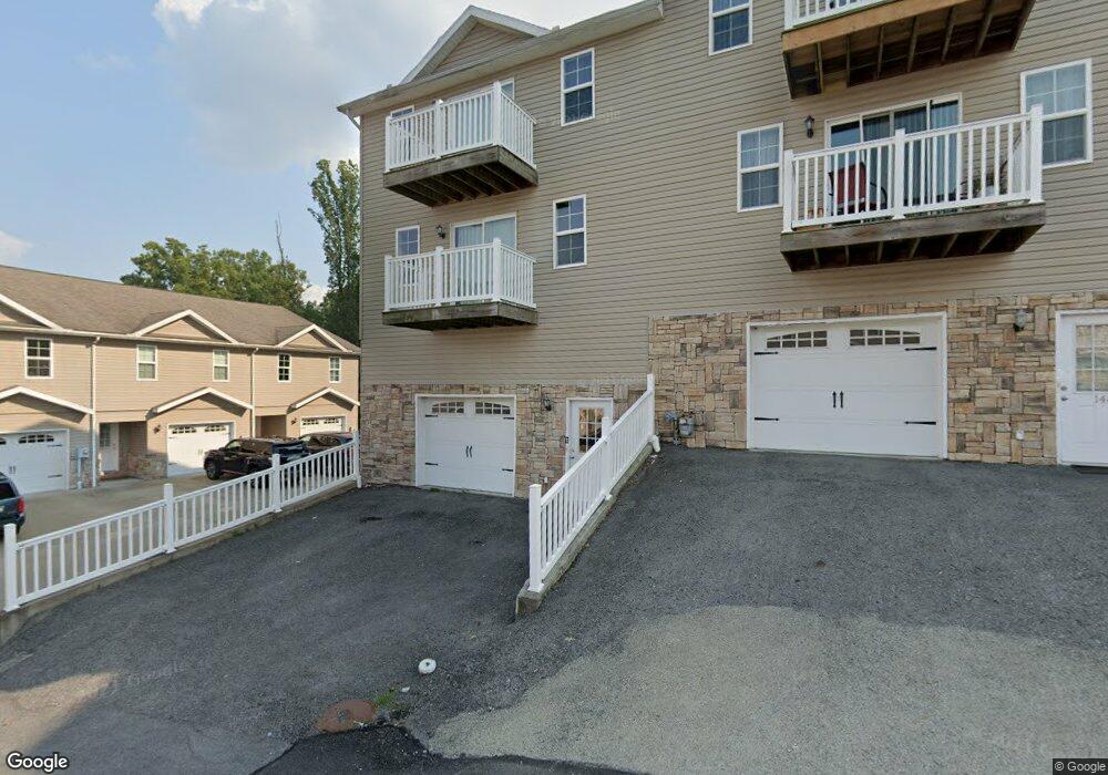
150 Top of the Rock Dr Morgantown, WV 26508
Estimated Value: $242,144 - $405,000
3
Beds
3
Baths
2,080
Sq Ft
$144/Sq Ft
Est. Value
About This Home
This home is located at 150 Top of the Rock Dr, Morgantown, WV 26508 and is currently estimated at $298,786, approximately $143 per square foot. 150 Top of the Rock Dr is a home with nearby schools including North Elementary School, Suncrest Middle School, and Morgantown High School.
Ownership History
Date
Name
Owned For
Owner Type
Purchase Details
Closed on
Dec 20, 2019
Sold by
Idlewood Enterprises Llc
Bought by
Mcp Graycliff Llc
Current Estimated Value
Home Financials for this Owner
Home Financials are based on the most recent Mortgage that was taken out on this home.
Original Mortgage
$18,375,000
Outstanding Balance
$8,644,152
Interest Rate
3.7%
Mortgage Type
Construction
Estimated Equity
-$8,345,366
Create a Home Valuation Report for This Property
The Home Valuation Report is an in-depth analysis detailing your home's value as well as a comparison with similar homes in the area
Home Values in the Area
Average Home Value in this Area
Purchase History
| Date | Buyer | Sale Price | Title Company |
|---|---|---|---|
| Mcp Graycliff Llc | $20,500,000 | First American Title Ins Co |
Source: Public Records
Mortgage History
| Date | Status | Borrower | Loan Amount |
|---|---|---|---|
| Open | Mcp Graycliff Llc | $18,375,000 |
Source: Public Records
Tax History Compared to Growth
Tax History
| Year | Tax Paid | Tax Assessment Tax Assessment Total Assessment is a certain percentage of the fair market value that is determined by local assessors to be the total taxable value of land and additions on the property. | Land | Improvement |
|---|---|---|---|---|
| 2024 | $1,814 | $84,890 | $12,000 | $72,890 |
| 2023 | $1,809 | $84,890 | $12,000 | $72,890 |
| 2022 | $1,740 | $84,890 | $12,000 | $72,890 |
| 2021 | $1,748 | $84,890 | $12,000 | $72,890 |
| 2020 | $1,397 | $67,540 | $600 | $66,940 |
| 2019 | $1,407 | $67,540 | $600 | $66,940 |
| 2018 | $1,412 | $67,540 | $600 | $66,940 |
| 2017 | $1,419 | $67,540 | $600 | $66,940 |
| 2016 | $1,748 | $82,680 | $600 | $82,080 |
| 2015 | $1,672 | $82,680 | $600 | $82,080 |
| 2014 | $1,594 | $82,680 | $600 | $82,080 |
Source: Public Records
Map
Nearby Homes
- 160 Poplar Dr
- 407 Kings Point Ln
- 1641 van Voorhis Rd
- 1639 van Voorhis Rd
- 129 Bakers Dr
- 3 Cliff View Cir
- 110 Marco Polo Dr
- 118 Marco Polo Dr
- 106 Marco Polo Dr
- 3 Bakers Pointe
- Lot 32 Brettwald Dr
- 101 Walnut Ln
- 47 Saint Clair's Village
- 13 Trail Dr
- 65 Saint Clairs Village
- 230 Poplar Dr
- 89 Saint Clair's Village
- 81 Saint Clairs Village
- 127 Stanley St
- 999 W Run Rd
- 148 Top of the Rock Dr
- 146 Top of the Rock Dr
- 144 Top of the Rock Dr
- 802 Big Mountain Dr
- 804 Big Mountain Dr
- 806 Big Mountain Dr
- 142 Top of the Rock Dr
- 149 Top of the Rock Dr
- 147 Top of the Rock Dr
- 808 Big Mountain Dr
- 140 Top of the Rock Dr
- 145 Top of the Rock Dr
- 810 Big Mountain Dr
- 143 Top of the Rock Dr
- 138 Top of the Rock Dr
- 141 Top of the Rock Dr
- 812 Big Mountain Dr
- 856 Big Mountain Dr
- 866 Big Mountain Dr
- 136 Top of the Rock Dr