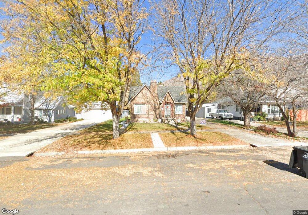
150 W 200 N Springville, UT 84663
Estimated Value: $443,000 - $486,000
5
Beds
2
Baths
2,576
Sq Ft
$183/Sq Ft
Est. Value
About This Home
This home is located at 150 W 200 N, Springville, UT 84663 and is currently estimated at $471,499, approximately $183 per square foot. 150 W 200 N is a home located in Utah County with nearby schools including Westside Elementary School, Springville Junior High School, and Springville High School.
Ownership History
Date
Name
Owned For
Owner Type
Purchase Details
Closed on
Jun 21, 2018
Sold by
Wheeler Kristeen L
Bought by
Johnson Troy
Current Estimated Value
Home Financials for this Owner
Home Financials are based on the most recent Mortgage that was taken out on this home.
Original Mortgage
$282,600
Outstanding Balance
$244,402
Interest Rate
4.5%
Mortgage Type
New Conventional
Estimated Equity
$227,097
Purchase Details
Closed on
Nov 18, 1998
Sold by
Wheeler Douglas L
Bought by
Wheeler Douglas L and Wheeler Kristeen L
Home Financials for this Owner
Home Financials are based on the most recent Mortgage that was taken out on this home.
Original Mortgage
$101,600
Interest Rate
6.42%
Create a Home Valuation Report for This Property
The Home Valuation Report is an in-depth analysis detailing your home's value as well as a comparison with similar homes in the area
Home Values in the Area
Average Home Value in this Area
Purchase History
| Date | Buyer | Sale Price | Title Company |
|---|---|---|---|
| Johnson Troy | -- | Utah First Title Ins Agency | |
| Wheeler Douglas L | -- | Provo Land Title Company |
Source: Public Records
Mortgage History
| Date | Status | Borrower | Loan Amount |
|---|---|---|---|
| Open | Johnson Troy | $282,600 | |
| Previous Owner | Wheeler Douglas L | $101,600 |
Source: Public Records
Tax History Compared to Growth
Tax History
| Year | Tax Paid | Tax Assessment Tax Assessment Total Assessment is a certain percentage of the fair market value that is determined by local assessors to be the total taxable value of land and additions on the property. | Land | Improvement |
|---|---|---|---|---|
| 2025 | $2,223 | $236,775 | $121,700 | $308,800 |
| 2024 | $2,223 | $227,755 | $0 | $0 |
| 2023 | $2,183 | $223,850 | $0 | $0 |
| 2022 | $2,091 | $210,595 | $0 | $0 |
| 2021 | $1,879 | $294,500 | $91,000 | $203,500 |
| 2020 | $1,735 | $263,700 | $75,800 | $187,900 |
| 2019 | $1,523 | $235,700 | $72,300 | $163,400 |
| 2018 | $1,346 | $198,700 | $65,300 | $133,400 |
| 2017 | $1,355 | $106,205 | $0 | $0 |
| 2016 | $1,106 | $85,030 | $0 | $0 |
| 2015 | $1,011 | $79,475 | $0 | $0 |
| 2014 | $992 | $77,440 | $0 | $0 |
Source: Public Records
Map
Nearby Homes