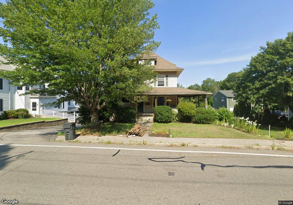
150 Worcester St North Grafton, MA 01536
Estimated Value: $551,000 - $610,000
3
Beds
3
Baths
2,764
Sq Ft
$212/Sq Ft
Est. Value
About This Home
This home is located at 150 Worcester St, North Grafton, MA 01536 and is currently estimated at $585,940, approximately $211 per square foot. 150 Worcester St is a home located in Worcester County with nearby schools including Grafton High School, Silver Spruce Montessori School, and Al-Hamra Academy.
Ownership History
Date
Name
Owned For
Owner Type
Purchase Details
Closed on
Oct 23, 2003
Sold by
Otoole Edward M
Bought by
Donohue Dawn E and Donohue Lee S
Current Estimated Value
Home Financials for this Owner
Home Financials are based on the most recent Mortgage that was taken out on this home.
Original Mortgage
$262,800
Outstanding Balance
$121,158
Interest Rate
6.15%
Mortgage Type
Purchase Money Mortgage
Estimated Equity
$464,782
Purchase Details
Closed on
Mar 12, 1998
Sold by
Roney Stephen H and Roney Diane G
Bought by
Otoole Edward M and Otoole Michelle
Purchase Details
Closed on
Apr 7, 1992
Sold by
Fdic
Bought by
Roney Stephen H and Roney Diane
Create a Home Valuation Report for This Property
The Home Valuation Report is an in-depth analysis detailing your home's value as well as a comparison with similar homes in the area
Home Values in the Area
Average Home Value in this Area
Purchase History
| Date | Buyer | Sale Price | Title Company |
|---|---|---|---|
| Donohue Dawn E | $292,000 | -- | |
| Donohue Dawn E | $292,000 | -- | |
| Donohue Dawn E | $292,000 | -- | |
| Otoole Edward M | $100,000 | -- | |
| Otoole Edward M | $100,000 | -- | |
| Roney Stephen H | $65,000 | -- | |
| Roney Stephen H | $65,000 | -- |
Source: Public Records
Mortgage History
| Date | Status | Borrower | Loan Amount |
|---|---|---|---|
| Open | Donohue Dawn E | $262,800 | |
| Closed | Donohue Dawn E | $262,800 | |
| Previous Owner | Roney Stephen H | $177,000 |
Source: Public Records
Tax History Compared to Growth
Tax History
| Year | Tax Paid | Tax Assessment Tax Assessment Total Assessment is a certain percentage of the fair market value that is determined by local assessors to be the total taxable value of land and additions on the property. | Land | Improvement |
|---|---|---|---|---|
| 2025 | $6,582 | $472,200 | $143,400 | $328,800 |
| 2024 | $6,324 | $441,900 | $136,600 | $305,300 |
| 2023 | $6,171 | $392,800 | $136,600 | $256,200 |
| 2022 | $5,621 | $333,000 | $117,300 | $215,700 |
| 2021 | $5,230 | $304,400 | $106,600 | $197,800 |
| 2020 | $4,465 | $270,600 | $106,600 | $164,000 |
| 2019 | $4,332 | $260,000 | $88,000 | $172,000 |
| 2018 | $4,405 | $265,500 | $87,100 | $178,400 |
| 2017 | $4,300 | $262,200 | $70,000 | $192,200 |
| 2016 | $3,940 | $235,200 | $82,100 | $153,100 |
| 2015 | $3,892 | $235,900 | $81,000 | $154,900 |
| 2014 | $3,501 | $229,400 | $90,800 | $138,600 |
Source: Public Records
Map
Nearby Homes
- 167 Worcester St
- 17 Hingham Rd
- 6 Overlook St
- 14 Northgate Ct Unit 14
- 194 Worcester St
- 0 East St
- 3 Abby Rd
- 72 Westborough Rd Unit 1
- 72 Westborough Rd Unit 2
- 23 Institute Rd
- 1 Doris Dr
- 9 Logan Path
- 5 Lincoln Ln Unit 5
- 51 John Dr Unit 51
- 46 John Dr Unit 46
- 150 North St
- 1 Canton Ct Unit 35
- 4 Abby Rd
- 25 Clearview St
- 34 Clews St
- 151 Worcester St
- 151 Worcester St Unit 1
- 144 Worcester St
- 148 Worcester St
- 156 Worcester St
- 156 Worcester St Unit 1
- 147 Worcester St
- 155 Worcester St
- 149 Worcester St
- 142 Worcester St
- 158 Worcester St
- 157 Worcester St
- 140 Worcester St
- 160 Worcester St
- 145 Worcester St
- 159 Worcester St
- 143 Worcester St
- 138 Worcester St
- 2 N Main St
- 161 Worcester St