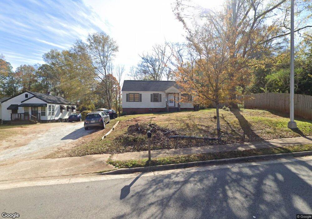
1500 E 10th St West Point, GA 31833
Estimated Value: $72,000 - $116,000
2
Beds
1
Bath
1,399
Sq Ft
$68/Sq Ft
Est. Value
About This Home
This home is located at 1500 E 10th St, West Point, GA 31833 and is currently estimated at $95,318, approximately $68 per square foot. 1500 E 10th St is a home located in Troup County with nearby schools including West Point Elementary School, Long Cane Elementary School, and Whitesville Road Elementary School.
Ownership History
Date
Name
Owned For
Owner Type
Purchase Details
Closed on
Jul 8, 2022
Sold by
Earl Maxie
Bought by
Spratling Sheila Wright
Current Estimated Value
Purchase Details
Closed on
Jul 10, 2009
Sold by
Secretary Of Housing
Bought by
Earl Maxie
Purchase Details
Closed on
Oct 14, 1999
Sold by
Spears William H and Spears Syble S
Bought by
Wells Fargo Bank '
Purchase Details
Closed on
Jan 1, 1961
Bought by
Spears William H and Spears Syble S
Create a Home Valuation Report for This Property
The Home Valuation Report is an in-depth analysis detailing your home's value as well as a comparison with similar homes in the area
Home Values in the Area
Average Home Value in this Area
Purchase History
| Date | Buyer | Sale Price | Title Company |
|---|---|---|---|
| Spratling Sheila Wright | $40,000 | -- | |
| Earl Maxie | $25,000 | -- | |
| Earl Maxie | $25,000 | -- | |
| Wells Fargo Bank ' | $45,000 | -- | |
| Spears William H | -- | -- |
Source: Public Records
Tax History Compared to Growth
Tax History
| Year | Tax Paid | Tax Assessment Tax Assessment Total Assessment is a certain percentage of the fair market value that is determined by local assessors to be the total taxable value of land and additions on the property. | Land | Improvement |
|---|---|---|---|---|
| 2024 | $962 | $27,200 | $10,040 | $17,160 |
| 2023 | $436 | $30,760 | $10,040 | $20,720 |
| 2022 | $776 | $27,800 | $10,040 | $17,760 |
| 2021 | $836 | $27,720 | $10,040 | $17,680 |
| 2020 | $521 | $17,280 | $1,640 | $15,640 |
| 2019 | $511 | $16,944 | $1,664 | $15,280 |
| 2018 | $489 | $16,224 | $1,664 | $14,560 |
| 2017 | $489 | $16,224 | $1,664 | $14,560 |
| 2016 | $484 | $16,044 | $1,664 | $14,380 |
| 2015 | $485 | $16,044 | $1,664 | $14,380 |
| 2014 | $463 | $15,287 | $1,664 | $13,623 |
| 2013 | -- | $16,404 | $1,664 | $14,740 |
Source: Public Records
Map
Nearby Homes
- 0 Sunset Dr Unit 10451831
- 0 Arrowhead Dr Unit 10451860
- 1008 E 12th St
- 509 Cleveland St
- 713 Avenue H
- 804 E 6th St
- 4517 Georgia 18
- 4509 Georgia 18
- 4523 Georgia 18
- 4527 Georgia 18
- 1505 Wisteria Dr
- 508 Pine St
- 311 E 4th St
- 112 Hillcrest Rd
- 107 Garden Walk
- 1903 Ridgewood Dr
- 128 Highland Dr
- 0 Ga Highway 0116 Unit 10619139
- 1007 4th Ave
- 712 4th Ave
- 508 E 10th St
- 406 E 10th St
- 1414 E 10th St
- 1420 E 10th St
- 1502 E 10th St
- 1418 E 10th St
- 1504 E 10th St
- 1000 Dogwood Cir
- 1416 E 10th St
- 1425 Higgins St
- 1427 Higgins St
- 10th Street
- 1012 Dogwood Cir
- 1417 Higgins St
- 1412 E 10th St
- 14161420 Higgins St
- 141620 Higgins St
- 1415 Higgins St
- 1409 E 10th St
- 1410 E 10th St