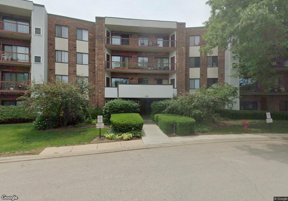
1500 Harbour Dr, Unit 1A Wheeling, IL 60090
Estimated Value: $147,978 - $211,000
2
Beds
--
Bath
100,000
Sq Ft
$2/Sq Ft
Est. Value
About This Home
This home is located at 1500 Harbour Dr Unit 1A, Wheeling, IL 60090 and is currently estimated at $190,995, approximately $1 per square foot. 1500 Harbour Dr Unit 1A is a home located in Cook County with nearby schools including Dwight D Eisenhower Elementary School, Anne Sullivan Elementary School, and Betsy Ross Elementary School.
Ownership History
Date
Name
Owned For
Owner Type
Purchase Details
Closed on
May 18, 2006
Sold by
Pacenti Anthony J and Ann Pacenti Trust
Bought by
Volkov Dmitry
Current Estimated Value
Home Financials for this Owner
Home Financials are based on the most recent Mortgage that was taken out on this home.
Original Mortgage
$60,000
Interest Rate
6.62%
Mortgage Type
Fannie Mae Freddie Mac
Purchase Details
Closed on
Oct 7, 2004
Sold by
Pacenti Ann
Bought by
Pacenti Ann and Ann Pacenti Trust
Create a Home Valuation Report for This Property
The Home Valuation Report is an in-depth analysis detailing your home's value as well as a comparison with similar homes in the area
Home Values in the Area
Average Home Value in this Area
Purchase History
| Date | Buyer | Sale Price | Title Company |
|---|---|---|---|
| Volkov Dmitry | $165,500 | Multiple | |
| Pacenti Ann | -- | -- |
Source: Public Records
Mortgage History
| Date | Status | Borrower | Loan Amount |
|---|---|---|---|
| Closed | Volkov Dmitry | $60,000 |
Source: Public Records
Tax History
| Year | Tax Paid | Tax Assessment Tax Assessment Total Assessment is a certain percentage of the fair market value that is determined by local assessors to be the total taxable value of land and additions on the property. | Land | Improvement |
|---|---|---|---|---|
| 2025 | $2,647 | $15,506 | $2,061 | $13,445 |
| 2024 | $2,647 | $12,229 | $1,889 | $10,340 |
| 2023 | $2,504 | $12,229 | $1,889 | $10,340 |
| 2022 | $2,504 | $12,229 | $1,889 | $10,340 |
| 2021 | $2,324 | $10,352 | $214 | $10,138 |
| 2020 | $2,335 | $10,352 | $214 | $10,138 |
| 2019 | $2,344 | $11,541 | $214 | $11,327 |
| 2018 | $1,173 | $7,142 | $171 | $6,971 |
| 2017 | $1,175 | $7,142 | $171 | $6,971 |
| 2016 | $1,348 | $7,142 | $171 | $6,971 |
| 2015 | $1,070 | $6,007 | $815 | $5,192 |
| 2014 | $1,060 | $6,007 | $815 | $5,192 |
| 2013 | $1,007 | $6,007 | $815 | $5,192 |
Source: Public Records
About This Building
Map
Nearby Homes
- 1030 Cottonwood Ct Unit 2A
- 1025 Cottonwood Ct Unit 2AR
- 1014 Lakeland Ct Unit 2A
- 2604 N Prindle Ave
- 1810 E Waverly Dr
- 2643 N Prindle Ave
- 791 Lakeside Circle Dr Unit 1
- 1507 Clearwater Ln Unit 1
- 709 Lakeside Circle Dr Unit 2
- 2812 Jackson Dr
- 2439 N Windsor Dr
- 2822 Jackson Dr
- 1636 E Jonquil Terrace
- 2454 E Hunter Dr Unit 93
- 2632 N Windsor Dr Unit 104
- 1424 E Jonquil Cir
- 2612 N Windsor Dr Unit 201
- 1206 E Suffield Dr
- 1205 E Hintz Rd Unit 208
- 1211 Highland Dr
- 1500 Harbour Dr Unit 1J
- 1500 Harbour Dr Unit 3G
- 1500 Harbour Dr Unit 1B
- 1500 Harbour Dr Unit 4F
- 1500 Harbour Dr Unit 4C
- 1500 Harbour Dr Unit 4U
- 1500 Harbour Dr Unit 2S
- 1500 Harbour Dr Unit 1K
- 1500 Harbour Dr Unit 1E
- 1500 Harbour Dr Unit 1Q
- 1500 Harbour Dr Unit 4M
- 1500 Harbour Dr Unit 3P
- 1500 Harbour Dr Unit 3K
- 1500 Harbour Dr Unit 4P
- 1500 Harbour Dr Unit 3F
- 1500 Harbour Dr Unit 4G
- 1500 Harbour Dr Unit 3S
- 1500 Harbour Dr Unit 2U
- 1500 Harbour Dr Unit 4J
- 1500 Harbour Dr Unit 1T
Your Personal Tour Guide
Ask me questions while you tour the home.