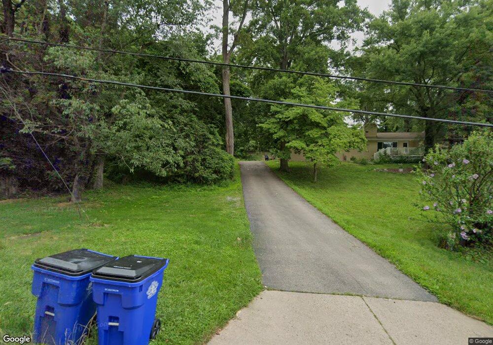
1500 Maine Blvd East Liverpool, OH 43920
Estimated Value: $127,000 - $162,000
3
Beds
2
Baths
1,460
Sq Ft
$95/Sq Ft
Est. Value
About This Home
This home is located at 1500 Maine Blvd, East Liverpool, OH 43920 and is currently estimated at $139,097, approximately $95 per square foot. 1500 Maine Blvd is a home located in Columbiana County with nearby schools including Westgate Middle School, North Elementary School, and East Liverpool High School.
Ownership History
Date
Name
Owned For
Owner Type
Purchase Details
Closed on
Jan 27, 2022
Sold by
Adkins David L
Bought by
Adkins Garrett R
Current Estimated Value
Home Financials for this Owner
Home Financials are based on the most recent Mortgage that was taken out on this home.
Original Mortgage
$71,200
Outstanding Balance
$65,846
Interest Rate
3.22%
Mortgage Type
New Conventional
Estimated Equity
$73,251
Purchase Details
Closed on
Feb 19, 1999
Sold by
Bricker Geraldine E
Bought by
Adkins David and Adkins Kay Lorraine
Create a Home Valuation Report for This Property
The Home Valuation Report is an in-depth analysis detailing your home's value as well as a comparison with similar homes in the area
Home Values in the Area
Average Home Value in this Area
Purchase History
| Date | Buyer | Sale Price | Title Company |
|---|---|---|---|
| Adkins Garrett R | -- | None Listed On Document | |
| Adkins David | $79,000 | -- |
Source: Public Records
Mortgage History
| Date | Status | Borrower | Loan Amount |
|---|---|---|---|
| Open | Adkins Garrett R | $71,200 |
Source: Public Records
Tax History Compared to Growth
Tax History
| Year | Tax Paid | Tax Assessment Tax Assessment Total Assessment is a certain percentage of the fair market value that is determined by local assessors to be the total taxable value of land and additions on the property. | Land | Improvement |
|---|---|---|---|---|
| 2024 | $1,634 | $39,770 | $1,510 | $38,260 |
| 2023 | $1,635 | $39,770 | $1,510 | $38,260 |
| 2022 | $1,679 | $39,770 | $1,510 | $38,260 |
| 2021 | $1,665 | $36,160 | $1,400 | $34,760 |
| 2020 | $1,667 | $36,160 | $1,400 | $34,760 |
| 2019 | $1,667 | $36,160 | $1,400 | $34,760 |
| 2018 | $1,614 | $32,870 | $1,260 | $31,610 |
| 2017 | $1,214 | $32,870 | $1,260 | $31,610 |
| 2016 | $1,152 | $32,310 | $1,680 | $30,630 |
| 2015 | $1,152 | $32,310 | $1,680 | $30,630 |
| 2014 | $1,139 | $32,310 | $1,680 | $30,630 |
Source: Public Records
Map
Nearby Homes
- 1615 Montrose St
- 929 Bank St
- 636 River Rd
- 1001 Ambrose Ave
- 820 Chester St
- 938 Ambrose Ave
- 755 Minerva St
- 925 Montgomery St
- 920 Mckinnon Ave
- 812 Bradshaw Ave
- 739 Avondale St
- 420 Vine St
- 410 Blakely St
- 921 Orchard Grove Ave
- 406 Vine St
- 334 & 336 Thompson Ave
- 315 Vine St
- 319 Thompson Ave
- 1507 Saint Clair Ave
- 807 Rigby St
- 1500 Maine Blvd
- 1512 Maine Blvd
- 1400 Maine Blvd
- 1518 Maine Blvd
- 1080 Bank St
- 1520 Maine Blvd
- 830 Mason St
- 1072 Bank St
- 1230 Maine Blvd
- 1601 Montrose St
- 1600 Maine Blvd
- 1068 Bank St
- 1220 Maine Blvd
- 1065 Ephriam St
- 1058 Bank St
- 1063 Ephriam St
- 1610 Maine Blvd
- 1052 Bank St
- 1066 Ephriam St
- 1064 Ephriam St
