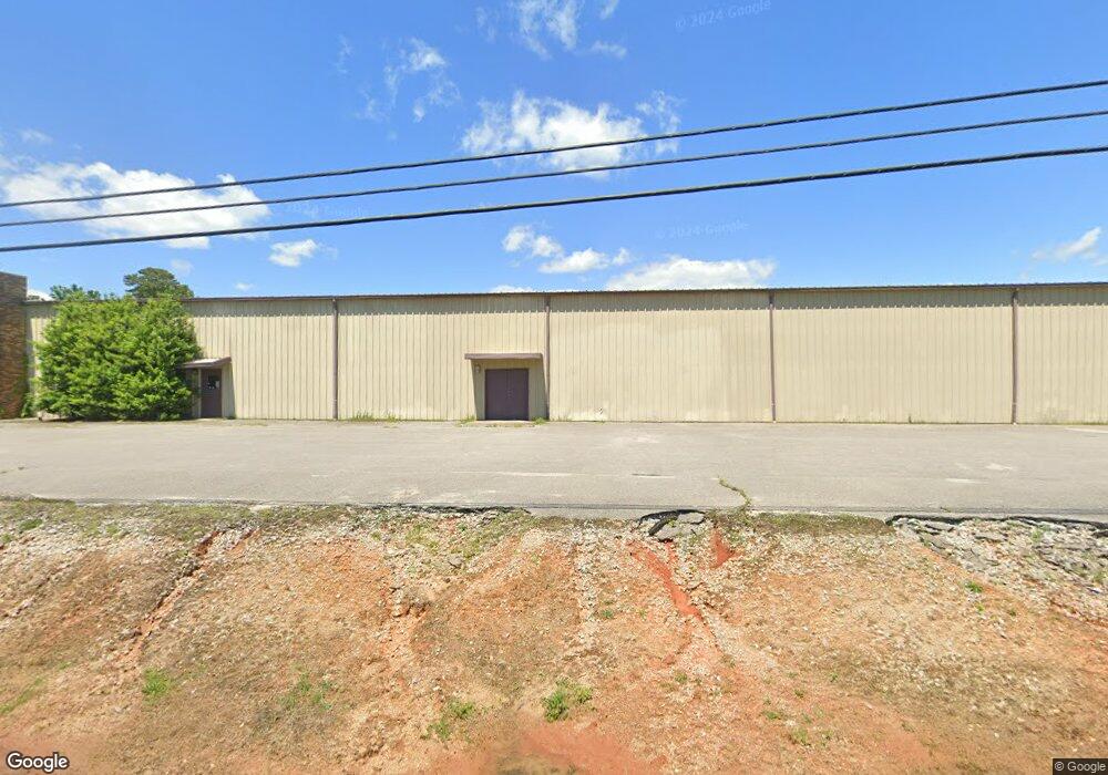
1500 Us Highway 72 W Athens, AL 35611
Estimated Value: $1,592,622
--
Bed
--
Bath
30,480
Sq Ft
$52/Sq Ft
Est. Value
About This Home
This home is located at 1500 Us Highway 72 W, Athens, AL 35611 and is currently priced at $1,592,622, approximately $52 per square foot. 1500 Us Highway 72 W is a home located in Limestone County with nearby schools including Athens Intermediate School, SPARK Academy at Cowart Elementary, and Athens Middle School.
Ownership History
Date
Name
Owned For
Owner Type
Purchase Details
Closed on
Oct 20, 2021
Sold by
Guardian Alabama Self Storage Athens Llc
Bought by
Wicla Terra Equities Llc
Current Estimated Value
Home Financials for this Owner
Home Financials are based on the most recent Mortgage that was taken out on this home.
Original Mortgage
$2,819,300
Outstanding Balance
$2,573,915
Interest Rate
2.88%
Mortgage Type
Commercial
Purchase Details
Closed on
Jun 29, 2021
Sold by
Tri-State Development Inc
Bought by
Guardian Alabama Self Storage Athens Llc
Purchase Details
Closed on
Oct 14, 2019
Sold by
Paws Memorial Services Llc
Bought by
Tri State Development Inc
Purchase Details
Closed on
Jan 11, 2017
Sold by
Dollins Wilford
Bought by
Paws Memorial Services Llc
Create a Home Valuation Report for This Property
The Home Valuation Report is an in-depth analysis detailing your home's value as well as a comparison with similar homes in the area
Home Values in the Area
Average Home Value in this Area
Purchase History
| Date | Buyer | Sale Price | Title Company |
|---|---|---|---|
| Wicla Terra Equities Llc | $1,200,000 | None Available | |
| Guardian Alabama Self Storage Athens Llc | $700,000 | None Available | |
| Tri State Development Inc | $700,000 | None Available | |
| Paws Memorial Services Llc | $625,000 | -- |
Source: Public Records
Mortgage History
| Date | Status | Borrower | Loan Amount |
|---|---|---|---|
| Open | Wicla Terra Equities Llc | $2,819,300 |
Source: Public Records
Tax History Compared to Growth
Tax History
| Year | Tax Paid | Tax Assessment Tax Assessment Total Assessment is a certain percentage of the fair market value that is determined by local assessors to be the total taxable value of land and additions on the property. | Land | Improvement |
|---|---|---|---|---|
| 2024 | $13,794 | $344,860 | $0 | $0 |
| 2023 | $13,794 | $404,320 | $0 | $0 |
| 2022 | $12,680 | $317,000 | $0 | $0 |
| 2021 | $10,598 | $264,960 | $0 | $0 |
| 2020 | $10,094 | $252,340 | $0 | $0 |
| 2019 | $9,210 | $230,260 | $0 | $0 |
| 2018 | $6,186 | $154,640 | $0 | $0 |
| 2017 | $1,467 | $36,680 | $0 | $0 |
| 2016 | $1,467 | $183,310 | $0 | $0 |
| 2015 | $1,467 | $36,680 | $0 | $0 |
| 2014 | $1,259 | $0 | $0 | $0 |
Source: Public Records
Map
Nearby Homes
- Lot 1 Browns Ferry St
- 107 Virginia Dr
- 203 Gordon Dr
- 409 Suffield St
- 1501 Reynard St
- 1504 Pinedale St
- 8336 Us Highway 72 W
- Lot 17 Acorn Hill Cir
- 313 Christopher Dr
- 1505 Nella Dr
- 1509 Nella Dr
- 1408 Plato Jones St
- 24490 Colorado Ln
- 24496 Colorado Ln
- 24450 Colorado Ln
- Falkner III G Plan at Athens Preserve
- Oakstone V J Plan at Athens Preserve
- Oakstone V I Plan at Athens Preserve
- Trillium IV J Plan at Athens Preserve
- Trillium IV I Plan at Athens Preserve
- 1500 Us Highway 72 W
- 1403 Brownsferry St
- 1423 Us Highway 72 W
- 1423 Us Highway 72 W
- 1425 12th St
- 1423 U S 72
- 1417 Us Highway 72 W
- 1419 12th St
- 1413 Us Highway 72 W
- 1423 Us Highway 72 E
- 1419 U S 72
- 1309 Brownsferry St
- 1418 12th St
- 1411 Us Highway 72 W
- 1415 12th St
- 1705 Townsend St
- 1305 Brownsferry St
- 1414 12th St
- 1413 12th St
- 1703 Townsend St