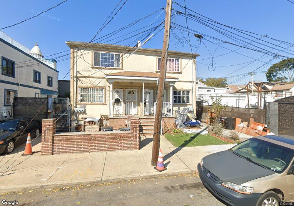
15009 111th Rd Jamaica, NY 11433
Jamaica NeighborhoodEstimated Value: $811,898 - $1,102,000
--
Bed
--
Bath
1,938
Sq Ft
$496/Sq Ft
Est. Value
About This Home
This home is located at 15009 111th Rd, Jamaica, NY 11433 and is currently estimated at $961,725, approximately $496 per square foot. 15009 111th Rd is a home located in Queens County with nearby schools including P.S. 48 William Wordsworth and Junior High School 8 Richard S Grossley.
Ownership History
Date
Name
Owned For
Owner Type
Purchase Details
Closed on
Sep 20, 2007
Sold by
111-17 Sutphin Blvd Corp
Bought by
Davidson Oswald and Davidson Veronica
Current Estimated Value
Home Financials for this Owner
Home Financials are based on the most recent Mortgage that was taken out on this home.
Original Mortgage
$533,850
Outstanding Balance
$335,239
Interest Rate
6.59%
Mortgage Type
Purchase Money Mortgage
Estimated Equity
$626,486
Create a Home Valuation Report for This Property
The Home Valuation Report is an in-depth analysis detailing your home's value as well as a comparison with similar homes in the area
Home Values in the Area
Average Home Value in this Area
Purchase History
| Date | Buyer | Sale Price | Title Company |
|---|---|---|---|
| Davidson Oswald | $680,000 | -- | |
| Davidson Oswald | $680,000 | -- |
Source: Public Records
Mortgage History
| Date | Status | Borrower | Loan Amount |
|---|---|---|---|
| Open | Davidson Oswald | $533,850 | |
| Closed | Davidson Oswald | $533,850 |
Source: Public Records
Tax History Compared to Growth
Tax History
| Year | Tax Paid | Tax Assessment Tax Assessment Total Assessment is a certain percentage of the fair market value that is determined by local assessors to be the total taxable value of land and additions on the property. | Land | Improvement |
|---|---|---|---|---|
| 2025 | $7,774 | $38,707 | $10,495 | $28,212 |
| 2024 | $7,774 | $38,707 | $11,104 | $27,603 |
| 2023 | $7,716 | $38,415 | $10,709 | $27,706 |
| 2022 | $7,235 | $49,680 | $14,820 | $34,860 |
| 2021 | $7,195 | $43,140 | $14,820 | $28,320 |
| 2020 | $6,828 | $39,360 | $14,820 | $24,540 |
| 2019 | $6,748 | $43,380 | $14,820 | $28,560 |
| 2018 | $6,526 | $32,013 | $10,296 | $21,717 |
| 2017 | $6,156 | $30,201 | $11,371 | $18,830 |
| 2016 | $5,696 | $30,201 | $11,371 | $18,830 |
| 2015 | $4,245 | $26,880 | $16,500 | $10,380 |
| 2014 | $4,245 | $26,880 | $16,500 | $10,380 |
Source: Public Records
Map
Nearby Homes
- 111-41 Sutphin Blvd
- 15027 Linden Blvd
- 14620 111th Ave
- 15317 110th Rd
- 111-32 147th St
- 11137 156th St
- 11416 James Ct
- 110-36 156th St
- 114-26 149th St
- 10966 153rd St
- 150-16 114th Rd
- 150-22 114th Rd
- 11417 147th St
- 114-26 148th St
- 111-28 146th St
- 109-55 153rd St
- 15036 114th Rd
- 153-27 110th Ave
- 110-39 156th St
- 114-29 147th St
- 15007 111th Rd
- 11112 153rd St
- 111-12 153rd St
- 11113 Sutphin Blvd
- 111-09 Sutphin Blvd
- 11109 Sutphin Blvd
- 111-17 Sutphin Blvd
- 111-21 Sutphin Blvd
- 111-10 153rd St
- 11125 Sutphin Blvd
- 111-27 Sutphin Blvd
- 111-37 153rd St
- 11127 Sutphin Blvd
- 111-05 Sutphin Blvd Unit A
- 111-05 Sutphin Blvd Unit B
- 111-05 Sutphin Blvd
- 11105 Sutphin Blvd
- 11124 153rd St
- 153-02 111th Rd
- 11129 Sutphin Blvd