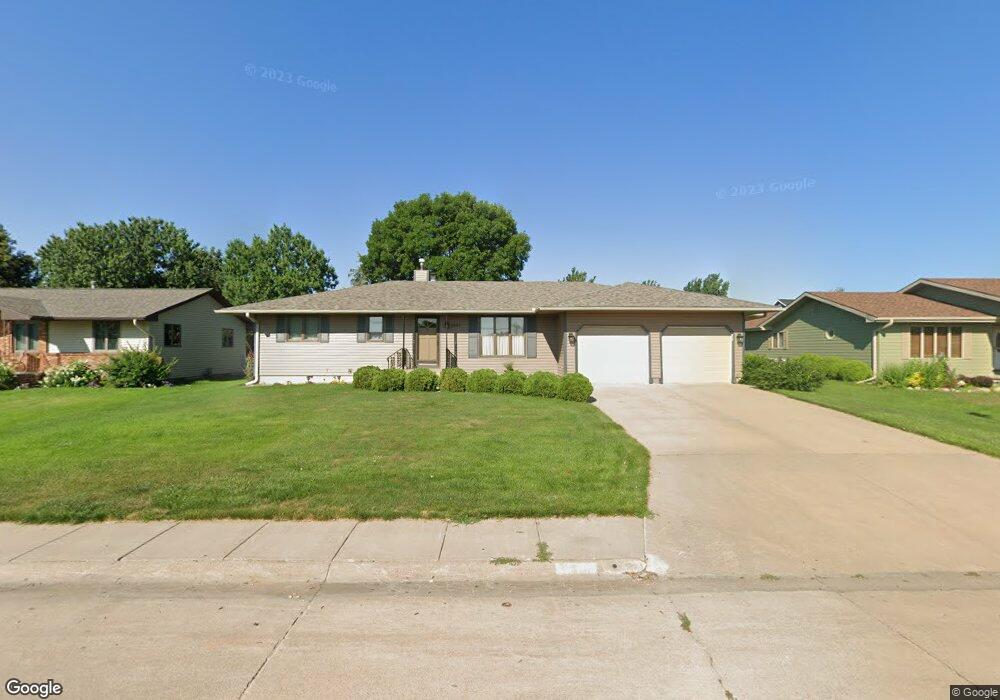
1501 Apache Ave Hastings, NE 68901
Estimated Value: $291,425 - $347,000
2
Beds
3
Baths
1,688
Sq Ft
$187/Sq Ft
Est. Value
About This Home
This home is located at 1501 Apache Ave, Hastings, NE 68901 and is currently estimated at $316,356, approximately $187 per square foot. 1501 Apache Ave is a home located in Adams County with nearby schools including Hastings Senior High School, St. Michael's Preschool & Elementary School, and Zion Lutheran School.
Ownership History
Date
Name
Owned For
Owner Type
Purchase Details
Closed on
Dec 13, 2019
Sold by
Theisen Roy H and Theisen Evelyn A
Bought by
Greenwalt Jeffrey A and Greenwalt Lois A
Current Estimated Value
Home Financials for this Owner
Home Financials are based on the most recent Mortgage that was taken out on this home.
Original Mortgage
$148,800
Outstanding Balance
$103,694
Interest Rate
3.7%
Mortgage Type
New Conventional
Estimated Equity
$212,662
Create a Home Valuation Report for This Property
The Home Valuation Report is an in-depth analysis detailing your home's value as well as a comparison with similar homes in the area
Home Values in the Area
Average Home Value in this Area
Purchase History
| Date | Buyer | Sale Price | Title Company |
|---|---|---|---|
| Greenwalt Jeffrey A | $186,000 | None Available |
Source: Public Records
Mortgage History
| Date | Status | Borrower | Loan Amount |
|---|---|---|---|
| Open | Greenwalt Jeffrey A | $148,800 |
Source: Public Records
Tax History
| Year | Tax Paid | Tax Assessment Tax Assessment Total Assessment is a certain percentage of the fair market value that is determined by local assessors to be the total taxable value of land and additions on the property. | Land | Improvement |
|---|---|---|---|---|
| 2025 | $3,899 | $249,389 | $28,080 | $221,309 |
| 2024 | $4,043 | $249,389 | $28,080 | $221,309 |
| 2023 | $4,461 | $216,193 | $28,080 | $188,113 |
| 2022 | $4,042 | $179,460 | $28,080 | $151,380 |
| 2021 | $3,884 | $177,120 | $25,740 | $151,380 |
| 2020 | $3,819 | $177,120 | $25,740 | $151,380 |
| 2019 | $3,779 | $177,120 | $25,740 | $151,380 |
| 2018 | $3,648 | $170,100 | $18,720 | $151,380 |
| 2017 | $3,581 | $167,130 | $0 | $0 |
| 2016 | $3,376 | $157,420 | $18,720 | $138,700 |
| 2011 | -- | $146,330 | $16,850 | $129,480 |
Source: Public Records
Map
Nearby Homes
- 1720 Apache Ave
- 1406 Sheridan Place
- 1401 Heritage Dr
- 1233 Heritage Dr
- 1253 Westridge Dr
- 1250 Heritage Place
- 1909 W 10th St
- 1105 Jefferson Ave
- 1934 W 9th St
- 1920 W 9th St
- 2019 W 9th St
- 910 Jefferson Ave
- 2412 W 8th St
- 736 N Barnes Ave
- 1334 W 12th St
- 1810 W 8th St
- 1831 W 8th St
- 1701 Boyce St
- 1109 N Webster Ave
- 2603 Bateman St
- 1509 Apache Ave
- 1421 Apache Ave
- 1410 Arapahoe Ave
- 1502 Arapahoe Ave
- 1415 Apache Ave
- 1515 Apache Ave
- 1506 Apache Ave
- 1506 Arapahoe Ave
- 1512 Apache Ave
- 1406 Arapahoe Ave
- 1420 Apache Ave
- 1405 Apache Ave
- 1521 Apache Ave
- 1518 Apache Ave
- 1510 Arapahoe Ave
- 1414 Apache Ave
- 1401 Apache Ave
- 1520 Apache Ave
- 1503 Arapahoe Ave
- 1405 Arapahoe Ave
Your Personal Tour Guide
Ask me questions while you tour the home.