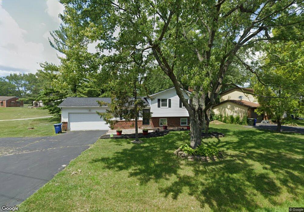
1501 Demorest Rd Columbus, OH 43228
Riverbend NeighborhoodEstimated Value: $231,000 - $269,000
3
Beds
2
Baths
1,080
Sq Ft
$237/Sq Ft
Est. Value
About This Home
This home is located at 1501 Demorest Rd, Columbus, OH 43228 and is currently estimated at $255,614, approximately $236 per square foot. 1501 Demorest Rd is a home located in Franklin County with nearby schools including West Franklin Elementary School, Franklin Woods Intermediate School, and Finland Middle School.
Ownership History
Date
Name
Owned For
Owner Type
Purchase Details
Closed on
Jun 23, 2025
Sold by
Heath A Hartgrove Family Trust and Hartgrove Heath A
Bought by
Ragland Jalin
Current Estimated Value
Purchase Details
Closed on
Oct 24, 2022
Sold by
Hartgrove-Holley Barbara S
Bought by
Heath A Hartgrove Family Trust
Purchase Details
Closed on
May 8, 1998
Sold by
Holley John H
Bought by
Hartgrove Holley Barbara S
Purchase Details
Closed on
May 20, 1992
Purchase Details
Closed on
Apr 1, 1986
Create a Home Valuation Report for This Property
The Home Valuation Report is an in-depth analysis detailing your home's value as well as a comparison with similar homes in the area
Home Values in the Area
Average Home Value in this Area
Purchase History
| Date | Buyer | Sale Price | Title Company |
|---|---|---|---|
| Ragland Jalin | -- | None Listed On Document | |
| Heath A Hartgrove Family Trust | -- | Simplifile | |
| Hartgrove Holley Barbara S | -- | -- | |
| -- | -- | -- | |
| -- | $60,000 | -- |
Source: Public Records
Tax History Compared to Growth
Tax History
| Year | Tax Paid | Tax Assessment Tax Assessment Total Assessment is a certain percentage of the fair market value that is determined by local assessors to be the total taxable value of land and additions on the property. | Land | Improvement |
|---|---|---|---|---|
| 2024 | $3,367 | $92,340 | $23,630 | $68,710 |
| 2023 | $3,307 | $92,330 | $23,625 | $68,705 |
| 2022 | $2,202 | $53,870 | $3,540 | $50,330 |
| 2021 | $2,246 | $53,870 | $3,540 | $50,330 |
| 2020 | $2,234 | $53,870 | $3,540 | $50,330 |
| 2019 | $2,017 | $44,700 | $2,940 | $41,760 |
| 2018 | $1,978 | $44,700 | $2,940 | $41,760 |
| 2017 | $1,998 | $44,700 | $2,940 | $41,760 |
| 2016 | $1,949 | $40,960 | $4,660 | $36,300 |
| 2015 | $1,949 | $40,960 | $4,660 | $36,300 |
| 2014 | $1,951 | $40,960 | $4,660 | $36,300 |
| 2013 | $1,002 | $42,105 | $5,180 | $36,925 |
Source: Public Records
Map
Nearby Homes
- 1485 Demorest Rd
- 3728 Greenock Ct
- 3623 High Creek Dr
- 1830 Winding Hollow Dr
- 3488 Rocky Rd
- 3766 Dunlane Ct
- 1657 Ripplebrook Rd
- 3206 Andy Terrace
- 3814 Clime Rd
- 3326 Bluhm Ct
- 1465 Tall Meadows Dr
- 2062 Summer Banks Dr
- 1226 Pinnacle Dr
- 2930 Alkire Rd
- 1181 Onslow Dr
- 3728 Miltonsburg Dr
- 2155 Pentress Dr
- 2188 Dry Ridge Ct
- 2157 Hierarch Ct
- 3360 Briggs Rd
- 1503 Demorest Rd
- 1497 Demorest Rd
- 1493 Demorest Rd
- 1505 Demorest Rd
- 1508 Demorest Rd
- 1498 Demorest Rd
- 1481 Demorest Rd
- 1515 Demorest Rd
- 1524 Klibreck Ct
- 1490 Demorest Rd
- 1521 Klibreck Ct
- 1477 Demorest Rd
- 1486 Demorest Rd
- 1516 Demorest Rd
- 1521 Demorest Rd
- 1473 Demorest Rd
- 1526 Demorest Rd
- 1478 Demorest Rd
- 1465 Demorest Rd
- 1530 Demorest Rd