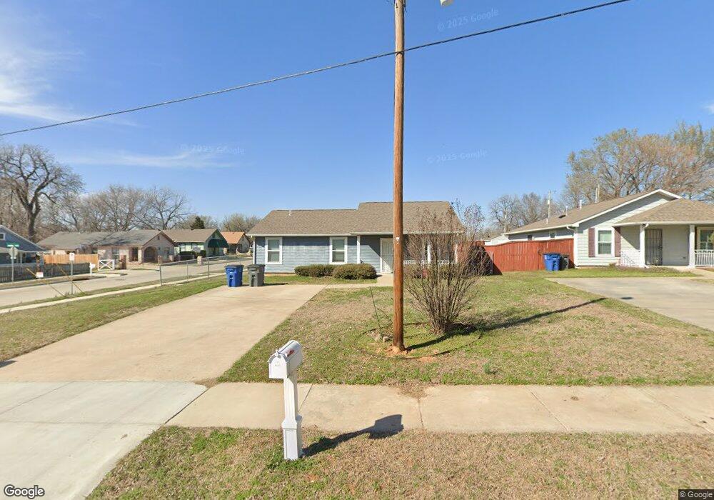
1501 E Independence St Tulsa, OK 74106
Crutchfield NeighborhoodEstimated Value: $131,217 - $169,000
Studio
--
Bath
1,120
Sq Ft
$135/Sq Ft
Est. Value
About This Home
This home is located at 1501 E Independence St, Tulsa, OK 74106 and is currently estimated at $151,054, approximately $134 per square foot. 1501 E Independence St is a home with nearby schools including Springdale Elementary School, Monroe Demonstration Academy, and McLain High School of Science and Technology.
Ownership History
Date
Name
Owned For
Owner Type
Purchase Details
Closed on
Jun 12, 2015
Sold by
Tulsa Habitat For Humanity Inc
Bought by
Gipson Brittany M
Current Estimated Value
Home Financials for this Owner
Home Financials are based on the most recent Mortgage that was taken out on this home.
Original Mortgage
$11,000
Outstanding Balance
$8,520
Interest Rate
3.91%
Mortgage Type
Stand Alone Second
Estimated Equity
$142,534
Create a Home Valuation Report for This Property
The Home Valuation Report is an in-depth analysis detailing your home's value as well as a comparison with similar homes in the area
Home Values in the Area
Average Home Value in this Area
Purchase History
| Date | Buyer | Sale Price | Title Company |
|---|---|---|---|
| Gipson Brittany M | $86,000 | Guaranty Abstract Co |
Source: Public Records
Mortgage History
| Date | Status | Borrower | Loan Amount |
|---|---|---|---|
| Open | Gipson Brittany M | $11,000 | |
| Open | Gipson Brittany M | $70,000 |
Source: Public Records
Tax History
| Year | Tax Paid | Tax Assessment Tax Assessment Total Assessment is a certain percentage of the fair market value that is determined by local assessors to be the total taxable value of land and additions on the property. | Land | Improvement |
|---|---|---|---|---|
| 2025 | $1,235 | $9,217 | $456 | $8,761 |
| 2024 | $1,095 | $8,919 | $512 | $8,407 |
| 2023 | $1,095 | $9,630 | $608 | $9,022 |
| 2022 | $1,113 | $8,350 | $632 | $7,718 |
| 2021 | $1,103 | $8,350 | $632 | $7,718 |
| 2020 | $1,088 | $8,350 | $632 | $7,718 |
| 2019 | $1,144 | $8,350 | $632 | $7,718 |
| 2018 | $1,147 | $8,350 | $632 | $7,718 |
| 2017 | $1,145 | $9,350 | $708 | $8,642 |
| 2016 | $1,121 | $9,350 | $708 | $8,752 |
| 2015 | $95 | $708 | $708 | $0 |
| 2014 | $84 | $627 | $627 | $0 |
Source: Public Records
Map
Nearby Homes
- 1025 N Quincy Ave
- 707 N Trenton Ave
- 732 N Victor Ave
- 1235 N Trenton Ave
- 1315 N Saint Louis Ave
- 56 N Xanthus Ave
- 1327 N Rockford Ave
- 1331 N Rockford Ave
- 1728 N Rockford Ave
- 1728 N Rockford Ave
- 105 S Wheeling Ave
- 0 N Saint Louis Ave Unit 2549844
- 1923 E Oklahoma St
- 2125 E 2nd St
- 1014 E Pine Place
- 629 E 3rd St
- 410 S Xanthus Ave
- 447 E Latimer St
- 2229 E Oklahoma St
- 759 E Queen St N
- 811 N Rockford Ave
- 1507 E Independence St
- 1515 E Independence St
- 738 N Rockford Ave
- 804 N Rockford Ave
- 736 N Rockford Ave
- 808 N Rockford East Ave
- 808 N Rockford Ave
- 1516 E Independence St
- 815 N Rockford Ave
- 804 N Saint Louis Ave
- 808 N Saint Louis Ave
- 814 N Saint Louis Ave
- 810 N Saint Louis Ave
- 730 N Rockford Ave
- 734 N Saint Louis Ave
- 719 N Rockford Ave
- 819 N Rockford Ave
- 818 N Saint Louis Ave
- 728 N Saint Louis Ave
Your Personal Tour Guide
Ask me questions while you tour the home.