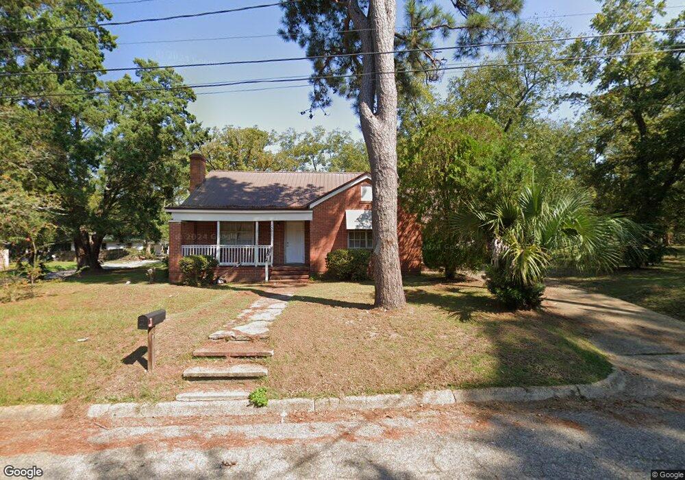
1501 E Newton St Dothan, AL 36303
Estimated Value: $91,000 - $156,904
3
Beds
3
Baths
2,115
Sq Ft
$57/Sq Ft
Est. Value
About This Home
This home is located at 1501 E Newton St, Dothan, AL 36303 and is currently estimated at $119,726, approximately $56 per square foot. 1501 E Newton St is a home located in Houston County with nearby schools including Dothan City Early Education Center, Jerry Lee Faine Elementary School, and Dothan Preparatory Academy.
Ownership History
Date
Name
Owned For
Owner Type
Purchase Details
Closed on
Jan 25, 2024
Sold by
Kelley James and Kelley Sharon G
Bought by
Russaw Frederica
Current Estimated Value
Home Financials for this Owner
Home Financials are based on the most recent Mortgage that was taken out on this home.
Original Mortgage
$57,000
Outstanding Balance
$46,796
Interest Rate
0.58%
Mortgage Type
Construction
Estimated Equity
$72,930
Purchase Details
Closed on
Nov 5, 2012
Sold by
Jpmorgan Chase Bank Na
Bought by
Kelley James and Kelley Sharon G
Create a Home Valuation Report for This Property
The Home Valuation Report is an in-depth analysis detailing your home's value as well as a comparison with similar homes in the area
Purchase History
| Date | Buyer | Sale Price | Title Company |
|---|---|---|---|
| Russaw Frederica | $60,000 | Attorney Only | |
| Kelley James | $12,000 | -- |
Source: Public Records
Mortgage History
| Date | Status | Borrower | Loan Amount |
|---|---|---|---|
| Open | Russaw Frederica | $57,000 |
Source: Public Records
Tax History
| Year | Tax Paid | Tax Assessment Tax Assessment Total Assessment is a certain percentage of the fair market value that is determined by local assessors to be the total taxable value of land and additions on the property. | Land | Improvement |
|---|---|---|---|---|
| 2025 | $706 | $19,620 | $0 | $0 |
| 2024 | $706 | $21,040 | $0 | $0 |
| 2023 | $757 | $20,260 | $0 | $0 |
| 2022 | $573 | $16,620 | $0 | $0 |
| 2021 | $563 | $20,800 | $0 | $0 |
| 2020 | $574 | $16,640 | $0 | $0 |
| 2019 | $603 | $17,480 | $0 | $0 |
| 2018 | $603 | $17,480 | $0 | $0 |
| 2017 | $463 | $13,420 | $0 | $0 |
| 2016 | $463 | $0 | $0 | $0 |
| 2015 | $463 | $0 | $0 | $0 |
| 2014 | $355 | $0 | $0 | $0 |
Source: Public Records
Map
Nearby Homes
- 1207 E Burdeshaw St
- 412 N Range St
- 1001 Meharis Cir
- 0 U S Highway 84 E
- 474 Webb Rd
- 605 E Newton St
- 904 Worthy Ave
- Lots 6 & 7 Lennox Ave
- LOT 8 & 9 Lennox Ave
- 707 State Ave
- 1118 Dellwood Ave
- 500 Pine St
- 905 State Ave
- 605 Collier St
- 308 Doris Ln
- 408 E Spring St
- 1200 N Cherry St
- 302 E Stough St
- 241 Headland Ave
- 2907 Saint Peter St
- 600 Price St
- 602 Price St
- 1506 E Newton St
- 1409 E Newton St
- 1504 E Newton St
- 1502 E Newton St
- 1508 Pryor St
- 1407 E Newton St
- 605 Price St
- 607 Price St
- 1403 E Newton St
- 611 Price St
- 1400 Pryor St
- 1402 E Newton St
- 602 Monroe St
- 1401 E Newton St
- 701 Parker St
- 604 Monroe St
- 507 Patterson St
- 511 Spellman St
Your Personal Tour Guide
Ask me questions while you tour the home.