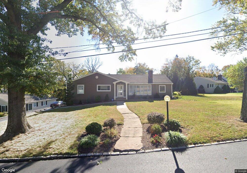
1501 Force Dr Mountainside, NJ 07092
Estimated Value: $822,000 - $994,000
Studio
--
Bath
1,535
Sq Ft
$576/Sq Ft
Est. Value
About This Home
This home is located at 1501 Force Dr, Mountainside, NJ 07092 and is currently estimated at $884,217, approximately $576 per square foot. 1501 Force Dr is a home located in Union County with nearby schools including Beechwood School, Deerfield Elementary School, and St Pauls Day School.
Ownership History
Date
Name
Owned For
Owner Type
Purchase Details
Closed on
Jul 20, 2010
Sold by
Carty Brian V and Carty Melissa M
Bought by
Lynn Omar and Lynn Heather
Current Estimated Value
Home Financials for this Owner
Home Financials are based on the most recent Mortgage that was taken out on this home.
Original Mortgage
$410,000
Outstanding Balance
$272,995
Interest Rate
4.76%
Mortgage Type
New Conventional
Estimated Equity
$611,222
Purchase Details
Closed on
Mar 27, 2002
Sold by
Ruggiero Peter
Bought by
Carty Brian and Carty Madeline
Home Financials for this Owner
Home Financials are based on the most recent Mortgage that was taken out on this home.
Original Mortgage
$310,000
Interest Rate
6.02%
Create a Home Valuation Report for This Property
The Home Valuation Report is an in-depth analysis detailing your home's value as well as a comparison with similar homes in the area
Home Values in the Area
Average Home Value in this Area
Purchase History
| Date | Buyer | Sale Price | Title Company |
|---|---|---|---|
| Lynn Omar | $460,000 | Multiple | |
| Carty Brian | $415,000 | -- |
Source: Public Records
Mortgage History
| Date | Status | Borrower | Loan Amount |
|---|---|---|---|
| Open | Lynn Omar | $410,000 | |
| Previous Owner | Carty Brian | $310,000 |
Source: Public Records
Tax History
| Year | Tax Paid | Tax Assessment Tax Assessment Total Assessment is a certain percentage of the fair market value that is determined by local assessors to be the total taxable value of land and additions on the property. | Land | Improvement |
|---|---|---|---|---|
| 2025 | $11,853 | $578,200 | $319,500 | $258,700 |
| 2024 | $11,495 | $578,200 | $319,500 | $258,700 |
| 2023 | $11,495 | $578,200 | $319,500 | $258,700 |
| 2022 | $11,547 | $578,200 | $319,500 | $258,700 |
| 2021 | $11,356 | $578,200 | $319,500 | $258,700 |
| 2020 | $10,636 | $142,300 | $62,100 | $80,200 |
| 2019 | $10,691 | $142,300 | $62,100 | $80,200 |
| 2018 | $10,712 | $142,300 | $62,100 | $80,200 |
| 2017 | $10,260 | $137,300 | $62,100 | $75,200 |
| 2016 | $10,027 | $137,300 | $62,100 | $75,200 |
Source: Public Records
Map
Nearby Homes
- 1532 Long Meadow
- 113 Barchester Way
- 316 Orenda Cir
- 170 New Providence Rd
- 1605 Justin Place
- 1613 Rising Way
- 1314 Wood Valley Rd
- 909 Wyandotte Trail
- 206 Echo Ridge Way
- 272 Old Tote Rd
- 910 Highland Ave
- 2588 Liberty Ave
- 403 Roberts Ln
- 336 Roberts Ln
- 825 Grant Ave
- 16 Canterbury Dr
- 301 John St
- 553 Parkview Ave
- 401 Acacia Rd
- 143 Stanmore Place
- 1495 Force Dr
- 218 Pembrook Rd
- 1504 Us Highway 22
- 1489 Force Dr
- 222 Pembrook Rd
- 1500 Force Dr
- 1508 Us Highway 22
- 210 Pembrook Rd
- 217 Pembrook Rd
- 1500 Us Highway 22
- 1494 Force Dr
- 213 Pembrook Rd
- 1488 Force Dr
- 1485 Force Dr
- 232 Pembrook Rd
- 1496 Us Highway 22
- 1474 Alpine Ridge Way Unit 1
- 1474 Alpine Ridge Way Unit 2
- 1474 Alpine Ridge Way Unit 4
- 1474 Alpine Ridge Way Unit 15
Your Personal Tour Guide
Ask me questions while you tour the home.