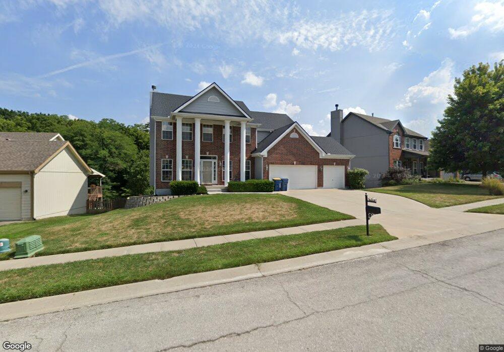
1501 Glen Brook Ln Liberty, MO 64068
Estimated Value: $422,518 - $487,000
4
Beds
3
Baths
1,385
Sq Ft
$331/Sq Ft
Est. Value
About This Home
This home is located at 1501 Glen Brook Ln, Liberty, MO 64068 and is currently estimated at $457,880, approximately $330 per square foot. 1501 Glen Brook Ln is a home located in Clay County with nearby schools including Manor Hill Elementary School, Liberty Middle School, and Liberty High School.
Ownership History
Date
Name
Owned For
Owner Type
Purchase Details
Closed on
Jul 22, 2011
Sold by
Acton Keith W and Doyle Sherry J
Bought by
Acton Keith W
Current Estimated Value
Home Financials for this Owner
Home Financials are based on the most recent Mortgage that was taken out on this home.
Original Mortgage
$160,600
Outstanding Balance
$110,592
Interest Rate
4.53%
Mortgage Type
New Conventional
Estimated Equity
$347,288
Purchase Details
Closed on
Aug 29, 2003
Sold by
Mcbride & Son Homes Kansas City Llc
Bought by
Acton Keith W and Doyle Sherry J
Home Financials for this Owner
Home Financials are based on the most recent Mortgage that was taken out on this home.
Original Mortgage
$192,000
Interest Rate
5.71%
Mortgage Type
Purchase Money Mortgage
Create a Home Valuation Report for This Property
The Home Valuation Report is an in-depth analysis detailing your home's value as well as a comparison with similar homes in the area
Home Values in the Area
Average Home Value in this Area
Purchase History
| Date | Buyer | Sale Price | Title Company |
|---|---|---|---|
| Acton Keith W | -- | Lsi | |
| Acton Keith W | -- | Stewart Title |
Source: Public Records
Mortgage History
| Date | Status | Borrower | Loan Amount |
|---|---|---|---|
| Open | Acton Keith W | $160,600 | |
| Closed | Acton Keith W | $192,000 |
Source: Public Records
Tax History Compared to Growth
Tax History
| Year | Tax Paid | Tax Assessment Tax Assessment Total Assessment is a certain percentage of the fair market value that is determined by local assessors to be the total taxable value of land and additions on the property. | Land | Improvement |
|---|---|---|---|---|
| 2025 | $5,150 | $75,010 | -- | -- |
| 2024 | $5,150 | $66,960 | -- | -- |
| 2023 | $5,237 | $66,960 | $0 | $0 |
| 2022 | $4,654 | $58,750 | $0 | $0 |
| 2021 | $4,618 | $58,748 | $7,600 | $51,148 |
| 2020 | $4,173 | $49,860 | $0 | $0 |
| 2019 | $4,173 | $49,856 | $7,600 | $42,256 |
| 2018 | $3,840 | $45,050 | $0 | $0 |
| 2017 | $0 | $45,050 | $5,700 | $39,350 |
| 2016 | $0 | $43,930 | $5,700 | $38,230 |
| 2015 | $3,710 | $43,930 | $5,700 | $38,230 |
| 2014 | $3,539 | $41,570 | $5,320 | $36,250 |
Source: Public Records
Map
Nearby Homes
- 977 Wellington Way
- 1505 Glen Brook Ln
- 1030 Maple Woods Dr
- 507 Vivian St
- 1608 Ray St
- 465 Lilly Ln
- 457 Lilly Ln
- 1588 Columbine Ct
- 429 Lilly Ln
- 1601 Johnston St
- 753 Todd Ct
- 215 Grant St
- 1304 Wellington Way
- McKinley Plan at Homestead of Liberty - Homestead
- Monroe Plan at Homestead of Liberty - Homestead
- Chestnut Plan at Homestead of Liberty - Homestead
- The Brooklyn Plan at Homestead of Liberty - Homestead
- Cypress Plan at Homestead of Liberty - Homestead
- The Linden Plan at Homestead of Liberty - Homestead
- Spruce Plan at Homestead of Liberty - Homestead
- 1497 Glen Brook Ln
- 1509 Glen Brook Ln
- 1493 Glen Brook Ln
- 1001 Maple Woods Dr
- 1492 Glen Brook Ln
- 1513 Glen Brook Ln
- 1488 Glen Brook Ln
- 1508 Glen Brook Ln
- 1489 Glen Brook Ln
- 1005 Maple Woods Dr
- 1002 Maple Woods Dr
- 1485 Glen Brook Ln
- 1512 Glen Brook Ln
- 1517 Glen Brook Ln
- 1484 Glen Brook Ln
- 1009 Maple Woods Dr
- 1516 Glen Brook Ln
- 1006 Maple Woods Dr
- 1521 Glen Brook Ln
- 1505 Ashton Dr