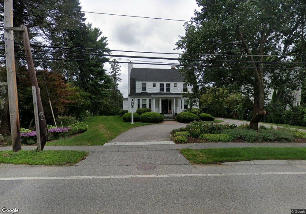
1501 Main St Concord, MA 01742
Estimated Value: $1,341,578 - $1,496,000
4
Beds
3
Baths
2,804
Sq Ft
$499/Sq Ft
Est. Value
About This Home
This home is located at 1501 Main St, Concord, MA 01742 and is currently estimated at $1,399,395, approximately $499 per square foot. 1501 Main St is a home located in Middlesex County with nearby schools including Thoreau Elementary School, Concord Middle School, and Nashoba Brooks School.
Ownership History
Date
Name
Owned For
Owner Type
Purchase Details
Closed on
Oct 28, 2015
Sold by
Dexter Charlotte L
Bought by
Dexter Thomas and Dexter Charlotte L
Current Estimated Value
Purchase Details
Closed on
Feb 11, 2014
Sold by
C L Dexter Children Ir and Dexter Thomas
Bought by
Dexter Charlotte L
Purchase Details
Closed on
Jun 24, 2008
Sold by
Dexter Charlotte L
Bought by
Charlotte L Dexter T and Dexter Charlotte L
Create a Home Valuation Report for This Property
The Home Valuation Report is an in-depth analysis detailing your home's value as well as a comparison with similar homes in the area
Home Values in the Area
Average Home Value in this Area
Purchase History
| Date | Buyer | Sale Price | Title Company |
|---|---|---|---|
| Dexter Thomas | -- | -- | |
| Dexter Charlotte L | $380,000 | -- | |
| C L Dexter Children Ir | -- | -- | |
| Charlotte L Dexter T | -- | -- |
Source: Public Records
Tax History Compared to Growth
Tax History
| Year | Tax Paid | Tax Assessment Tax Assessment Total Assessment is a certain percentage of the fair market value that is determined by local assessors to be the total taxable value of land and additions on the property. | Land | Improvement |
|---|---|---|---|---|
| 2025 | $148 | $1,119,100 | $465,800 | $653,300 |
| 2024 | $14,694 | $1,119,100 | $465,800 | $653,300 |
| 2023 | $13,563 | $1,046,500 | $423,500 | $623,000 |
| 2022 | $12,722 | $861,900 | $338,700 | $523,200 |
| 2021 | $12,259 | $832,800 | $338,700 | $494,100 |
| 2020 | $11,909 | $836,900 | $338,700 | $498,200 |
| 2019 | $11,668 | $822,300 | $349,900 | $472,400 |
| 2018 | $11,252 | $787,400 | $321,200 | $466,200 |
| 2017 | $10,757 | $764,500 | $298,300 | $466,200 |
| 2016 | $10,627 | $763,400 | $298,300 | $465,100 |
| 2015 | $10,056 | $703,700 | $276,200 | $427,500 |
Source: Public Records
Map
Nearby Homes
- 70 McCallar Ln
- 102 Highland St
- 111 Central St
- 54 Maple St
- 1687 Main St
- 114 Upland Rd
- 27 Water St
- 37 Water St
- 70 Hillside Ave
- 1844 Main St Unit 1844
- 88 Wright Rd
- 10 Wright Rd
- 12 S Meadow Ridge Unit 12
- 12 S Meadow Ridge
- 65 Summit St
- 23 Concord Greene Unit 4
- 1053 Main St
- 16 Concord Greene Unit 5
- 24 Concord Greene Unit 7
- 80 N Branch Rd