
Seller's Agent in 2019
Dan Maymar
John L. Scott Ashland
(541) 292-0211
25 Total Sales
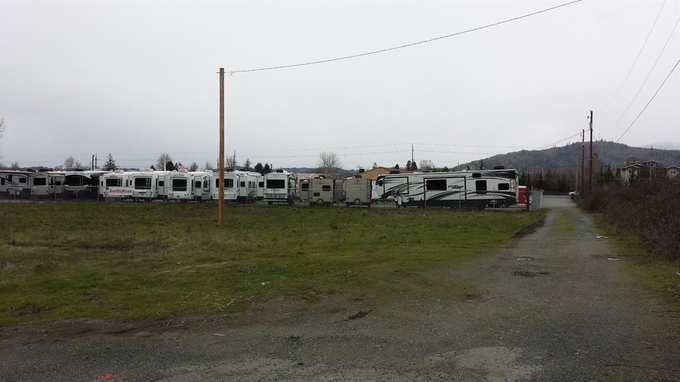
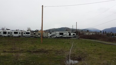

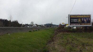
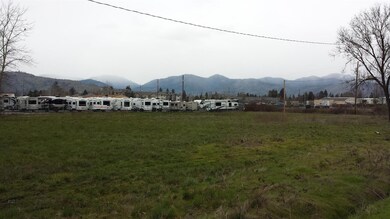
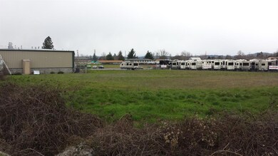
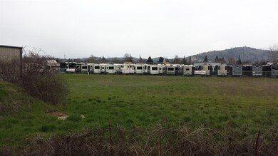
Cleared and level 1.75 +/- General Commercial zoned parcel with Redwood Highway 199 frontage within a mile of the Allen Creek shopping center and surrounded by growth, homes, apartments, senior housing, industry, etc. Property has extensive Redwood Highway frontage visibility and access is off Redwood Avenue. Property also features a lighted billboard that is highly visible from Redwood Highway 199 - currently leased. Seller will carry 50% down, interest only balance due in 2 years.
Last Agent to Sell the Property
John L. Scott Ashland Brokerage Phone: 5412920211 License #200311017 Listed on: 04/10/2018
Last Buyer's Agent
John L. Scott Ashland Brokerage Phone: 5412920211 License #200311017 Listed on: 04/10/2018
| Date | Event | Price | List to Sale | Price per Sq Ft |
|---|---|---|---|---|
| 04/17/2019 04/17/19 | Sold | $185,000 | -17.8% | $265 / Sq Ft |
| 03/08/2019 03/08/19 | Pending | -- | -- | -- |
| 03/29/2017 03/29/17 | For Sale | $225,000 | -- | $323 / Sq Ft |
| Year | Tax Paid | Tax Assessment Tax Assessment Total Assessment is a certain percentage of the fair market value that is determined by local assessors to be the total taxable value of land and additions on the property. | Land | Improvement |
|---|---|---|---|---|
| 2025 | $18,748 | $1,404,480 | $243,290 | $1,161,190 |
| 2024 | $18,748 | $1,404,480 | $243,290 | $1,161,190 |
| 2023 | $17,773 | $1,369,690 | $0 | $0 |
| 2022 | $17,857 | $1,329,800 | -- | -- |
| 2021 | $16,772 | $1,291,070 | $0 | $0 |
| 2020 | $2,185 | $168,170 | $0 | $0 |
| 2019 | $2,122 | $163,280 | $0 | $0 |
| 2018 | $2,159 | $158,530 | $0 | $0 |
| 2017 | $2,143 | $153,920 | $0 | $0 |
| 2016 | $1,884 | $149,440 | $0 | $0 |
| 2015 | $1,823 | $145,090 | $0 | $0 |
| 2014 | $1,773 | $140,870 | $0 | $0 |
Seller's Agent in 2019
Dan Maymar
John L. Scott Ashland
(541) 292-0211
25 Total Sales
Source: Oregon Datashare
MLS Number: 102974913
APN: R319708
Disclaimer: Certain information contained herein is derived from information provided by parties other than Homes.com. All information provided is deemed reliable, but is not guaranteed to be accurate and should be independently verified.
![]() © 2025 Oregon Datashare (KCAR | MLSCO | SOMLS). All rights reserved. The data relating to real estate for sale on this web site comes in part from the Internet Data Exchange Program of the Oregon Datashare. Real estate listings held by IDX Brokerage firms other than Ten-X are marked with the Internet Data Exchange logo or the Internet Data Exchange thumbnail logo and detailed information about them includes the name of the listing Brokers. Information provided is for consumers' personal, non-commercial use and may not be used for any purpose other than to identify prospective properties the viewer may be interested in purchasing. The consumer will not copy, retransmit nor redistribute any of the content from this website. Information provided is deemed reliable, but not guaranteed.
© 2025 Oregon Datashare (KCAR | MLSCO | SOMLS). All rights reserved. The data relating to real estate for sale on this web site comes in part from the Internet Data Exchange Program of the Oregon Datashare. Real estate listings held by IDX Brokerage firms other than Ten-X are marked with the Internet Data Exchange logo or the Internet Data Exchange thumbnail logo and detailed information about them includes the name of the listing Brokers. Information provided is for consumers' personal, non-commercial use and may not be used for any purpose other than to identify prospective properties the viewer may be interested in purchasing. The consumer will not copy, retransmit nor redistribute any of the content from this website. Information provided is deemed reliable, but not guaranteed.