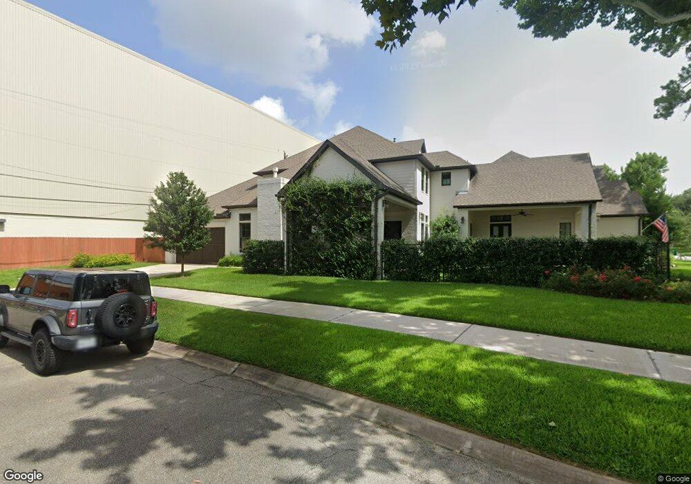
1501 Ronson Rd Houston, TX 77055
Spring Branch East NeighborhoodEstimated Value: $641,000 - $1,493,000
4
Beds
4
Baths
3,461
Sq Ft
$340/Sq Ft
Est. Value
About This Home
This home is located at 1501 Ronson Rd, Houston, TX 77055 and is currently estimated at $1,177,068, approximately $340 per square foot. 1501 Ronson Rd is a home located in Harris County with nearby schools including Valley Oaks Elementary School, Landrum Middle School, and Memorial High School.
Ownership History
Date
Name
Owned For
Owner Type
Purchase Details
Closed on
Jan 18, 2019
Sold by
1501 Ronson Series A Separate Series Of
Bought by
Hattig Gregory and Hattig Leslie
Current Estimated Value
Purchase Details
Closed on
Apr 2, 2018
Sold by
Hattig Gregory
Bought by
1501 Ronson Series and Hattig Homes Llc
Purchase Details
Closed on
Aug 2, 2002
Sold by
Goldstein Jody Michele
Bought by
Hattig Gregory Wayne
Home Financials for this Owner
Home Financials are based on the most recent Mortgage that was taken out on this home.
Original Mortgage
$77,400
Interest Rate
6.48%
Mortgage Type
Seller Take Back
Purchase Details
Closed on
Apr 23, 2002
Sold by
Meador Norma G
Bought by
Hattig Gregory
Home Financials for this Owner
Home Financials are based on the most recent Mortgage that was taken out on this home.
Original Mortgage
$77,400
Interest Rate
7.09%
Create a Home Valuation Report for This Property
The Home Valuation Report is an in-depth analysis detailing your home's value as well as a comparison with similar homes in the area
Home Values in the Area
Average Home Value in this Area
Purchase History
| Date | Buyer | Sale Price | Title Company |
|---|---|---|---|
| Hattig Gregory | -- | None Available | |
| 1501 Ronson Series | -- | None Available | |
| Hattig Gregory Wayne | -- | -- | |
| Hattig Gregory | -- | Stewart Title |
Source: Public Records
Mortgage History
| Date | Status | Borrower | Loan Amount |
|---|---|---|---|
| Previous Owner | Hattig Gregory Wayne | $77,400 | |
| Previous Owner | Hattig Gregory | $77,400 |
Source: Public Records
Tax History Compared to Growth
Tax History
| Year | Tax Paid | Tax Assessment Tax Assessment Total Assessment is a certain percentage of the fair market value that is determined by local assessors to be the total taxable value of land and additions on the property. | Land | Improvement |
|---|---|---|---|---|
| 2025 | $19,803 | $1,298,038 | $437,499 | $860,539 |
| 2024 | $19,803 | $1,184,000 | $437,499 | $746,501 |
| 2023 | $19,803 | $1,215,327 | $419,999 | $795,328 |
| 2022 | $8,439 | $1,078,286 | $367,499 | $710,787 |
| 2021 | $23,083 | $897,000 | $367,499 | $529,501 |
| 2020 | $26,068 | $1,000,454 | $331,578 | $668,876 |
| 2019 | $19,884 | $731,578 | $331,578 | $400,000 |
| 2018 | $4,466 | $365,000 | $331,578 | $33,422 |
| 2017 | $9,549 | $365,000 | $331,578 | $33,422 |
| 2016 | $9,549 | $365,000 | $331,578 | $33,422 |
| 2015 | $3,032 | $383,265 | $313,157 | $70,108 |
| 2014 | $3,032 | $217,400 | $147,368 | $70,032 |
Source: Public Records
Map
Nearby Homes
- 1441 Bingle Rd
- 1526 Ojeman Rd Unit A
- 1607 W Rose Terrace Ln
- 1614 Ojeman Rd Unit E
- 1614 Ojeman Rd Unit J
- 8606 Westview Dr
- 1506 Longacre Dr
- 8706 Strongoak Ln
- 1510 Longacre Dr
- 1701 Bayram Dr
- 1328 Bingle Rd
- 1653 Bingle Rd
- 1324 Bingle Rd
- 8603 Costmary Ln
- 1719 Bayram Dr
- 1720 Sedola Ln
- 1704 Sedola Ln
- 1705 Bologna Ln
- 8521 Merlin Dr
- 1711 Bologna Ln
- 1505 Ronson Rd
- 1509 Ronson Rd
- 8537 Panatella Dr
- 8526 Panatella Dr
- 1506 Ronson Rd
- 8533 Panatella Dr
- 1513 Ronson Rd
- 8529 Panatella Dr
- 1510 Ronson Rd
- 1514 Ronson Rd
- 8522 Panatella Dr
- 1517 Ronson Rd
- 8525 Panatella Dr
- 1514 Bingle Rd
- 1518 Ronson Rd
- 1512 Bingle Rd
- 1509 Bayram Dr
- 1513 Bayram Dr
- 8521 Panatella Dr
- 1521 Ronson Rd