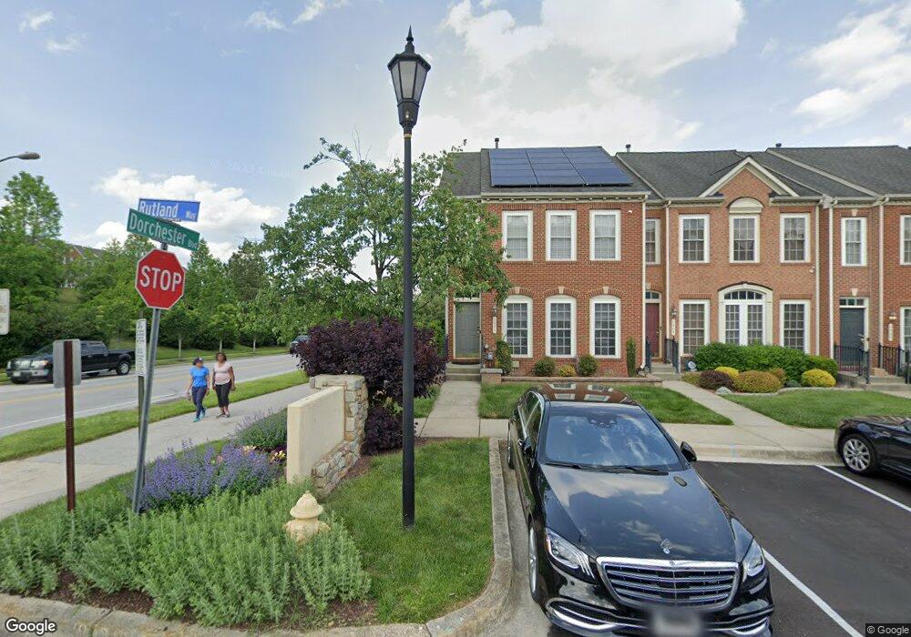
1501 Rutland Way Hanover, MD 21076
Estimated Value: $763,748
--
Bed
3
Baths
2,072
Sq Ft
$369/Sq Ft
Est. Value
About This Home
This home is located at 1501 Rutland Way, Hanover, MD 21076 and is currently estimated at $763,748, approximately $368 per square foot. 1501 Rutland Way is a home located in Anne Arundel County with nearby schools including Hebron-Harman Elementary School, MacArthur Middle School, and Meade High School.
Ownership History
Date
Name
Owned For
Owner Type
Purchase Details
Closed on
Jun 30, 2006
Sold by
Cc & Dorchester Llc
Bought by
Redfield Stewart
Current Estimated Value
Home Financials for this Owner
Home Financials are based on the most recent Mortgage that was taken out on this home.
Original Mortgage
$441,700
Outstanding Balance
$277,785
Interest Rate
7.75%
Mortgage Type
Purchase Money Mortgage
Estimated Equity
$485,963
Create a Home Valuation Report for This Property
The Home Valuation Report is an in-depth analysis detailing your home's value as well as a comparison with similar homes in the area
Home Values in the Area
Average Home Value in this Area
Purchase History
| Date | Buyer | Sale Price | Title Company |
|---|---|---|---|
| Redfield Stewart | $552,142 | -- |
Source: Public Records
Mortgage History
| Date | Status | Borrower | Loan Amount |
|---|---|---|---|
| Open | Redfield Stewart | $441,700 | |
| Closed | Redfield Stewart | $110,400 |
Source: Public Records
Tax History Compared to Growth
Tax History
| Year | Tax Paid | Tax Assessment Tax Assessment Total Assessment is a certain percentage of the fair market value that is determined by local assessors to be the total taxable value of land and additions on the property. | Land | Improvement |
|---|---|---|---|---|
| 2025 | $1,667 | $422,200 | $140,000 | $282,200 |
| 2024 | $1,667 | $406,200 | $0 | $0 |
| 2023 | $1,696 | $390,200 | $0 | $0 |
| 2022 | $4,251 | $374,200 | $140,000 | $234,200 |
| 2021 | $3,264 | $371,867 | $0 | $0 |
| 2020 | $5,085 | $369,533 | $0 | $0 |
| 2019 | $9,795 | $367,200 | $130,000 | $237,200 |
| 2018 | $3,678 | $362,767 | $0 | $0 |
| 2017 | $4,687 | $358,333 | $0 | $0 |
| 2016 | -- | $353,900 | $0 | $0 |
| 2015 | -- | $347,333 | $0 | $0 |
| 2014 | -- | $340,767 | $0 | $0 |
Source: Public Records
Map
Nearby Homes
- 1544 Rutland Way
- 7266 Dorchester Woods Ln
- 7296 Dorchester Woods Ln
- 7151 Wright Rd
- 7143 Wright Rd
- Parcel 325 Wright Rd
- Parcel 265 Wright Rd
- Parcel 271 Wright Rd
- Parcel 316-7147 Wright Rd
- 7111 River Birch Dr
- 7135 Wright Rd
- 7131 Wright Rd
- 7591 Taunton Ct
- 7490 Race Rd
- 7432 Race Rd
- 7147 Wedmore Ct
- 7310 Wisteria Point Dr
- 7327 Wisteria Point Dr
- 6810 Morning Glory Trail
- 6504 Whitetail Crossing Way
- 1503 Rutland Way
- 1505 Rutland Way
- 1507 Rutland Way
- 1509 Rutland Way
- 1511 Rutland Way
- 1502 Rutland Way
- 1513 Rutland Way
- 1504 Rutland Way
- 1506 Rutland Way
- 1508 Rutland Way
- 1515 Rutland Way
- 1510 Rutland Way
- 1504 Penzance Way
- 1512 Rutland Way
- 1506 Penzance Way
- 1502 Penzance Way
- 1508 Penzance Way
- 1514 Rutland Way
- 1510 Penzance Way
- 1516 Rutland Way