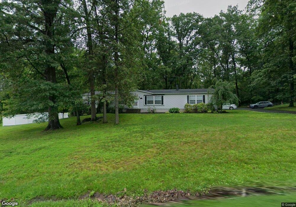
1501 Tunnel Rd Perkasie, PA 18944
East Rockhill NeighborhoodEstimated Value: $483,000 - $567,000
3
Beds
3
Baths
2,052
Sq Ft
$257/Sq Ft
Est. Value
About This Home
This home is located at 1501 Tunnel Rd, Perkasie, PA 18944 and is currently estimated at $526,828, approximately $256 per square foot. 1501 Tunnel Rd is a home located in Bucks County with nearby schools including Pennridge High School, Upper Bucks Christian School, and Community Service Foundation.
Ownership History
Date
Name
Owned For
Owner Type
Purchase Details
Closed on
Sep 11, 1998
Sold by
Hawkins Robert E and Hawkins Walter E
Bought by
Hawkins Walter E and Morcom Merle A
Current Estimated Value
Home Financials for this Owner
Home Financials are based on the most recent Mortgage that was taken out on this home.
Original Mortgage
$124,000
Interest Rate
8.5%
Purchase Details
Closed on
Oct 26, 1987
Bought by
Hawkins Robert E and Hawkins Walter E
Create a Home Valuation Report for This Property
The Home Valuation Report is an in-depth analysis detailing your home's value as well as a comparison with similar homes in the area
Home Values in the Area
Average Home Value in this Area
Purchase History
| Date | Buyer | Sale Price | Title Company |
|---|---|---|---|
| Hawkins Walter E | $27,079 | -- | |
| Hawkins Robert E | $64,500 | -- |
Source: Public Records
Mortgage History
| Date | Status | Borrower | Loan Amount |
|---|---|---|---|
| Closed | Hawkins Walter E | $124,000 |
Source: Public Records
Tax History Compared to Growth
Tax History
| Year | Tax Paid | Tax Assessment Tax Assessment Total Assessment is a certain percentage of the fair market value that is determined by local assessors to be the total taxable value of land and additions on the property. | Land | Improvement |
|---|---|---|---|---|
| 2025 | $5,108 | $29,200 | $7,160 | $22,040 |
| 2024 | $5,108 | $29,200 | $7,160 | $22,040 |
| 2023 | $5,050 | $29,200 | $7,160 | $22,040 |
| 2022 | $5,050 | $29,200 | $7,160 | $22,040 |
| 2021 | $5,050 | $29,200 | $7,160 | $22,040 |
| 2020 | $5,050 | $29,200 | $7,160 | $22,040 |
| 2019 | $5,021 | $29,200 | $7,160 | $22,040 |
| 2018 | $4,962 | $29,200 | $7,160 | $22,040 |
| 2017 | $4,926 | $29,200 | $7,160 | $22,040 |
| 2016 | $4,926 | $29,200 | $7,160 | $22,040 |
| 2015 | -- | $29,200 | $7,160 | $22,040 |
| 2014 | -- | $29,200 | $7,160 | $22,040 |
Source: Public Records
Map
Nearby Homes
- 1000 Bluebird Ln Unit COVINGTON
- 1000 Bluebird Ln Unit WOODFORD
- 1000 Bluebird Ln Unit MAGNOLIA
- 1000 Bluebird Ln Unit DEVONSHIRE
- Woodford Plan at Everleigh Woods
- Manchester Plan at Everleigh Woods
- Arcadia Plan at Everleigh Woods
- Parker Plan at Everleigh Woods
- Sebastian Plan at Everleigh Woods
- Hawthorne Plan at Everleigh Woods
- Kipling Plan at Everleigh Woods
- Magnolia Plan at Everleigh Woods
- Savannah Plan at Everleigh Woods
- Ethan Plan at Everleigh Woods
- Devonshire Plan at Everleigh Woods
- Covington Plan at Everleigh Woods
- Augusta Plan at Everleigh Woods
- Nottingham Plan at Everleigh Woods
- 96 Liberty Trail
- 449 Liberty Trail
- 1498 Tunnel Rd
- 325 Dell Dr
- 336 Harriet Dr
- 321 Dell Dr
- 332 Harriet Dr
- 409 3 Mile Run Rd
- 405 3 Mile Run Rd
- 405 3 Mile Run Rd
- 317 Dell Dr
- 325 Harriet Dr
- 401 3 Mile Run Rd
- 413 3 Mile Run Rd
- 328 Harriet Dr
- 413 3 Mile Run Rd
- 320 Dell Dr
- 401 Three Mile Run Rd
- 313 Dell Dr
- 321 Harriet Dr
- 415 3 Mile Run Rd
- 324 Harriet Dr