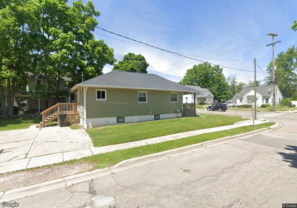
1501 W Main St Owosso, MI 48867
Estimated Value: $99,497 - $115,000
3
Beds
1
Bath
864
Sq Ft
$124/Sq Ft
Est. Value
About This Home
This home is located at 1501 W Main St, Owosso, MI 48867 and is currently estimated at $107,374, approximately $124 per square foot. 1501 W Main St is a home located in Shiawassee County with nearby schools including Owosso High School, Salem Lutheran School, and Spring Vale Christian School.
Ownership History
Date
Name
Owned For
Owner Type
Purchase Details
Closed on
Sep 20, 2021
Sold by
Brown Mike
Bought by
Rysa Partners Llc
Current Estimated Value
Purchase Details
Closed on
Apr 27, 2010
Sold by
National City Bank
Bought by
Secretary Of H U D
Purchase Details
Closed on
Oct 7, 2009
Sold by
Price Robert V and Price Linda M
Bought by
National City Bank
Purchase Details
Closed on
Sep 17, 2004
Sold by
Skutt Troy E
Bought by
Price Robert and Price Linda M
Home Financials for this Owner
Home Financials are based on the most recent Mortgage that was taken out on this home.
Original Mortgage
$67,835
Interest Rate
6.08%
Mortgage Type
FHA
Purchase Details
Closed on
Apr 14, 2004
Sold by
Magley Rosemary
Bought by
Skutt Troy E
Create a Home Valuation Report for This Property
The Home Valuation Report is an in-depth analysis detailing your home's value as well as a comparison with similar homes in the area
Home Values in the Area
Average Home Value in this Area
Purchase History
| Date | Buyer | Sale Price | Title Company |
|---|---|---|---|
| Rysa Partners Llc | $18,000 | Accommodation | |
| Secretary Of H U D | -- | -- | |
| National City Bank | $69,145 | -- | |
| Price Robert | $68,900 | -- | |
| Skutt Troy E | $28,000 | -- |
Source: Public Records
Mortgage History
| Date | Status | Borrower | Loan Amount |
|---|---|---|---|
| Previous Owner | Price Robert | $67,835 |
Source: Public Records
Tax History Compared to Growth
Tax History
| Year | Tax Paid | Tax Assessment Tax Assessment Total Assessment is a certain percentage of the fair market value that is determined by local assessors to be the total taxable value of land and additions on the property. | Land | Improvement |
|---|---|---|---|---|
| 2025 | $1,843 | $38,400 | $0 | $0 |
| 2024 | $1,843 | $35,300 | $0 | $0 |
| 2023 | $819 | $31,100 | $0 | $0 |
| 2022 | $1,776 | $28,400 | $0 | $0 |
| 2021 | $1,350 | $26,600 | $0 | $0 |
| 2020 | $1,375 | $25,300 | $0 | $0 |
| 2019 | $1,351 | $20,700 | $0 | $0 |
| 2018 | -- | $20,600 | $0 | $0 |
| 2017 | -- | $20,300 | $0 | $0 |
| 2016 | -- | $20,300 | $0 | $0 |
| 2015 | -- | $20,100 | $0 | $0 |
| 2014 | -- | $19,900 | $0 | $0 |
Source: Public Records
Map
Nearby Homes
- 1408 W Main St
- 117 Elliot St
- 700 Nafus St
- 717 Nafus St
- 911 Beehler St
- 214 S Cedar St
- 817 S Chipman St
- 821 Ryan St
- 1339 Olmstead St
- Vacant W Oliver St
- 618 Clinton St
- 206 N Howell St
- 528 River St
- 522 River St
- 214 N Elm St
- V/L W South (1 6) Acres St
- V/L W South - Lot#11 St
- 523 Fletcher St
- 707 W King St
- 428 Cass St