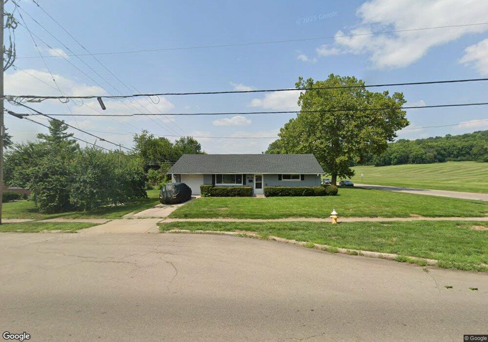
1501 W Stroop Rd Dayton, OH 45439
Estimated Value: $159,000 - $172,000
2
Beds
1
Bath
936
Sq Ft
$175/Sq Ft
Est. Value
About This Home
This home is located at 1501 W Stroop Rd, Dayton, OH 45439 and is currently estimated at $163,745, approximately $174 per square foot. 1501 W Stroop Rd is a home located in Montgomery County with nearby schools including Southdale Elementary School, Van Buren Middle School, and Kettering Fairmont High School.
Ownership History
Date
Name
Owned For
Owner Type
Purchase Details
Closed on
Aug 4, 2017
Sold by
Mentor Partners Group Llc
Bought by
Rsf Properties Llc
Current Estimated Value
Purchase Details
Closed on
Dec 16, 2004
Sold by
Huber Management Corp
Bought by
Mentor Partners Group Llc
Home Financials for this Owner
Home Financials are based on the most recent Mortgage that was taken out on this home.
Original Mortgage
$878,500
Interest Rate
4.99%
Mortgage Type
Purchase Money Mortgage
Create a Home Valuation Report for This Property
The Home Valuation Report is an in-depth analysis detailing your home's value as well as a comparison with similar homes in the area
Home Values in the Area
Average Home Value in this Area
Purchase History
| Date | Buyer | Sale Price | Title Company |
|---|---|---|---|
| Rsf Properties Llc | $37,500 | None Available | |
| Mentor Partners Group Llc | $1,094,700 | None Available |
Source: Public Records
Mortgage History
| Date | Status | Borrower | Loan Amount |
|---|---|---|---|
| Previous Owner | Mentor Partners Group Llc | $878,500 |
Source: Public Records
Tax History Compared to Growth
Tax History
| Year | Tax Paid | Tax Assessment Tax Assessment Total Assessment is a certain percentage of the fair market value that is determined by local assessors to be the total taxable value of land and additions on the property. | Land | Improvement |
|---|---|---|---|---|
| 2024 | $2,547 | $39,440 | $10,850 | $28,590 |
| 2023 | $2,547 | $39,440 | $10,850 | $28,590 |
| 2022 | $2,093 | $25,490 | $7,000 | $18,490 |
| 2021 | $1,943 | $25,490 | $7,000 | $18,490 |
| 2020 | $1,949 | $25,490 | $7,000 | $18,490 |
| 2019 | $2,027 | $23,480 | $7,000 | $16,480 |
| 2018 | $2,038 | $23,480 | $7,000 | $16,480 |
| 2017 | $1,885 | $23,480 | $7,000 | $16,480 |
| 2016 | $2,014 | $23,630 | $7,000 | $16,630 |
| 2015 | $1,941 | $23,630 | $7,000 | $16,630 |
| 2014 | $1,941 | $23,630 | $7,000 | $16,630 |
| 2012 | -- | $24,820 | $8,400 | $16,420 |
Source: Public Records
Map
Nearby Homes
- 1673 W Stroop Rd
- 4301 Tait Rd
- 2090 Mattis Dr
- 3720 Ridgeleigh Rd Unit D
- 1905 Tait Circle Rd
- 1952 Tait Circle Rd
- 1349 Tamerlane Rd
- 3519 Waterbury Dr
- 2050 William Ln
- 1314 Ridgeview Ave
- 4400 Royal Ridge Way
- 1301 Ridgeview Ave
- 4207 S Dixie Dr
- 4519 Harbison St
- 1125 Laurelwood Rd
- 3225 Southdale Dr Unit 1
- 4629 Richwood Dr
- 4447 Royal Ridge Way
- 4661 Richwood Dr
- 1955 Kresswood Cir
- 3973 Tait Rd
- 1513 W Stroop Rd
- 3959 Tait Rd
- 1525 W Stroop Rd
- 3945 Tait Rd
- 1537 W Stroop Rd
- 4026 Prystup Place
- 1512 Hillwood Dr
- 3933 Tait Rd
- 4023 Prystup Place
- 1549 W Stroop Rd
- 1536 Hillwood Dr
- 1500 Hillwood Dr
- 1832 W Stroop Rd
- 3917 Tait Rd
- 1561 W Stroop Rd
- 4041 Prystup Place
- 1548 Hillwood Dr
- 3918 Utica Dr
- 1846 W Stroop Rd