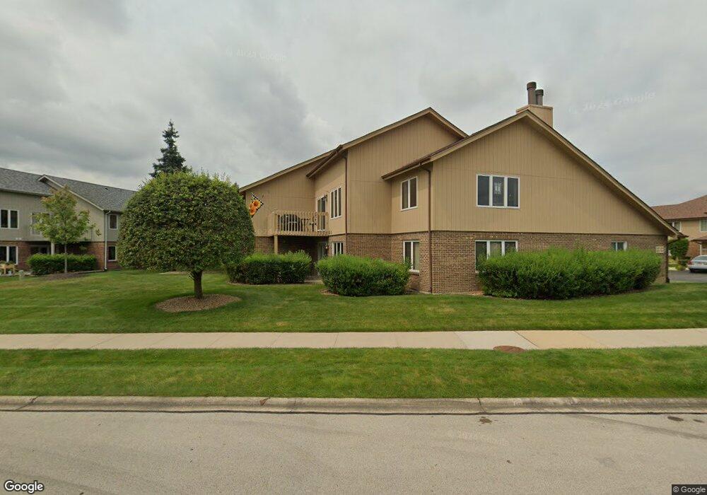
15012 Mayo Dr Unit 17C Orland Park, IL 60462
Central Orland NeighborhoodEstimated Value: $297,732 - $331,000
3
Beds
2
Baths
2,000
Sq Ft
$159/Sq Ft
Est. Value
About This Home
This home is located at 15012 Mayo Dr Unit 17C, Orland Park, IL 60462 and is currently estimated at $317,933, approximately $158 per square foot. 15012 Mayo Dr Unit 17C is a home located in Cook County with nearby schools including Prairie Elementary School, Liberty Elementary School, and Jerling Junior High School.
Ownership History
Date
Name
Owned For
Owner Type
Purchase Details
Closed on
Aug 13, 1999
Sold by
Scholl William A and Scholl Angelyn
Bought by
Unander Curt C and Unander Jane M
Current Estimated Value
Home Financials for this Owner
Home Financials are based on the most recent Mortgage that was taken out on this home.
Original Mortgage
$60,000
Outstanding Balance
$17,309
Interest Rate
7.7%
Estimated Equity
$300,624
Create a Home Valuation Report for This Property
The Home Valuation Report is an in-depth analysis detailing your home's value as well as a comparison with similar homes in the area
Home Values in the Area
Average Home Value in this Area
Purchase History
| Date | Buyer | Sale Price | Title Company |
|---|---|---|---|
| Unander Curt C | $171,000 | -- |
Source: Public Records
Mortgage History
| Date | Status | Borrower | Loan Amount |
|---|---|---|---|
| Open | Unander Curt C | $60,000 |
Source: Public Records
Tax History Compared to Growth
Tax History
| Year | Tax Paid | Tax Assessment Tax Assessment Total Assessment is a certain percentage of the fair market value that is determined by local assessors to be the total taxable value of land and additions on the property. | Land | Improvement |
|---|---|---|---|---|
| 2024 | $5,199 | $26,743 | $4,149 | $22,594 |
| 2023 | $3,885 | $26,743 | $4,149 | $22,594 |
| 2022 | $3,885 | $19,128 | $3,651 | $15,477 |
| 2021 | $3,799 | $19,127 | $3,651 | $15,476 |
| 2020 | $3,771 | $19,127 | $3,651 | $15,476 |
| 2019 | $2,931 | $16,850 | $3,319 | $13,531 |
| 2018 | $2,848 | $16,850 | $3,319 | $13,531 |
| 2017 | $2,811 | $16,850 | $3,319 | $13,531 |
| 2016 | $3,393 | $16,441 | $2,987 | $13,454 |
| 2015 | $3,301 | $16,441 | $2,987 | $13,454 |
| 2014 | $3,277 | $16,441 | $2,987 | $13,454 |
| 2013 | $3,204 | $17,009 | $2,987 | $14,022 |
Source: Public Records
Map
Nearby Homes
- 8909 Silverdale Dr Unit 5C
- 9180 136th St
- 9061 Somerset Ct Unit 16
- 8944 Fernwood Ct
- 9148 Clairmont Ct Unit 120
- 14739 Maple Ave
- 14712 S 88th Ave
- 14759 Montgomery Dr
- 14746 Lakeview Dr
- 56 Orland Square Dr
- 9048 W 147th St
- 15324 Regent Dr
- 14641 Birch St
- 15336 Regent Dr
- 14540 Birch St
- 14656 Green St
- 14508 Maycliff Dr
- 14453 S 88th Ave
- 15633 Orlan Brook Dr
- 8624 Kendall Ln
- 15010 Mayo Dr Unit 17D
- 15014 Mayo Dr Unit 17B
- 15016 Mayo Dr Unit 17A
- 8936 Silverdale Dr Unit 6C
- 8934 Silverdale Dr Unit 6B
- 8938 Silverdale Dr Unit 6D
- 8932 Silverdale Dr Unit 6A
- 15006 Mayo Dr Unit 16C
- 8952 Silverdale Dr Unit 7B
- 15000 Mayo Dr Unit 16A
- 15002 Mayo Dr Unit 16B
- 8954 Silverdale Dr Unit 7D
- 15037 Mayo Dr Unit 19A
- 15004 Mayo Dr Unit 160
- 15004 Mayo Dr Unit 16D
- 8956 Silverdale Dr Unit 7C
- 15035 Mayo Dr Unit 19B
- 15007 Mayo Dr Unit 21A
- 8939 Silverdale Dr Unit 3D