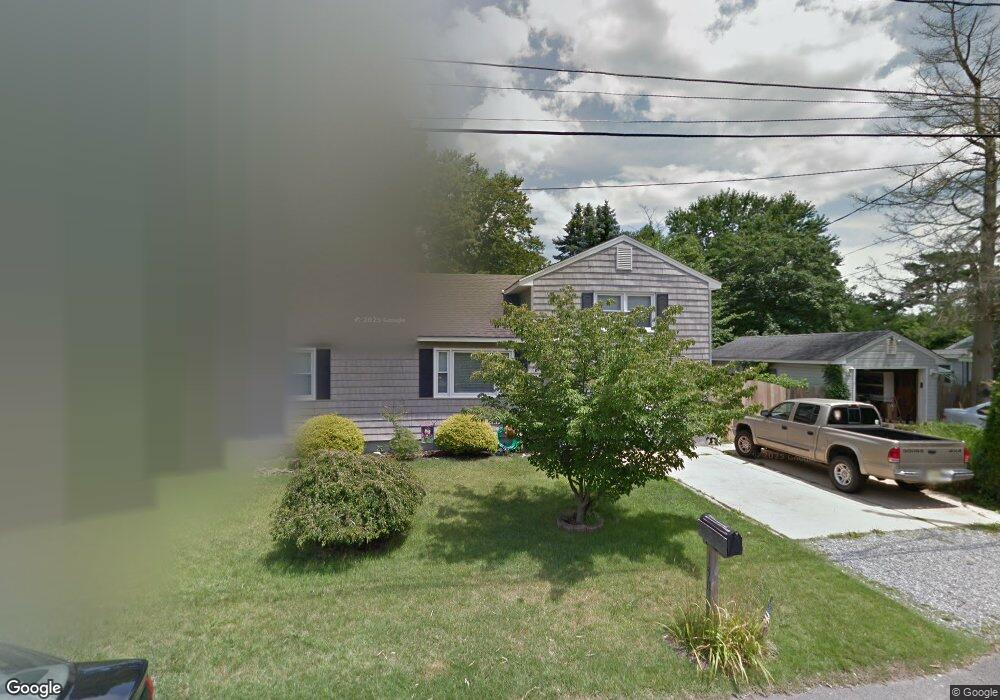
1502 Beverly Rd Forked River, NJ 08731
Estimated Value: $327,000 - $459,000
4
Beds
2
Baths
1,672
Sq Ft
$239/Sq Ft
Est. Value
About This Home
This home is located at 1502 Beverly Rd, Forked River, NJ 08731 and is currently estimated at $400,151, approximately $239 per square foot. 1502 Beverly Rd is a home located in Ocean County with nearby schools including Lacey Township High School.
Ownership History
Date
Name
Owned For
Owner Type
Purchase Details
Closed on
Dec 20, 2002
Sold by
Bergstrom Thomas
Bought by
Schmidt Jack and Schmidt Jennifer
Current Estimated Value
Home Financials for this Owner
Home Financials are based on the most recent Mortgage that was taken out on this home.
Original Mortgage
$127,000
Outstanding Balance
$53,688
Interest Rate
6.02%
Estimated Equity
$346,463
Purchase Details
Closed on
Apr 30, 1996
Sold by
Lahann Wilbur W
Bought by
Generally David and Generally Bonnie
Home Financials for this Owner
Home Financials are based on the most recent Mortgage that was taken out on this home.
Original Mortgage
$103,000
Interest Rate
7.82%
Mortgage Type
VA
Create a Home Valuation Report for This Property
The Home Valuation Report is an in-depth analysis detailing your home's value as well as a comparison with similar homes in the area
Home Values in the Area
Average Home Value in this Area
Purchase History
| Date | Buyer | Sale Price | Title Company |
|---|---|---|---|
| Schmidt Jack | $172,000 | -- | |
| Generally David | $101,000 | -- |
Source: Public Records
Mortgage History
| Date | Status | Borrower | Loan Amount |
|---|---|---|---|
| Open | Schmidt Jack | $127,000 | |
| Previous Owner | Generally David | $103,000 |
Source: Public Records
Tax History
| Year | Tax Paid | Tax Assessment Tax Assessment Total Assessment is a certain percentage of the fair market value that is determined by local assessors to be the total taxable value of land and additions on the property. | Land | Improvement |
|---|---|---|---|---|
| 2025 | $4,644 | $169,800 | $67,500 | $102,300 |
| 2024 | $4,023 | $169,800 | $67,500 | $102,300 |
| 2023 | $3,843 | $169,800 | $67,500 | $102,300 |
| 2022 | $3,843 | $169,800 | $67,500 | $102,300 |
| 2021 | $3,778 | $169,800 | $67,500 | $102,300 |
| 2020 | $3,657 | $169,800 | $67,500 | $102,300 |
| 2019 | $3,593 | $169,800 | $67,500 | $102,300 |
| 2018 | $3,551 | $169,800 | $67,500 | $102,300 |
| 2017 | $3,469 | $169,800 | $67,500 | $102,300 |
| 2016 | $3,455 | $169,800 | $67,500 | $102,300 |
| 2015 | $3,301 | $169,800 | $67,500 | $102,300 |
| 2014 | $3,700 | $215,100 | $105,500 | $109,600 |
Source: Public Records
Map
Nearby Homes
- 0000 Earie Way
- 1440 Leguene Ave
- 1326 Leguene Ave
- 1620 Ewart Rd
- 1660 Joffre Rd
- 1525 Argonne Ave
- 240 Wainwright St
- 0 Lakeside Dr S Unit 22601319
- 321 Letts Ave
- 1223 Sylvania Place
- 1988 Brookdale Dr
- 4 Kent Ct
- 000 Elwood St
- 304 Shepard Ave
- 1216 Taylor Ln
- 627 Tappan St
- 00 Lacey Rd
- 1972 Glen Oak Dr
- 105 Shodda St
- 69 Canterbury Dr
- 1509 Beverly Rd
- 1510 Beverly Rd
- 1512 Beverly Rd
- 1509 Lakeside Dr S
- 1511 Lakeside Dr S
- 1505 Beverly Rd
- 1404 Earie Way
- 1511 Beverly Rd
- 1515 Lakeside Dr S
- 1501 Lakeside Dr S
- 1519 Lakeside Dr S
- 1412 Earie Way
- 1515 Dee Rd
- 1515 Beverly Rd
- 1403 Earie Way
- 1505 Clair Rd
- 1417 Lakeside Dr S
- 1411 Earie Way
- 1519 Beverly Rd
- 1416 Circle Dr
Your Personal Tour Guide
Ask me questions while you tour the home.