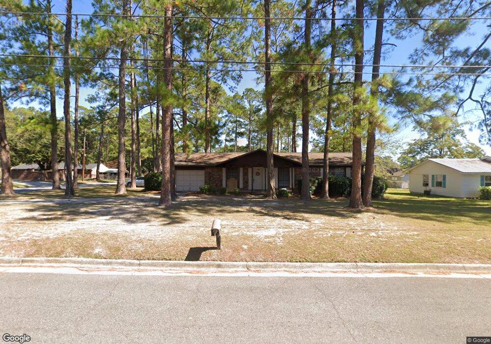
1502 Darling Ave Waycross, GA 31501
Estimated Value: $97,000 - $152,000
3
Beds
2
Baths
1,175
Sq Ft
$107/Sq Ft
Est. Value
About This Home
This home is located at 1502 Darling Ave, Waycross, GA 31501 and is currently estimated at $125,633, approximately $106 per square foot. 1502 Darling Ave is a home located in Ware County with nearby schools including Center Elementary School, Waycross Middle School, and Ware County High School.
Ownership History
Date
Name
Owned For
Owner Type
Purchase Details
Closed on
Apr 22, 2024
Sold by
Mckee Robyn A
Bought by
Lewis Noel
Current Estimated Value
Purchase Details
Closed on
Apr 1, 2022
Sold by
Thrift April M
Bought by
Mckee Robyn A
Home Financials for this Owner
Home Financials are based on the most recent Mortgage that was taken out on this home.
Original Mortgage
$10,000,000
Interest Rate
3.92%
Mortgage Type
Mortgage Modification
Purchase Details
Closed on
Apr 3, 1996
Sold by
Hurst Greg and Mary Es
Bought by
Bennett John C and Bennett Beverly
Purchase Details
Closed on
Apr 30, 1989
Bought by
Hurst Greg and Mary Es
Create a Home Valuation Report for This Property
The Home Valuation Report is an in-depth analysis detailing your home's value as well as a comparison with similar homes in the area
Home Values in the Area
Average Home Value in this Area
Purchase History
| Date | Buyer | Sale Price | Title Company |
|---|---|---|---|
| Lewis Noel | -- | -- | |
| Mckee Robyn A | $58,000 | -- | |
| Bennett John C | $43,000 | -- | |
| Hurst Greg | $14,000 | -- |
Source: Public Records
Mortgage History
| Date | Status | Borrower | Loan Amount |
|---|---|---|---|
| Previous Owner | Mckee Robyn A | $10,000,000 |
Source: Public Records
Tax History Compared to Growth
Tax History
| Year | Tax Paid | Tax Assessment Tax Assessment Total Assessment is a certain percentage of the fair market value that is determined by local assessors to be the total taxable value of land and additions on the property. | Land | Improvement |
|---|---|---|---|---|
| 2024 | $1,446 | $36,367 | $2,250 | $34,117 |
| 2023 | $1,066 | $36,612 | $1,606 | $35,006 |
| 2022 | $1,161 | $36,612 | $1,606 | $35,006 |
| 2021 | $1,090 | $31,496 | $1,606 | $29,890 |
| 2020 | $899 | $23,930 | $1,606 | $22,324 |
| 2019 | $817 | $20,664 | $1,606 | $19,058 |
| 2018 | $799 | $19,756 | $1,606 | $18,150 |
| 2017 | $779 | $19,756 | $1,606 | $18,150 |
| 2016 | $779 | $19,756 | $1,606 | $18,150 |
| 2015 | $784 | $19,755 | $1,606 | $18,150 |
| 2014 | $783 | $19,756 | $1,606 | $18,150 |
| 2013 | -- | $19,755 | $1,605 | $18,150 |
Source: Public Records
Map
Nearby Homes
- 515 Summit St
- 1301 Riverside Ave
- 2312 Spurgeon St
- 0 Beville St
- 2120 Tebeau St
- 2022 Pioneer St
- 904 Golfview Dr
- 2202 Pioneer St
- 2509 Tebeau St
- 607 Linden Dr
- 00 Pineview Dr
- 0 Pineview Dr
- .22 Alice St
- 2123 Sunnyside Dr
- 1408 Bethune St
- 1504 Habersham Dr
- 2099 Ridge Rd
- 601 Community Dr
- 1013 E Waring St
- 511 Riverside Dr
- 519 Summit St
- 1500 Darling Ave
- 1104 1106 & 1108 Albany
- 1611 A&B Creswell St
- 0 Saw Mill O'Berry Rd Unit 20352
- 0000 Alabama Av @ Utah
- 0000 N Farm Edge Rd
- 0 Roadway J
- 1346, 1348 5 Colquitt St
- Dorothy Dorothy Mc Donald
- 520 Crescent St
- 89 Doe Rd L89 36 8
- 1503 Darling Ave
- 1302 Plant Ave Waycross
- Tract 3 Victory Dr
- Tract 2 Victory Dr
- 0 George St Dewitt St Unit 19496
- 1005 1005 & 1007 Scruggs St
- 0 Cloughs Bay Rd Unit 18019
- 0 Cloughs Bay Rd Unit 18018