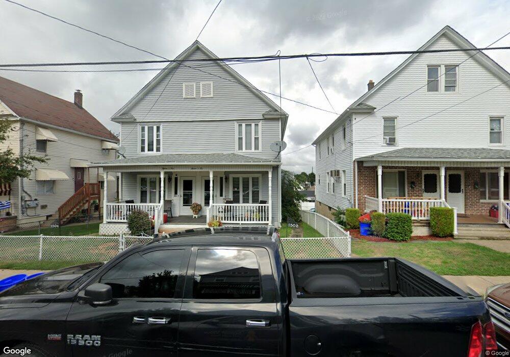
1502 Farr St Unit 4 Scranton, PA 18504
Hyde Park NeighborhoodEstimated Value: $118,783 - $296,000
--
Bed
--
Bath
--
Sq Ft
5,401
Sq Ft Lot
About This Home
This home is located at 1502 Farr St Unit 4, Scranton, PA 18504 and is currently estimated at $225,946. 1502 Farr St Unit 4 is a home located in Lackawanna County with nearby schools including Longan Elementary School, Adams Elementary School, and Isaac Tripp Elementary School.
Ownership History
Date
Name
Owned For
Owner Type
Purchase Details
Closed on
Mar 29, 2019
Sold by
Sheroda John and Hebert Marie
Bought by
Hebert Tiffany M
Current Estimated Value
Home Financials for this Owner
Home Financials are based on the most recent Mortgage that was taken out on this home.
Original Mortgage
$70,680
Outstanding Balance
$61,757
Interest Rate
4%
Mortgage Type
New Conventional
Estimated Equity
$164,189
Purchase Details
Closed on
Mar 11, 2019
Sold by
Sheroda John and Herbert Marie
Bought by
Sheroda John and Hebert Marie
Home Financials for this Owner
Home Financials are based on the most recent Mortgage that was taken out on this home.
Original Mortgage
$70,680
Outstanding Balance
$61,757
Interest Rate
4%
Mortgage Type
New Conventional
Estimated Equity
$164,189
Purchase Details
Closed on
Apr 22, 2009
Sold by
Sheroda Edward Raymond and Sheroda Nancy Ann
Bought by
Sheroda Edward Raymond
Create a Home Valuation Report for This Property
The Home Valuation Report is an in-depth analysis detailing your home's value as well as a comparison with similar homes in the area
Home Values in the Area
Average Home Value in this Area
Purchase History
| Date | Buyer | Sale Price | Title Company |
|---|---|---|---|
| Hebert Tiffany M | $74,400 | Secure Abstract Group | |
| Sheroda John | -- | None Available | |
| Sheroda Edward Raymond | -- | None Available |
Source: Public Records
Mortgage History
| Date | Status | Borrower | Loan Amount |
|---|---|---|---|
| Open | Hebert Tiffany M | $70,680 |
Source: Public Records
Tax History Compared to Growth
Tax History
| Year | Tax Paid | Tax Assessment Tax Assessment Total Assessment is a certain percentage of the fair market value that is determined by local assessors to be the total taxable value of land and additions on the property. | Land | Improvement |
|---|---|---|---|---|
| 2025 | $2,985 | $9,500 | $1,150 | $8,350 |
| 2024 | $2,723 | $9,500 | $1,150 | $8,350 |
| 2023 | $2,723 | $9,500 | $1,150 | $8,350 |
| 2022 | $2,663 | $9,500 | $1,150 | $8,350 |
| 2021 | $2,663 | $9,500 | $1,150 | $8,350 |
| 2020 | $2,612 | $9,500 | $1,150 | $8,350 |
| 2019 | $2,456 | $9,500 | $1,150 | $8,350 |
| 2018 | $2,456 | $9,500 | $1,150 | $8,350 |
| 2017 | $2,411 | $9,500 | $1,150 | $8,350 |
| 2016 | $0 | $9,500 | $1,150 | $8,350 |
| 2015 | $1,468 | $9,500 | $1,150 | $8,350 |
| 2014 | -- | $9,500 | $1,150 | $8,350 |
Source: Public Records
Map
Nearby Homes
- 1431 Dorothy St
- 1501 Farr St
- 991 N Sumner Ave Unit 1/2 L 13
- 1126 W Gibson St
- 1425 Bulwer St
- 1727 Dorothy St
- 1327 Oram St
- 833 Powderly Ct
- 1008 Mount Vernon Ave
- 638 N Lincoln Ave
- 602 604 N Lincoln Ave
- 116 Little Spike Way Unit L 40
- 534-536 N Garfield Ave
- 1102 Pettibone St
- 2133 Dorothy St
- 607 N Main Ave Unit 607-09
- 523 N Rebecca Ave
- 1235 N Sumner Ave
- 535 N Hyde Park Ave
- 942 Providence Rd