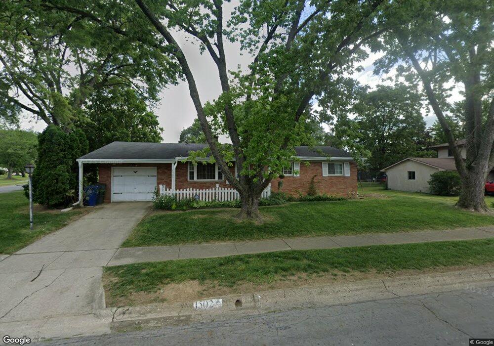
1502 Fowler Dr Columbus, OH 43224
Clinton Estates NeighborhoodEstimated Value: $219,010 - $273,000
3
Beds
2
Baths
1,162
Sq Ft
$207/Sq Ft
Est. Value
About This Home
This home is located at 1502 Fowler Dr, Columbus, OH 43224 and is currently estimated at $240,253, approximately $206 per square foot. 1502 Fowler Dr is a home located in Franklin County with nearby schools including Maize Road Elementary School, Medina Middle School, and Mifflin High School.
Ownership History
Date
Name
Owned For
Owner Type
Purchase Details
Closed on
Apr 9, 2000
Sold by
Crooks Martha R
Bought by
Merryman Juletta D
Current Estimated Value
Home Financials for this Owner
Home Financials are based on the most recent Mortgage that was taken out on this home.
Original Mortgage
$93,000
Outstanding Balance
$29,948
Interest Rate
8.24%
Estimated Equity
$210,305
Purchase Details
Closed on
Nov 14, 1990
Bought by
Crooks Martha R
Create a Home Valuation Report for This Property
The Home Valuation Report is an in-depth analysis detailing your home's value as well as a comparison with similar homes in the area
Home Values in the Area
Average Home Value in this Area
Purchase History
| Date | Buyer | Sale Price | Title Company |
|---|---|---|---|
| Merryman Juletta D | $93,000 | -- | |
| Crooks Martha R | -- | -- |
Source: Public Records
Mortgage History
| Date | Status | Borrower | Loan Amount |
|---|---|---|---|
| Open | Merryman Juletta D | $93,000 |
Source: Public Records
Tax History
| Year | Tax Paid | Tax Assessment Tax Assessment Total Assessment is a certain percentage of the fair market value that is determined by local assessors to be the total taxable value of land and additions on the property. | Land | Improvement |
|---|---|---|---|---|
| 2025 | $2,501 | $65,530 | $20,760 | $44,770 |
| 2024 | $2,501 | $65,530 | $20,760 | $44,770 |
| 2023 | $2,497 | $65,530 | $20,760 | $44,770 |
| 2022 | $1,320 | $34,200 | $10,080 | $24,120 |
| 2021 | $1,322 | $34,200 | $10,080 | $24,120 |
| 2020 | $1,324 | $34,200 | $10,080 | $24,120 |
| 2019 | $1,329 | $30,660 | $8,050 | $22,610 |
| 2018 | $1,427 | $30,660 | $8,050 | $22,610 |
| 2017 | $1,328 | $30,660 | $8,050 | $22,610 |
| 2016 | $1,684 | $34,170 | $7,460 | $26,710 |
| 2015 | $1,529 | $34,170 | $7,460 | $26,710 |
| 2014 | $1,532 | $34,170 | $7,460 | $26,710 |
| 2013 | $809 | $35,945 | $7,840 | $28,105 |
Source: Public Records
Map
Nearby Homes
- 4143 Karl Rd Unit 215
- 4143 Karl Rd Unit 314
- 4145 Karl Rd Unit 223
- 4795 Colonel Perry Dr
- 4800 Bourke Rd
- 1144 Reed Circle Dr
- 3967 Karl Rd Unit 224
- 1130 Carbone Dr
- 3941 Karl Rd Unit 326
- 3939 Karl Rd Unit 311
- 4923 Karl Rd Unit 4925
- 4852 Snowbird Cir Unit 13B
- 1863 Ward Rd
- 1485 Norma Rd
- 4857 Tamarack Blvd
- 1685 Norma Rd
- 1116 Tulsa Dr
- 5004 Julie Place
- 5010 Julie Place
- 4714 Ascot Dr
- 4404 Kenfield Rd
- 1516 Fowler Dr
- 4412 Kenfield Rd
- 4397 Kimmel Rd
- 4376 Kenfield Rd
- 1503 Fowler Dr
- 1511 Fowler Dr
- 4407 Kimmel Rd
- 1474 Fowler Dr
- 4407 Kenfield Rd
- 4420 Kenfield Rd
- 4375 Kenfield Rd
- 1519 Fowler Dr
- 4415 Kenfield Rd
- 4118 Kimmel Rd
- 4415 Kimmel Rd
- 1471 Fowler Dr
- 1525 Fowler Dr
- 4360 Kenfield Rd
- 4428 Kenfield Rd
Your Personal Tour Guide
Ask me questions while you tour the home.