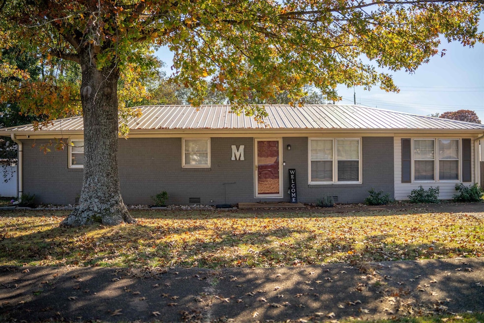
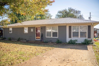
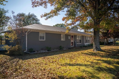
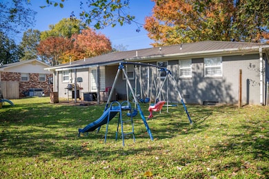
1502 Frey Ave Sheffield, AL 35660
Estimated payment $993/month
About This Home
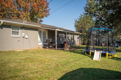
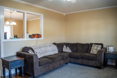
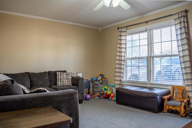
This beautifully remodeled ranch home features 3 bedrooms and 1.5 baths. Enjoy a open kitchen with stylish cabinets and countertops, along with LVP vinyl plank flooring throughout. The home also includes a laundry room and a covered patio perfect for relaxing or entertaining.
Home Details
Home Type
- Single Family
Est. Annual Taxes
- $504
Year Built
- Built in 1968
Lot Details
- 7,841 Sq Ft Lot
- Lot Dimensions are 80 x 100
Home Design
- 1,400 Sq Ft Home
Bedrooms and Bathrooms
- 3 Bedrooms
Laundry
- Laundry Room
Schools
- Sheffield Elementary And Middle School
- Sheffield High School
Community Details
- No Home Owners Association
- Sheffield Community
- Sheffield Center Add #1 Subdivision
Listing and Financial Details
- Assessor Parcel Number 07-08-27-4-002-030.000
Map
Home Values in the Area
Average Home Value in this Area
Tax History
| Year | Tax Paid | Tax Assessment Tax Assessment Total Assessment is a certain percentage of the fair market value that is determined by local assessors to be the total taxable value of land and additions on the property. | Land | Improvement |
|---|---|---|---|---|
| 2024 | $504 | $10,020 | $700 | $9,320 |
| 2023 | $473 | $10,020 | $0 | $0 |
| 2022 | $445 | $8,640 | $0 | $0 |
| 2021 | $405 | $7,860 | $0 | $0 |
| 2020 | $368 | $7,140 | $0 | $0 |
| 2019 | $366 | $7,140 | $0 | $0 |
| 2018 | $386 | $7,500 | $0 | $0 |
| 2017 | $312 | $6,900 | $0 | $0 |
| 2016 | $312 | $6,900 | $0 | $0 |
| 2013 | -- | $0 | $0 | $0 |
Property History
| Date | Event | Price | List to Sale | Price per Sq Ft |
|---|---|---|---|---|
| 11/10/2025 11/10/25 | For Sale | $179,999 | -- | $129 / Sq Ft |
Purchase History
| Date | Type | Sale Price | Title Company |
|---|---|---|---|
| Deed | $152,000 | -- | |
| Deed | $33,201 | -- | |
| Warranty Deed | -- | -- |
Mortgage History
| Date | Status | Loan Amount | Loan Type |
|---|---|---|---|
| Open | $149,246 | Construction |
Source: Strategic MLS Alliance (Cullman / Shoals Area)
MLS Number: 525750
APN: 07-08-27-4-002-030.000
Disclaimer: Certain information contained herein is derived from information provided by parties other than Homes.com. All information provided is deemed reliable, but is not guaranteed to be accurate and should be independently verified.
![]() IDX information is provided exclusively for personal, non-commercial use, and may not be used for any purpose other than to identify prospective properties consumers may be interested in purchasing. Information is deemed reliable but not guaranteed.
IDX information is provided exclusively for personal, non-commercial use, and may not be used for any purpose other than to identify prospective properties consumers may be interested in purchasing. Information is deemed reliable but not guaranteed.
- 1410 Frey Ave
- 601 Broadway St
- 1621 Oak Grove Blvd
- 1613 Ridge Dr
- 104 Ford St
- 111 Ford St
- 215 NW Central Ave
- 101 W Edison Ave
- 302 Union Ave
- 207 Ford St
- 1212 E 31st St
- 3303 E 13th Ave
- 1227 York St
- 1305 E 34th St
- 3102 E Colbert St
- 402 Ford St
- 3100 E Colbert St
- 1403 E 34th St
- 3003 E 14th Ave
- 141 Fox Loop
- 100 Brink Ct
- 3313 E 17th Ave
- 600 Firestone Ave
- 94 Cottonwood Dr
- 400 John Aldridge Dr
- 914 W College St
- 468 N Locust St Unit 2
- 130 River Rd
- 107 Harrison Dr
- 623 E Tuscaloosa St Unit A
- 150 Bellamy Place
- 930 Dixie Ave
- 1207 Glendora Ave
- 1301 Appleby Blvd
- 505 Malone Cir
- 1541 Helton Dr
- 1846 Darby Dr
- 100 Quail Run Dr
- 2251 Helton Dr
- 2038 Conway Dr
