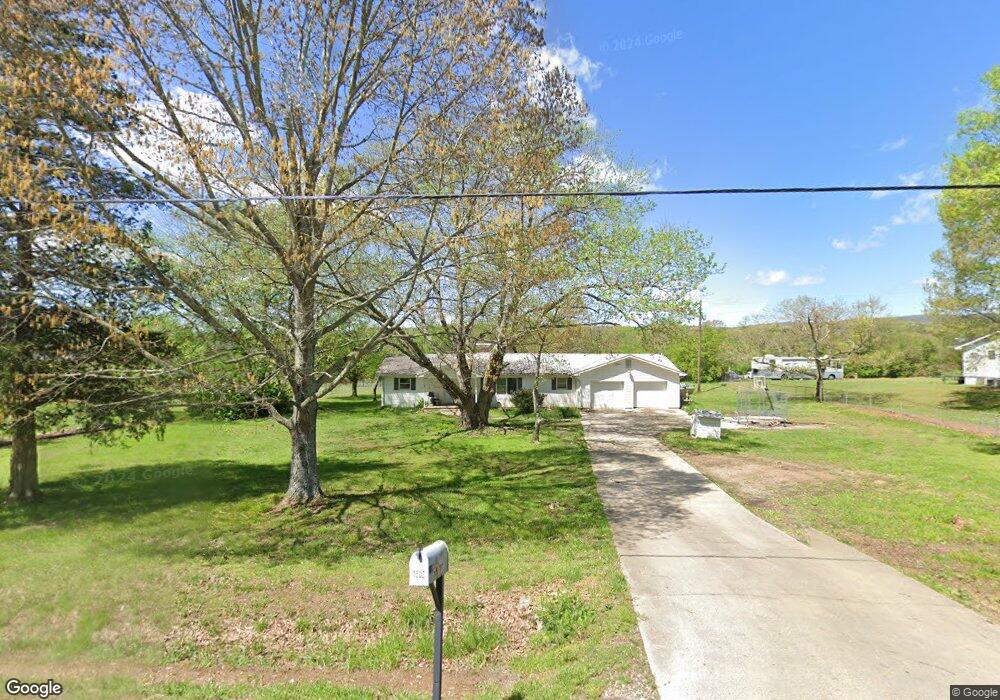
1502 Highway 201 La Fayette, GA 30728
Estimated Value: $164,000 - $322,000
3
Beds
1
Bath
1,308
Sq Ft
$170/Sq Ft
Est. Value
About This Home
This home is located at 1502 Highway 201, La Fayette, GA 30728 and is currently estimated at $222,154, approximately $169 per square foot. 1502 Highway 201 is a home located in Walker County with nearby schools including Naomi Elementary School, Lafayette Middle School, and Lafayette High School.
Ownership History
Date
Name
Owned For
Owner Type
Purchase Details
Closed on
Dec 27, 2002
Sold by
Gowin John W
Bought by
Gowin John W and Gowin Jacquelyn R
Current Estimated Value
Purchase Details
Closed on
Oct 22, 2001
Sold by
Holt Margaret Louise
Bought by
Summit Bank
Purchase Details
Closed on
Oct 10, 2001
Sold by
Summit Bank
Bought by
Gowin John W
Purchase Details
Closed on
Nov 3, 1997
Sold by
Holt David
Bought by
Holt Margaret Louise
Purchase Details
Closed on
Jan 1, 1972
Bought by
Holt David
Create a Home Valuation Report for This Property
The Home Valuation Report is an in-depth analysis detailing your home's value as well as a comparison with similar homes in the area
Home Values in the Area
Average Home Value in this Area
Purchase History
| Date | Buyer | Sale Price | Title Company |
|---|---|---|---|
| Gowin John W | -- | -- | |
| Summit Bank | -- | -- | |
| Gowin John W | $41,300 | -- | |
| Holt Margaret Louise | -- | -- | |
| Holt David | -- | -- |
Source: Public Records
Tax History Compared to Growth
Tax History
| Year | Tax Paid | Tax Assessment Tax Assessment Total Assessment is a certain percentage of the fair market value that is determined by local assessors to be the total taxable value of land and additions on the property. | Land | Improvement |
|---|---|---|---|---|
| 2024 | $1,427 | $61,265 | $12,523 | $48,742 |
| 2023 | $1,350 | $56,307 | $9,939 | $46,368 |
| 2022 | $1,558 | $61,444 | $4,394 | $57,050 |
| 2021 | $1,303 | $45,569 | $4,394 | $41,175 |
| 2020 | $1,181 | $39,356 | $4,394 | $34,962 |
| 2019 | $1,203 | $39,356 | $4,394 | $34,962 |
| 2018 | $1,041 | $39,356 | $4,394 | $34,962 |
| 2017 | $1,310 | $39,356 | $4,394 | $34,962 |
| 2016 | $1,093 | $39,356 | $4,394 | $34,962 |
| 2015 | $915 | $30,155 | $5,204 | $24,951 |
| 2014 | $775 | $30,155 | $5,204 | $24,951 |
| 2013 | -- | $30,155 | $5,204 | $24,951 |
Source: Public Records
Map
Nearby Homes
- 721 Gowan Rd
- 349 Joe Robertson Rd
- 00 Joe Robertson Rd
- 297 Townsend Rd
- 0 Townsend Rd
- 0 Clement Rd Unit 7454770
- 0 Clement Rd Unit 10376510
- 4177 S Jimmy Dr
- 1166 Lower Mill Creek Rd
- 4744 N Jimmy Dr
- 9724 Georgia 136
- 124 Jonathan Way
- 1580 Furnace Creek Rd
- 2950 Davis Rd
- 0 Ponder Creek Rd Unit 1524239
- 2906 Davis Rd
- 110 Windy Hill Dr
- 2708 Quarles Rd
- Tract 1 A & B I-75 Beavers Rd
- 0 Quarles Rd Unit 1523297
- 1466 Highway 201
- 71 Shephard Dr
- 319 Gowan Rd
- 71 Shepherd Dr
- 1421 Highway 201
- 1455 Highway 201
- 1302 Highway 201
- 1203 Highway 201
- 131 Pine Grove Rd
- 1811 Highway 201
- 1201 Highway 201
- 271 Gowin Rd
- 2051 Highway 201
- 1657 Highway 201
- 168 Cleghorn Dr
- 167 Cleghorn Dr
- 901 Highway 201
- 2133 Highway 201
- 878 Highway 201
- 898 Highway 201