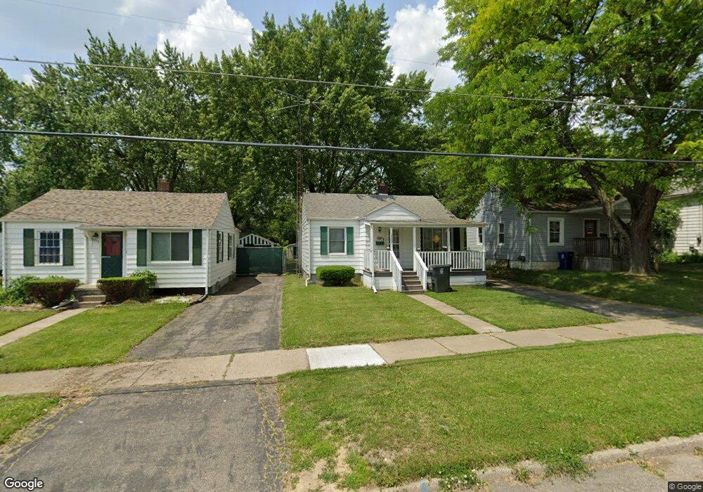
1502 Knight Ave Flint, MI 48503
Chevrolet NeighborhoodEstimated Value: $42,000 - $67,339
2
Beds
1
Bath
936
Sq Ft
$59/Sq Ft
Est. Value
About This Home
This home is located at 1502 Knight Ave, Flint, MI 48503 and is currently estimated at $54,835, approximately $58 per square foot. 1502 Knight Ave is a home located in Genesee County with nearby schools including Durant-Tuuri-Mott Elementary School, Flint Southwestern Classical Academy, and St. Paul Lutheran School.
Ownership History
Date
Name
Owned For
Owner Type
Purchase Details
Closed on
Sep 8, 2020
Sold by
Lejk Mechelle
Bought by
Steele Albert
Current Estimated Value
Home Financials for this Owner
Home Financials are based on the most recent Mortgage that was taken out on this home.
Original Mortgage
$25,500
Outstanding Balance
$22,588
Interest Rate
2.8%
Mortgage Type
New Conventional
Estimated Equity
$32,247
Purchase Details
Closed on
Dec 8, 2019
Sold by
Lejk Mechelle
Bought by
Lejk Mechelle and Steele Albert
Purchase Details
Closed on
Oct 8, 2019
Sold by
Lejk Mechelle and Estate Of Mildred M Pack
Bought by
Lejk Mechelle
Create a Home Valuation Report for This Property
The Home Valuation Report is an in-depth analysis detailing your home's value as well as a comparison with similar homes in the area
Home Values in the Area
Average Home Value in this Area
Purchase History
| Date | Buyer | Sale Price | Title Company |
|---|---|---|---|
| Steele Albert | $25,500 | None Available | |
| Lejk Mechelle | -- | None Available | |
| Lejk Mechelle | -- | None Available |
Source: Public Records
Mortgage History
| Date | Status | Borrower | Loan Amount |
|---|---|---|---|
| Open | Steele Albert | $25,500 |
Source: Public Records
Tax History
| Year | Tax Paid | Tax Assessment Tax Assessment Total Assessment is a certain percentage of the fair market value that is determined by local assessors to be the total taxable value of land and additions on the property. | Land | Improvement |
|---|---|---|---|---|
| 2025 | $1,133 | $27,800 | $0 | $0 |
| 2024 | $1,021 | $25,500 | $0 | $0 |
| 2023 | $1,000 | $19,700 | $0 | $0 |
| 2022 | $0 | $16,500 | $0 | $0 |
| 2021 | $1,043 | $14,300 | $0 | $0 |
| 2020 | $1,074 | $12,300 | $0 | $0 |
| 2019 | $875 | $13,100 | $0 | $0 |
| 2018 | $931 | $14,000 | $0 | $0 |
| 2017 | $903 | $0 | $0 | $0 |
| 2016 | $897 | $0 | $0 | $0 |
| 2015 | -- | $0 | $0 | $0 |
| 2014 | -- | $0 | $0 | $0 |
| 2012 | -- | $18,100 | $0 | $0 |
Source: Public Records
Map
Nearby Homes
- 2729 Chicago Blvd
- 1114 Clancy Ave
- 3217 Arlene Ave
- 3214 Clairmont St
- 1202 Knapp Ave
- 3317 Arlene Ave
- 3310 Larchmont St
- 1122 Stocker Ave
- 2805 Reynolds St
- 2618 Brown St
- 2624 Miller Rd
- 1308 Barney Ave
- 1017 Stocker Ave
- 3413 Augusta St
- 3402 Brandon St
- 2537 Swayze St
- 3510 Hogarth Ave
- 1412 S Ballenger Hwy
- 3102 Westwood Pkwy
- 3506 Chicago Blvd
- 1426 Knight Ave
- 1506 Knight Ave
- 1422 Knight Ave
- 1415 Hughes Ave
- 1514 Knight Ave
- 1501 Hughes Ave
- 1418 Knight Ave
- 1425 Hughes Ave
- 1505 Hughes Ave
- 1518 Knight Ave
- 1515 Hughes Ave
- 1425 Knight Ave
- 1427 Knight Ave
- 1505 Knight Ave
- 1410 Knight Ave
- 1509 Knight Ave
- 1421 Knight Ave
- 1522 Knight Ave
- 1517 Hughes Ave
- 1409 Hughes Ave
Your Personal Tour Guide
Ask me questions while you tour the home.