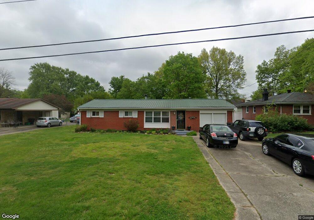
1502 Laib Dr New Albany, IN 47150
Estimated Value: $220,000 - $255,000
3
Beds
1
Bath
1,524
Sq Ft
$153/Sq Ft
Est. Value
About This Home
This home is located at 1502 Laib Dr, New Albany, IN 47150 and is currently estimated at $233,764, approximately $153 per square foot. 1502 Laib Dr is a home located in Floyd County with nearby schools including Slate Run Elementary School, Hazelwood Middle School, and New Albany Senior High School.
Ownership History
Date
Name
Owned For
Owner Type
Purchase Details
Closed on
Apr 6, 2006
Sold by
Estes William W and Estes Helen M
Bought by
Pcrkins Noeman H and Pcrkins Doris J
Current Estimated Value
Home Financials for this Owner
Home Financials are based on the most recent Mortgage that was taken out on this home.
Original Mortgage
$91,200
Interest Rate
6.48%
Mortgage Type
New Conventional
Create a Home Valuation Report for This Property
The Home Valuation Report is an in-depth analysis detailing your home's value as well as a comparison with similar homes in the area
Home Values in the Area
Average Home Value in this Area
Purchase History
| Date | Buyer | Sale Price | Title Company |
|---|---|---|---|
| Pcrkins Noeman H | -- | None Available |
Source: Public Records
Mortgage History
| Date | Status | Borrower | Loan Amount |
|---|---|---|---|
| Closed | Perkins Norman H | $128,300 | |
| Closed | Perkins Norman H | $125,337 | |
| Closed | Perkins Norman H | $110,082 | |
| Closed | Perkins Norman H | $17,000 | |
| Closed | Pcrkins Noeman H | $91,200 | |
| Closed | Perkins Norman H | $14,500 |
Source: Public Records
Tax History Compared to Growth
Tax History
| Year | Tax Paid | Tax Assessment Tax Assessment Total Assessment is a certain percentage of the fair market value that is determined by local assessors to be the total taxable value of land and additions on the property. | Land | Improvement |
|---|---|---|---|---|
| 2024 | $1,180 | $119,300 | $21,100 | $98,200 |
| 2023 | $1,203 | $121,500 | $21,100 | $100,400 |
| 2022 | $1,286 | $122,600 | $21,100 | $101,500 |
| 2021 | $1,144 | $114,300 | $21,100 | $93,200 |
| 2020 | $1,114 | $114,900 | $21,700 | $93,200 |
| 2019 | $1,323 | $129,800 | $21,700 | $108,100 |
| 2018 | $1,231 | $124,700 | $21,700 | $103,000 |
| 2017 | $1,122 | $116,700 | $21,700 | $95,000 |
| 2016 | $1,076 | $118,200 | $21,700 | $96,500 |
| 2014 | $1,063 | $111,000 | $21,600 | $89,400 |
| 2013 | -- | $108,200 | $21,700 | $86,500 |
Source: Public Records
Map
Nearby Homes
- 1409 Slate Run Rd Unit 5
- 1672 Garretson Ln
- 1421 Bellemeade Dr
- 1655 Harriett Ct
- 1352 Miller Ln
- 1520 Maple Ct
- 1435 Bellemeade Dr
- 1651 Summit Ave
- 1640 Oriole Dr
- 1236 Slate Run Rd
- 1589 Old Ford Rd
- 2705 Charlestown Rd
- 1578 Clifton Ave
- 2550 Broadway St
- 2548 Broadway St
- 1689 Old Ford Rd
- 8 Robin Ct
- 2127 Willard Ave
- 2216 Morton Ave
- 2218 Fairmont Ave