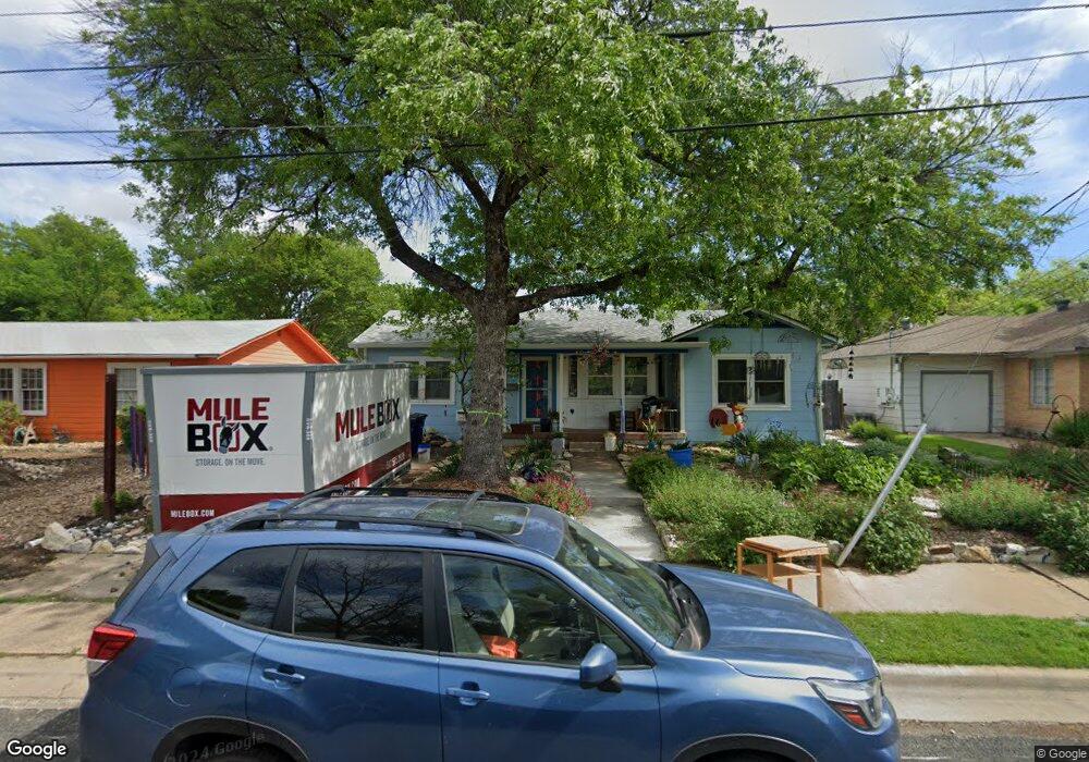
1502 Palo Duro Rd Unit A Austin, TX 78757
Brentwood NeighborhoodEstimated Value: $742,221 - $929,000
1
Bed
1
Bath
600
Sq Ft
$1,397/Sq Ft
Est. Value
About This Home
This home is located at 1502 Palo Duro Rd Unit A, Austin, TX 78757 and is currently estimated at $838,055, approximately $1,396 per square foot. 1502 Palo Duro Rd Unit A is a home located in Travis County with nearby schools including Brentwood Elementary School, Lamar Middle School, and McCallum High School.
Ownership History
Date
Name
Owned For
Owner Type
Purchase Details
Closed on
Sep 28, 2007
Sold by
Kandel Scott
Bought by
Tilson Roger D and Wuellner Clare Therese
Current Estimated Value
Home Financials for this Owner
Home Financials are based on the most recent Mortgage that was taken out on this home.
Original Mortgage
$168,000
Outstanding Balance
$106,742
Interest Rate
6.55%
Mortgage Type
Purchase Money Mortgage
Estimated Equity
$731,313
Purchase Details
Closed on
Oct 23, 1998
Sold by
Lindsay Larry H and Salinger Rebecca L
Bought by
Kandel Scott
Home Financials for this Owner
Home Financials are based on the most recent Mortgage that was taken out on this home.
Original Mortgage
$141,050
Interest Rate
6.73%
Mortgage Type
Purchase Money Mortgage
Create a Home Valuation Report for This Property
The Home Valuation Report is an in-depth analysis detailing your home's value as well as a comparison with similar homes in the area
Home Values in the Area
Average Home Value in this Area
Purchase History
| Date | Buyer | Sale Price | Title Company |
|---|---|---|---|
| Tilson Roger D | -- | American-Austin Title Co | |
| Kandel Scott | -- | -- |
Source: Public Records
Mortgage History
| Date | Status | Borrower | Loan Amount |
|---|---|---|---|
| Open | Tilson Roger D | $168,000 | |
| Previous Owner | Kandel Scott | $141,050 |
Source: Public Records
Tax History Compared to Growth
Tax History
| Year | Tax Paid | Tax Assessment Tax Assessment Total Assessment is a certain percentage of the fair market value that is determined by local assessors to be the total taxable value of land and additions on the property. | Land | Improvement |
|---|---|---|---|---|
| 2025 | $10,533 | $662,690 | $371,423 | $291,267 |
| 2023 | $9,869 | $654,949 | $0 | $0 |
| 2022 | $11,759 | $595,408 | $0 | $0 |
| 2021 | $11,782 | $541,280 | $300,000 | $253,122 |
| 2020 | $10,554 | $492,073 | $300,000 | $192,073 |
| 2018 | $9,778 | $441,637 | $300,000 | $141,637 |
| 2017 | $9,562 | $428,744 | $250,000 | $178,744 |
| 2016 | $9,509 | $426,407 | $250,000 | $176,407 |
| 2015 | $8,114 | $402,765 | $210,000 | $192,765 |
| 2014 | $8,114 | $366,809 | $170,000 | $196,809 |
Source: Public Records
Map
Nearby Homes
- 1803 Palo Duro Rd
- 6002 Camino Real
- 1701 Alcove Ct
- 1809 Alegria Rd
- 1911 Palo Duro Rd
- 1506 Payne Ave Unit A
- 1205 Palo Duro Rd
- 1708 Payne Ave
- 1912 Romeria Dr Unit B
- 1505 Karen Ave
- 1211 Alegria Rd
- 5611 Joe Sayers Ave
- 5607 Jim Hogg Ave
- 1907 Payne Ave
- 1216 Arcadia Ave Unit 1
- 1216 Arcadia Ave Unit 2
- 1414 Karen Ave
- 2000 Alegria Rd Unit A
- 5608 Clay Ave
- 5606 Clay Ave Unit B2
- 1502 Palo Duro Rd Unit B
- 1502 Palo Duro Rd
- 1504 Palo Duro Rd
- 1500 Palo Duro Rd
- 1506 Palo Duro Rd
- 1414 Palo Duro Rd
- 1503 Alguno Rd
- 1501 Alguno Rd
- 1501 Alguno Rd Unit 1
- 1505 Alguno Rd
- 1503 Palo Duro Rd
- 1508 Palo Duro Rd
- 1417 Alguno Rd
- 1412 Palo Duro Rd
- 1507 Palo Duro Rd
- 1507 Alguno Rd
- 1415 Alguno Rd
- 1417 Palo Duro Rd
- 1509 Palo Duro Rd