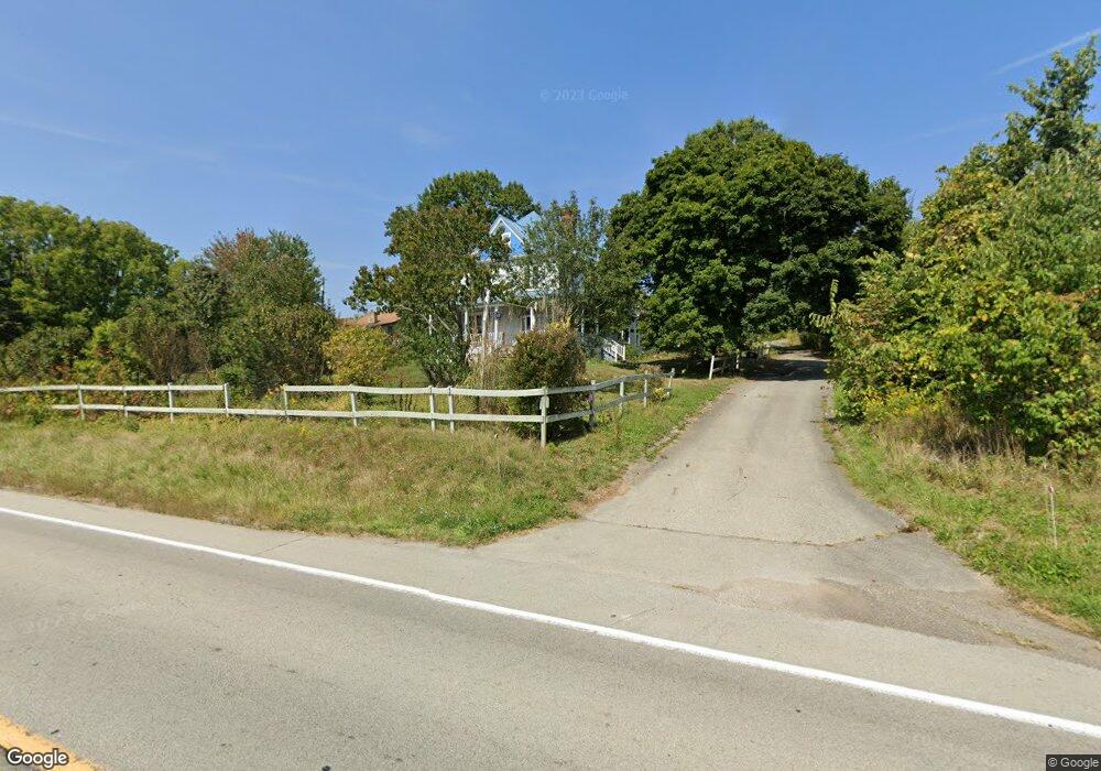
1502 Route 519 Eighty Four, PA 15330
Estimated Value: $398,000 - $597,000
4
Beds
3
Baths
3,426
Sq Ft
$134/Sq Ft
Est. Value
About This Home
This home is located at 1502 Route 519, Eighty Four, PA 15330 and is currently estimated at $459,755, approximately $134 per square foot. 1502 Route 519 is a home with nearby schools including Canon-Mcmillan Senior High School.
Ownership History
Date
Name
Owned For
Owner Type
Purchase Details
Closed on
Mar 4, 2005
Sold by
Robinson Thomas
Bought by
Kitchen John
Current Estimated Value
Home Financials for this Owner
Home Financials are based on the most recent Mortgage that was taken out on this home.
Original Mortgage
$208,500
Outstanding Balance
$105,914
Interest Rate
5.64%
Mortgage Type
New Conventional
Estimated Equity
$353,841
Purchase Details
Closed on
Mar 17, 2003
Sold by
Robinson Thomas
Bought by
Clore Ray
Home Financials for this Owner
Home Financials are based on the most recent Mortgage that was taken out on this home.
Original Mortgage
$120,000
Interest Rate
5.94%
Mortgage Type
New Conventional
Create a Home Valuation Report for This Property
The Home Valuation Report is an in-depth analysis detailing your home's value as well as a comparison with similar homes in the area
Home Values in the Area
Average Home Value in this Area
Purchase History
| Date | Buyer | Sale Price | Title Company |
|---|---|---|---|
| Kitchen John | $263,000 | -- | |
| Clore Ray | $150,000 | -- |
Source: Public Records
Mortgage History
| Date | Status | Borrower | Loan Amount |
|---|---|---|---|
| Open | Kitchen John | $208,500 | |
| Previous Owner | Clore Ray | $120,000 |
Source: Public Records
Tax History Compared to Growth
Tax History
| Year | Tax Paid | Tax Assessment Tax Assessment Total Assessment is a certain percentage of the fair market value that is determined by local assessors to be the total taxable value of land and additions on the property. | Land | Improvement |
|---|---|---|---|---|
| 2025 | $3,216 | $188,100 | $50,300 | $137,800 |
| 2024 | $3,002 | $188,100 | $50,300 | $137,800 |
| 2023 | $3,002 | $188,100 | $50,300 | $137,800 |
| 2022 | $2,993 | $188,100 | $50,300 | $137,800 |
| 2021 | $2,993 | $188,100 | $50,300 | $137,800 |
| 2020 | $2,842 | $188,100 | $50,300 | $137,800 |
| 2019 | $2,795 | $188,100 | $50,300 | $137,800 |
| 2018 | $2,737 | $188,100 | $50,300 | $137,800 |
| 2017 | $550 | $188,100 | $50,300 | $137,800 |
| 2016 | $550 | $15,767 | $1,372 | $14,395 |
| 2015 | $1,860 | $15,767 | $1,372 | $14,395 |
| 2014 | $574 | $15,767 | $1,372 | $14,395 |
| 2013 | $574 | $15,767 | $1,372 | $14,395 |
Source: Public Records
Map
Nearby Homes
- 000 Linden Rd
- 22 Belen Cir
- 22 Belen Hill Cir
- 0 Route 519 Unit 1706095
- 60 Carl Ave
- 340 Crossing Dr
- 353 Linnwood Rd
- Lot 1 Linden Rd
- 207 Linden Rd
- LOT 8 Thomas Eighty Four Rd
- 226 Chubbic Rd
- 190 Linnwood Rd
- 0 Linden Creek Rd
- 119 Linden Rd
- 892 Linden Rd
- 2002 Overlook Ct
- 2006 Overlook Ct
- 104 Linden Rd
- 215 Sierra Dr
- 884 Linden Rd
- 1504 Route 519
- 1580 Route 519
- 1580 Route 519
- 1472 Route 519
- 1468 Route 519
- 1605 Route 519
- 730 Linwood Rd
- 1441 Route 519
- 679 Linnwood Rd
- 1645 Pennsylvania 519
- 1645 Route 519
- 679 Linnwood Rd
- 476A Linden Rd
- 1653 Route 519
- 1653 Route 519
- 460 Linden Rd
- 472 Linden Rd
- 1648 Route 519
- 462 Linden Rd
- 1652 Route 519