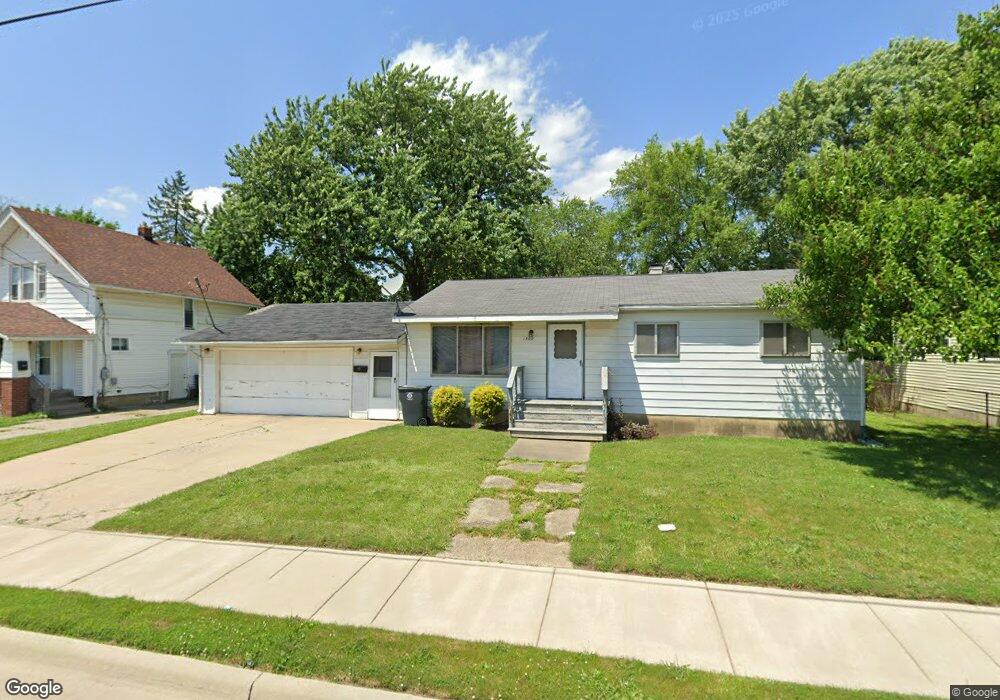
1502 W Atherton Rd Flint, MI 48507
South Side NeighborhoodEstimated Value: $64,000 - $72,766
3
Beds
1
Bath
1,049
Sq Ft
$64/Sq Ft
Est. Value
About This Home
This home is located at 1502 W Atherton Rd, Flint, MI 48507 and is currently estimated at $67,192, approximately $64 per square foot. 1502 W Atherton Rd is a home located in Genesee County with nearby schools including Neithercut Elementary School, Flint Southwestern Classical Academy, and International Academy of Flint (K-12).
Ownership History
Date
Name
Owned For
Owner Type
Purchase Details
Closed on
Oct 5, 2021
Sold by
Vaughn Loreta C
Bought by
Vaughn Loreta C
Current Estimated Value
Purchase Details
Closed on
Aug 21, 2008
Sold by
Mortgage Electronic Registration Systems
Bought by
Bank Of New York
Purchase Details
Closed on
Aug 20, 2008
Sold by
Knoff Daniel and Knoff Gloria Jean
Bought by
Mortgage Electronic Registration Systems
Purchase Details
Closed on
Aug 11, 2004
Sold by
Knoff Daniel Steven
Bought by
Knoff Daniel Steven and Knoff Gloria Jean
Create a Home Valuation Report for This Property
The Home Valuation Report is an in-depth analysis detailing your home's value as well as a comparison with similar homes in the area
Home Values in the Area
Average Home Value in this Area
Purchase History
| Date | Buyer | Sale Price | Title Company |
|---|---|---|---|
| Vaughn Loreta C | -- | Cline & Griffin Pc | |
| Vaughn Loreta C | -- | None Listed On Document | |
| Bank Of New York | -- | None Available | |
| Mortgage Electronic Registration Systems | $22,500 | None Available | |
| Knoff Daniel Steven | -- | -- | |
| Knoff Daniel Steven | -- | -- |
Source: Public Records
Tax History
| Year | Tax Paid | Tax Assessment Tax Assessment Total Assessment is a certain percentage of the fair market value that is determined by local assessors to be the total taxable value of land and additions on the property. | Land | Improvement |
|---|---|---|---|---|
| 2025 | $1,280 | $23,200 | $0 | $0 |
| 2024 | $1,183 | $23,200 | $0 | $0 |
| 2023 | $1,153 | $19,800 | $0 | $0 |
| 2022 | $0 | $16,500 | $0 | $0 |
| 2021 | $1,171 | $14,800 | $0 | $0 |
| 2020 | $1,074 | $12,300 | $0 | $0 |
| 2019 | $1,119 | $13,200 | $0 | $0 |
| 2018 | $1,166 | $16,700 | $0 | $0 |
| 2017 | $1,135 | $0 | $0 | $0 |
| 2016 | $1,127 | $0 | $0 | $0 |
| 2015 | -- | $0 | $0 | $0 |
| 2014 | -- | $0 | $0 | $0 |
| 2012 | -- | $17,800 | $0 | $0 |
Source: Public Records
Map
Nearby Homes
- 1410 Berrywood Ln
- 1506 Pettibone Ave
- 1413 Lincoln Ave
- 1405 Vermilya Ave
- 1514 Vermilya Ave
- 3713 Briarwood Dr
- 1902 Crestbrook Ln
- 1310 Alvord Ave
- 1105 Lincoln Ave
- 1028 Campbell St
- 1310 Huron St
- 1234 Huron St
- 1741 Carmanbrook Pkwy
- 1318 Ingleside Ave
- 1826 Greenbrook Ln
- 1814 Carmanbrook Pkwy
- 1823 Greenbrook Ln
- 934 Campbell St
- 1210 Pinehurst Ave
- 1727 Briarwood Dr
- 1426 W Atherton Rd
- 1510 W Atherton Rd
- 1501 Waldman Ave
- 1505 Waldman Ave
- 1418 W Atherton Rd
- 1425 Waldman Ave
- 1513 Waldman Ave
- 1518 W Atherton Rd
- 1417 Waldman Ave
- 1414 W Atherton Rd
- 1517 Waldman Ave
- 1515 W Atherton Rd
- 1524 W Atherton Rd
- 1413 W Atherton Rd
- 1409 Waldman Ave
- 1506 Waldman Ave
- 1502 Waldman Ave
- 1510 Waldman Ave
- 1422 Waldman Ave
- 1520 Waldman Ave
Your Personal Tour Guide
Ask me questions while you tour the home.