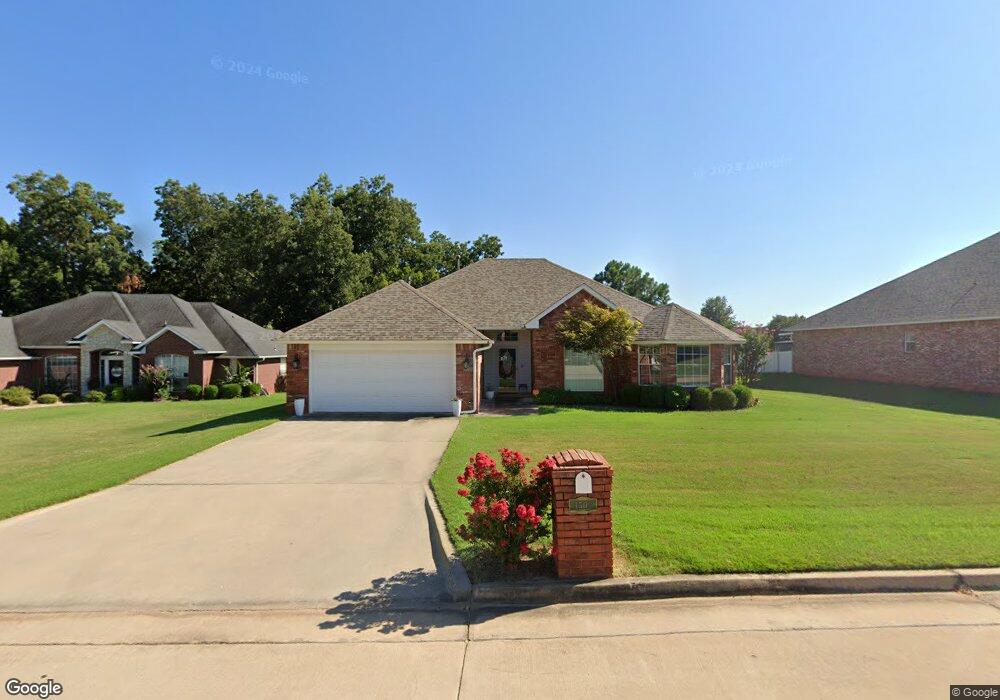
1503 Berkshire Place Shawnee, OK 74804
Estimated Value: $236,000 - $278,000
3
Beds
2
Baths
1,954
Sq Ft
$136/Sq Ft
Est. Value
About This Home
This home is located at 1503 Berkshire Place, Shawnee, OK 74804 and is currently estimated at $265,305, approximately $135 per square foot. 1503 Berkshire Place is a home located in Pottawatomie County.
Ownership History
Date
Name
Owned For
Owner Type
Purchase Details
Closed on
Jun 11, 2019
Sold by
Tolin Douglas D and Tolin Susan A
Bought by
Tolin Keely E
Current Estimated Value
Home Financials for this Owner
Home Financials are based on the most recent Mortgage that was taken out on this home.
Original Mortgage
$153,000
Outstanding Balance
$134,794
Interest Rate
4.2%
Mortgage Type
New Conventional
Estimated Equity
$130,511
Purchase Details
Closed on
Jun 28, 2000
Sold by
Tom Brown Homes Inc
Bought by
Tolin Douglas and Tolin Susan
Purchase Details
Closed on
Jan 3, 2000
Sold by
Shawnee Dev Corp
Bought by
Tom Brown Homes Inc
Create a Home Valuation Report for This Property
The Home Valuation Report is an in-depth analysis detailing your home's value as well as a comparison with similar homes in the area
Home Values in the Area
Average Home Value in this Area
Purchase History
| Date | Buyer | Sale Price | Title Company |
|---|---|---|---|
| Tolin Keely E | $177,000 | First American Title Ins Co | |
| Tolin Douglas | $149,500 | -- | |
| Tom Brown Homes Inc | $25,000 | -- |
Source: Public Records
Mortgage History
| Date | Status | Borrower | Loan Amount |
|---|---|---|---|
| Open | Tolin Keely E | $153,000 |
Source: Public Records
Tax History Compared to Growth
Tax History
| Year | Tax Paid | Tax Assessment Tax Assessment Total Assessment is a certain percentage of the fair market value that is determined by local assessors to be the total taxable value of land and additions on the property. | Land | Improvement |
|---|---|---|---|---|
| 2024 | $1,876 | $21,362 | $3,120 | $18,242 |
| 2023 | $1,876 | $20,740 | $3,120 | $17,620 |
| 2022 | $1,841 | $20,740 | $3,120 | $17,620 |
| 2021 | $1,857 | $20,740 | $3,120 | $17,620 |
| 2020 | $1,901 | $21,240 | $3,120 | $18,120 |
| 2019 | $1,957 | $21,604 | $2,808 | $18,796 |
| 2018 | $1,908 | $20,974 | $2,722 | $18,252 |
| 2017 | $1,835 | $20,363 | $2,589 | $17,774 |
| 2016 | $1,798 | $19,771 | $2,489 | $17,282 |
| 2015 | $1,539 | $19,195 | $2,431 | $16,764 |
| 2014 | $1,491 | $18,636 | $2,372 | $16,264 |
Source: Public Records
Map
Nearby Homes
- 1301 Manchester
- 0000 N Ridge Road Block 1 Lot 3 Rd
- 0000 N Rd
- 0000 N Ridge Road Block 1 Lot 4 Rd
- 1221 E 42nd St
- 0000 N Rd
- 0000 N Ridge Road Block 2 Lot 4 Rd
- 0000 N Rd
- 1309 Nottingham Cir
- 0000 N Ridge Road Block 2 Lot 6 Rd
- 0000 N Ridge Road Block 1 Lot 6 Rd
- 0000 Maple Grove Avenue Block 2 Lot 29 Ave
- 0000 Maple Grove Avenue Block 2 Lot 28 Ave
- 0000 Maple Grove Avenue Block 2 Lot 27 Ave
- 1104 Adeline
- 1101 Magnolia Dr
- 1305 Castle Creek St
- 3930 Maple Grove Ave
- 00 N Bryan - 100 Acres Ave
- 13 Brentwood Place
- 1505 Berkshire Place
- 1501 Berkshire Place
- 3007 Kensington Place
- 1507 Berkshire Place
- 3000 Kensington Place
- 1504 Berkshire Place
- 1506 Berkshire Place
- 1408 Berkshire Place
- 1502 Berkshire Place
- 1500 Berkshire Place
- 3006 Kensington Place
- 3003 Kensington Place
- 3004 Kensington Place
- 1405 Berkshire Place
- 3002 Kensington Place
- 1407 Berkshire Place
- 1403 Berkshire Place
- 3005 Crown Point
- 1400 Manchester
- 3007 Crown Point