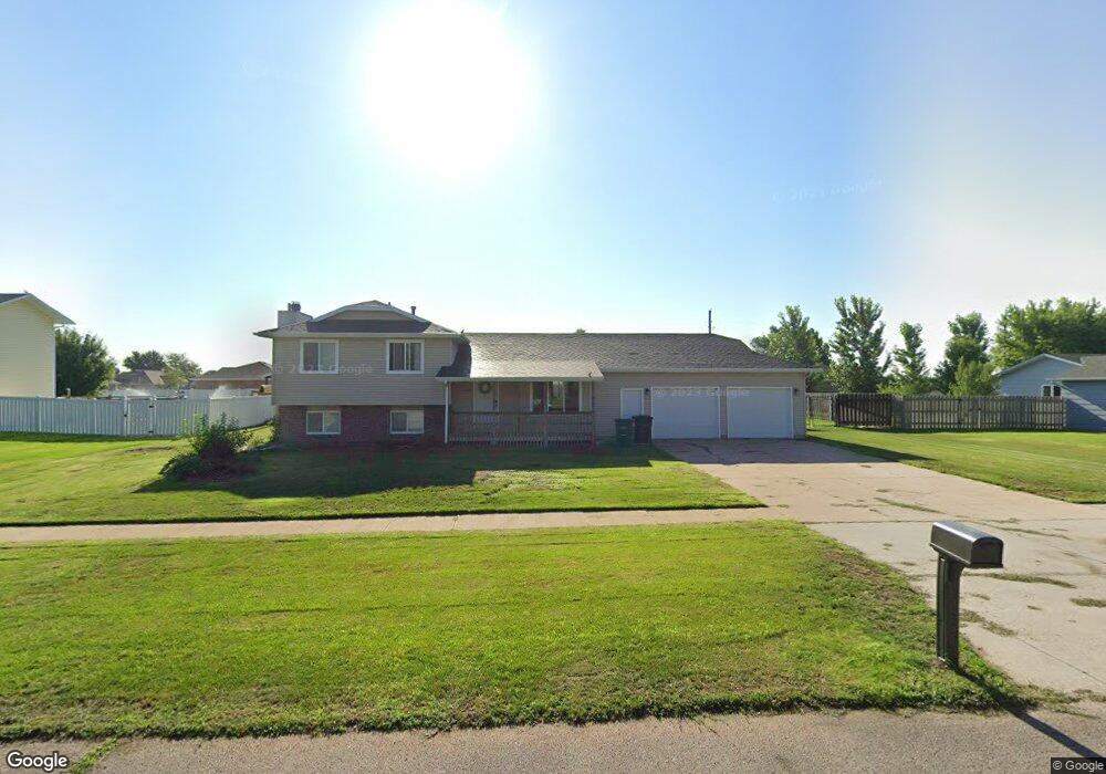
1503 Branding Iron Ln Grand Island, NE 68803
Estimated Value: $297,099 - $403,000
4
Beds
3
Baths
1,816
Sq Ft
$180/Sq Ft
Est. Value
About This Home
This home is located at 1503 Branding Iron Ln, Grand Island, NE 68803 and is currently estimated at $326,775, approximately $179 per square foot. 1503 Branding Iron Ln is a home located in Hall County with nearby schools including Engleman Elementary School, Westridge Middle School, and Grand Island Senior High School.
Ownership History
Date
Name
Owned For
Owner Type
Purchase Details
Closed on
May 13, 2021
Sold by
Brown Joseph M and Brown Lori J
Bought by
Brown Brook J and Allen Jessie R
Current Estimated Value
Home Financials for this Owner
Home Financials are based on the most recent Mortgage that was taken out on this home.
Original Mortgage
$174,800
Outstanding Balance
$158,412
Interest Rate
3.1%
Mortgage Type
New Conventional
Estimated Equity
$168,363
Purchase Details
Closed on
Jun 26, 2017
Sold by
Rhoads Reginald D and Rhoads Mary I
Bought by
Brown Brock M and Brown Joseph M
Home Financials for this Owner
Home Financials are based on the most recent Mortgage that was taken out on this home.
Original Mortgage
$188,635
Interest Rate
4.5%
Mortgage Type
Adjustable Rate Mortgage/ARM
Create a Home Valuation Report for This Property
The Home Valuation Report is an in-depth analysis detailing your home's value as well as a comparison with similar homes in the area
Home Values in the Area
Average Home Value in this Area
Purchase History
| Date | Buyer | Sale Price | Title Company |
|---|---|---|---|
| Brown Brook J | $219,000 | Nebraska Title Company | |
| Brown Brock M | $21,200 | Vintage Title And Escrow Com |
Source: Public Records
Mortgage History
| Date | Status | Borrower | Loan Amount |
|---|---|---|---|
| Open | Brown Brook J | $174,800 | |
| Previous Owner | Brown Brock M | $188,635 |
Source: Public Records
Tax History Compared to Growth
Tax History
| Year | Tax Paid | Tax Assessment Tax Assessment Total Assessment is a certain percentage of the fair market value that is determined by local assessors to be the total taxable value of land and additions on the property. | Land | Improvement |
|---|---|---|---|---|
| 2024 | $2,964 | $206,783 | $43,799 | $162,984 |
| 2023 | $3,998 | $220,026 | $43,799 | $176,227 |
| 2022 | $3,870 | $192,595 | $20,060 | $172,535 |
| 2021 | $3,436 | $168,487 | $20,060 | $148,427 |
| 2020 | $3,465 | $168,487 | $20,060 | $148,427 |
| 2019 | $3,521 | $167,017 | $20,060 | $146,957 |
| 2017 | $2,909 | $160,019 | $20,060 | $139,959 |
| 2016 | $2,800 | $134,404 | $20,060 | $114,344 |
| 2015 | $2,844 | $134,404 | $20,060 | $114,344 |
| 2014 | $2,738 | $124,714 | $20,060 | $104,654 |
Source: Public Records
Map
Nearby Homes
- 4242 Spur Ln
- 1429 Mansfield Rd
- 4121 Allen Ave
- 4128 Allen Ave
- 2110 Topeka Cir
- 2203 Macron St
- 808 Redwood Rd
- 1604 Meadow Rd
- 1103 Rylie Way
- 4145 Elmwood Dr
- 4019 Sacramento Cir
- 4035 Huff Blvd
- 4043 Huff Blvd
- 4019 Huff Blvd
- 4204 W Capital Ave
- 3931 Chukar Cir
- 3826 Meadow Way Trail
- 1328 Diamond Dr
- 4126 Sandalwood Dr
- 1315 Diamond Dr
- 1509 Branding Iron Ln
- 1421 Branding Iron Ln
- 1504 Branding Iron Ln
- 1416 Branding Iron Ln
- 1415 Branding Iron Ln
- 4242 Shanna St
- 4245 Shanna St
- 4238 Branding Iron Ct
- 4238 Shanna St
- 4234 Shanna St
- 4225 Shanna St
- 1409 Branding Iron Ln
- 4228 Shanna St
- 4249 Shanna St
- 4246 Branding Iron Ct
- 4246 Shanna St
- 4219 Shanna St
- 4224 Shanna St
- 1404 Branding Iron Ln
- 4245 Branding Iron Ct