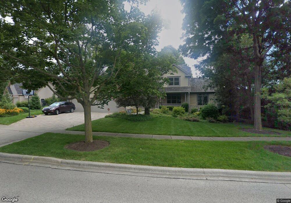
1503 Old Peterson Rd Libertyville, IL 60048
Estimated Value: $801,415 - $903,000
--
Bed
3
Baths
2,900
Sq Ft
$296/Sq Ft
Est. Value
About This Home
This home is located at 1503 Old Peterson Rd, Libertyville, IL 60048 and is currently estimated at $857,604, approximately $295 per square foot. 1503 Old Peterson Rd is a home located in Lake County with nearby schools including Adler Park School, Highland Middle School, and Libertyville High School.
Ownership History
Date
Name
Owned For
Owner Type
Purchase Details
Closed on
Jan 18, 2008
Sold by
Hunt Charles J and Hunt Barbara J
Bought by
Hunt Charles J and Hunt Barbara J
Current Estimated Value
Purchase Details
Closed on
Jul 30, 1996
Sold by
Northern Tr Bank Lake Forest Natl Assn
Bought by
Hunt Charles J and Hunt Barbara J
Home Financials for this Owner
Home Financials are based on the most recent Mortgage that was taken out on this home.
Original Mortgage
$323,900
Outstanding Balance
$25,740
Interest Rate
8.27%
Estimated Equity
$831,864
Create a Home Valuation Report for This Property
The Home Valuation Report is an in-depth analysis detailing your home's value as well as a comparison with similar homes in the area
Home Values in the Area
Average Home Value in this Area
Purchase History
| Date | Buyer | Sale Price | Title Company |
|---|---|---|---|
| Hunt Charles J | -- | None Available | |
| Hunt Charles J | $360,000 | -- |
Source: Public Records
Mortgage History
| Date | Status | Borrower | Loan Amount |
|---|---|---|---|
| Open | Hunt Charles J | $323,900 |
Source: Public Records
Tax History Compared to Growth
Tax History
| Year | Tax Paid | Tax Assessment Tax Assessment Total Assessment is a certain percentage of the fair market value that is determined by local assessors to be the total taxable value of land and additions on the property. | Land | Improvement |
|---|---|---|---|---|
| 2024 | $16,102 | $221,361 | $56,849 | $164,512 |
| 2023 | $14,653 | $204,170 | $52,434 | $151,736 |
| 2022 | $14,653 | $185,422 | $50,399 | $135,023 |
| 2021 | $15,535 | $199,374 | $54,191 | $145,183 |
| 2020 | $14,958 | $196,022 | $53,280 | $142,742 |
| 2019 | $13,460 | $194,158 | $52,773 | $141,385 |
| 2018 | $12,406 | $185,625 | $39,680 | $145,945 |
| 2017 | $12,265 | $179,764 | $38,427 | $141,337 |
| 2016 | $11,816 | $170,441 | $36,434 | $134,007 |
| 2015 | $11,705 | $146,580 | $34,054 | $112,526 |
| 2014 | $12,346 | $139,171 | $32,930 | $106,241 |
| 2012 | $12,479 | $152,587 | $36,105 | $116,482 |
Source: Public Records
Map
Nearby Homes
- 1917 Halifax St
- 1708 Park Crest Ct
- 1801 Torrey Pkwy
- 1834 Torrey Pkwy Unit 103
- 1960 Pinehurst Ct
- 1338 Trinity Place
- 1506 Bull Creek Dr
- 178 Brookhill Rd
- 832 Interlaken Ln
- 1935 Lynn Cir
- 694 Parkside Ct
- 662 Parkside Ct
- 616 Parkside Ct
- 619 Parkside Ct
- 31132-31140 N Milwaukee Ave
- 212 W Ellis Ave
- 208 W Ellis Ave
- 204 W Ellis Ave
- 223 Kenloch Ave
- 1023 Harris Rd
- 1501 Old Peterson Rd
- 1504 Old Peterson Rd
- 1506 Old Peterson Rd
- 1502 Old Peterson Rd
- 1508 Old Peterson Rd
- 1433 Braxton Rd
- 1428 Braxton Rd
- 1429 Braxton Rd
- 1429 Castleton Rd
- 1424 Braxton Rd
- 1425 Braxton Rd
- 1425 Castleton Rd
- 1420 Braxton Rd
- 1421 Braxton Rd
- 1421 Castleton Rd
- 1416 Braxton Rd
- 1417 Castleton Rd
- 1417 Braxton Rd
- 1412 Braxton Rd
- 1413 Castleton Rd