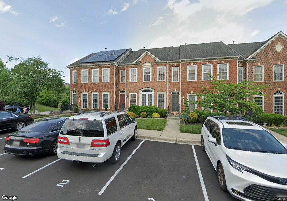
1503 Rutland Way Hanover, MD 21076
Estimated Value: $479,067 - $545,000
--
Bed
3
Baths
2,060
Sq Ft
$248/Sq Ft
Est. Value
About This Home
This home is located at 1503 Rutland Way, Hanover, MD 21076 and is currently estimated at $510,767, approximately $247 per square foot. 1503 Rutland Way is a home located in Anne Arundel County with nearby schools including Hebron-Harman Elementary School, MacArthur Middle School, and Meade High School.
Ownership History
Date
Name
Owned For
Owner Type
Purchase Details
Closed on
Jun 28, 2006
Sold by
Cc&Dorchester Llc
Bought by
Bernard Paul and Roberts Wendy J
Current Estimated Value
Home Financials for this Owner
Home Financials are based on the most recent Mortgage that was taken out on this home.
Original Mortgage
$403,023
Outstanding Balance
$251,820
Interest Rate
7.62%
Mortgage Type
Purchase Money Mortgage
Estimated Equity
$258,947
Create a Home Valuation Report for This Property
The Home Valuation Report is an in-depth analysis detailing your home's value as well as a comparison with similar homes in the area
Home Values in the Area
Average Home Value in this Area
Purchase History
| Date | Buyer | Sale Price | Title Company |
|---|---|---|---|
| Bernard Paul | $503,779 | -- |
Source: Public Records
Mortgage History
| Date | Status | Borrower | Loan Amount |
|---|---|---|---|
| Open | Bernard Paul | $403,023 | |
| Closed | Bernard Paul | $75,565 |
Source: Public Records
Tax History Compared to Growth
Tax History
| Year | Tax Paid | Tax Assessment Tax Assessment Total Assessment is a certain percentage of the fair market value that is determined by local assessors to be the total taxable value of land and additions on the property. | Land | Improvement |
|---|---|---|---|---|
| 2025 | $5,523 | $410,000 | $140,000 | $270,000 |
| 2024 | $5,523 | $394,667 | $0 | $0 |
| 2023 | $5,458 | $379,333 | $0 | $0 |
| 2022 | $3,804 | $364,000 | $140,000 | $224,000 |
| 2021 | $10,165 | $354,467 | $0 | $0 |
| 2020 | $4,908 | $344,933 | $0 | $0 |
| 2019 | $9,443 | $335,400 | $130,000 | $205,400 |
| 2018 | $3,401 | $335,400 | $130,000 | $205,400 |
| 2017 | $4,552 | $335,400 | $0 | $0 |
| 2016 | -- | $354,200 | $0 | $0 |
| 2015 | -- | $342,967 | $0 | $0 |
| 2014 | -- | $331,733 | $0 | $0 |
Source: Public Records
Map
Nearby Homes
- 1544 Rutland Way
- 7266 Dorchester Woods Ln
- 7296 Dorchester Woods Ln
- 7151 Wright Rd
- 7143 Wright Rd
- Parcel 325 Wright Rd
- Parcel 265 Wright Rd
- Parcel 271 Wright Rd
- Parcel 316-7147 Wright Rd
- 7111 River Birch Dr
- 7135 Wright Rd
- 7131 Wright Rd
- 7591 Taunton Ct
- 7490 Race Rd
- 7432 Race Rd
- 7147 Wedmore Ct
- 7310 Wisteria Point Dr
- 7327 Wisteria Point Dr
- 6810 Morning Glory Trail
- 6504 Whitetail Crossing Way
- 1505 Rutland Way
- 1501 Rutland Way
- 1507 Rutland Way
- 1509 Rutland Way
- 1511 Rutland Way
- 1513 Rutland Way
- 1504 Rutland Way
- 1502 Rutland Way
- 1515 Rutland Way
- 1506 Rutland Way
- 1508 Rutland Way
- 1510 Rutland Way
- 1512 Rutland Way
- 1504 Penzance Way
- 1514 Rutland Way
- 1506 Penzance Way
- 1508 Penzance Way
- 1502 Penzance Way
- 1516 Rutland Way
- 1510 Penzance Way