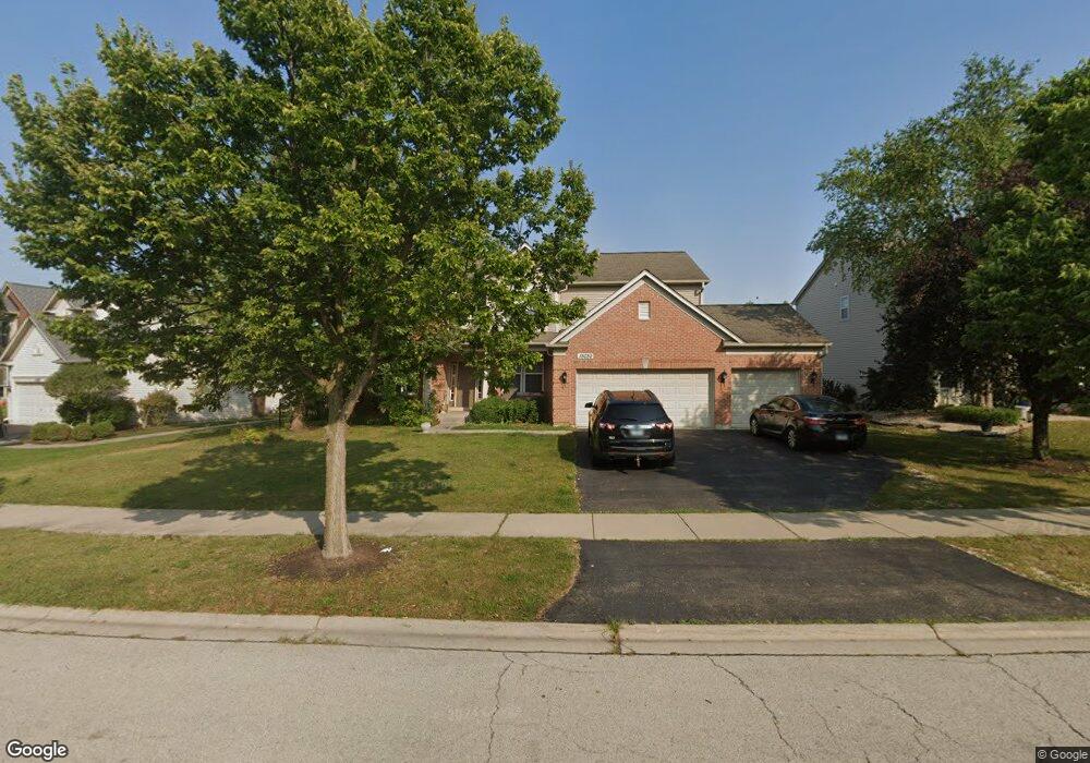
15030 Albright Dr Lockport, IL 60441
South Homer Glen NeighborhoodEstimated Value: $483,593 - $555,000
--
Bed
--
Bath
2,829
Sq Ft
$188/Sq Ft
Est. Value
About This Home
This home is located at 15030 Albright Dr, Lockport, IL 60441 and is currently estimated at $532,898, approximately $188 per square foot. 15030 Albright Dr is a home located in Will County with nearby schools including William J. Butler, Hadley Middle School, and Homer Jr High School.
Ownership History
Date
Name
Owned For
Owner Type
Purchase Details
Closed on
Apr 25, 2006
Sold by
Pulte Homes
Bought by
Lamacki Donald and Lamacki Barbara
Current Estimated Value
Home Financials for this Owner
Home Financials are based on the most recent Mortgage that was taken out on this home.
Original Mortgage
$320,850
Outstanding Balance
$208,582
Interest Rate
8.75%
Mortgage Type
Fannie Mae Freddie Mac
Estimated Equity
$324,316
Create a Home Valuation Report for This Property
The Home Valuation Report is an in-depth analysis detailing your home's value as well as a comparison with similar homes in the area
Home Values in the Area
Average Home Value in this Area
Purchase History
| Date | Buyer | Sale Price | Title Company |
|---|---|---|---|
| Lamacki Donald | $401,500 | None Available |
Source: Public Records
Mortgage History
| Date | Status | Borrower | Loan Amount |
|---|---|---|---|
| Open | Lamacki Donald | $320,850 |
Source: Public Records
Tax History Compared to Growth
Tax History
| Year | Tax Paid | Tax Assessment Tax Assessment Total Assessment is a certain percentage of the fair market value that is determined by local assessors to be the total taxable value of land and additions on the property. | Land | Improvement |
|---|---|---|---|---|
| 2024 | $12,760 | $162,527 | $24,074 | $138,453 |
| 2023 | $12,760 | $147,323 | $21,822 | $125,501 |
| 2022 | $12,193 | $137,556 | $20,375 | $117,181 |
| 2021 | $11,761 | $130,323 | $19,304 | $111,019 |
| 2020 | $11,716 | $125,528 | $18,594 | $106,934 |
| 2019 | $11,376 | $120,758 | $17,887 | $102,871 |
| 2018 | $11,060 | $116,411 | $17,682 | $98,729 |
| 2017 | $10,869 | $113,152 | $17,187 | $95,965 |
| 2016 | $10,633 | $109,379 | $16,614 | $92,765 |
| 2015 | $10,347 | $105,273 | $15,990 | $89,283 |
| 2014 | $10,347 | $103,098 | $15,660 | $87,438 |
| 2013 | $10,347 | $103,098 | $15,660 | $87,438 |
Source: Public Records
Map
Nearby Homes
- 15053 Sagebrush Ln Unit 1254
- 16860 S Ivy Ln
- 16947 S Timber Dr
- 16663 S Windsor Ln Unit T1644
- 16601 S Windsor Ln Unit T1611
- 16609 S Silo Bend Dr
- 17355 Sprucewood Dr
- 17356 Sprucewood Dr
- 17358 Sprucewood Dr
- 17362 Sprucewood Dr
- 17430 Victoria Ln
- 16515 S Farmington Ln
- 15326 W Harvest Ln
- 15456 Amelia Cir
- 0 W Bruce Rd
- Essex Plan at Sadie Ridge
- Campbell Plan at Sadie Ridge - The Townes at Sadie
- Braeden Plan at Sadie Ridge - The Townes at Sadie
- Brighton Plan at Sadie Ridge - The Townes at Sadie
- Danbury II Plan at Sadie Ridge - The Townes at Sadie
- 15024 Albright Dr
- 15034 Albright Dr
- 15041 Rickert Ln
- 15022 Albright Dr
- 15042 Albright Dr
- 15049 Rickert Ln
- 15037 Rickert Ln
- 15007 Albright Ct
- 15054 Albright Dr
- 15025 Albright Ct
- 15029 Albright Dr
- 15018 Albright Dr
- 15037 Albright Dr Unit 2
- 15057 Rickert Ln
- 15017 Albright Ct
- 15011 Albright Ct
- 14965 Ashton Ln
- 15040 Rickert Ln
- 15015 Albright Ct
- 15045 Albright Dr