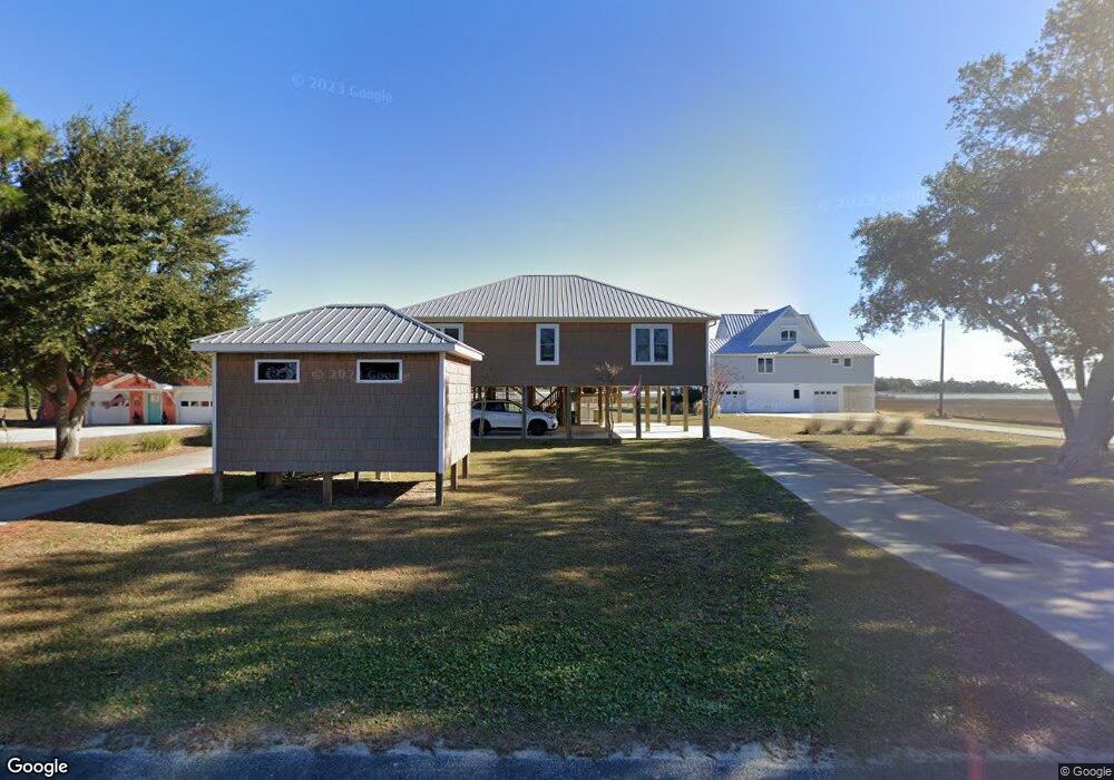
1504 Burnett Rd Wilmington, NC 28409
Estimated Value: $1,092,667 - $1,323,000
3
Beds
2
Baths
1,789
Sq Ft
$680/Sq Ft
Est. Value
About This Home
This home is located at 1504 Burnett Rd, Wilmington, NC 28409 and is currently estimated at $1,216,889, approximately $680 per square foot. 1504 Burnett Rd is a home located in New Hanover County with nearby schools including Edwin A. Anderson Elementary School, Charles P. Murray Middle School, and Eugene Ashley High School.
Ownership History
Date
Name
Owned For
Owner Type
Purchase Details
Closed on
Feb 16, 1996
Sold by
Wall Duel Bennett
Bought by
Wall Patricia Mcleod
Current Estimated Value
Purchase Details
Closed on
Mar 6, 1992
Sold by
Heath Robert F Kimberly W
Bought by
Wall Duel Bennett Patricia M
Purchase Details
Closed on
Jul 26, 1991
Sold by
Heath Robert F Kimberly W
Bought by
Marine Fisheries Division N C
Purchase Details
Closed on
Feb 1, 1987
Sold by
Sorrell Worth L Miriam W
Bought by
Heath Robert F Kimberly W
Purchase Details
Closed on
Jan 1, 1979
Bought by
Sorrell Worth L Miriam W
Create a Home Valuation Report for This Property
The Home Valuation Report is an in-depth analysis detailing your home's value as well as a comparison with similar homes in the area
Home Values in the Area
Average Home Value in this Area
Purchase History
| Date | Buyer | Sale Price | Title Company |
|---|---|---|---|
| Wall Patricia Mcleod | -- | -- | |
| Wall Duel Bennett Patricia M | $132,000 | -- | |
| Marine Fisheries Division N C | -- | -- | |
| Heath Robert F Kimberly W | $70,000 | -- | |
| Sorrell Worth L Miriam W | -- | -- |
Source: Public Records
Tax History Compared to Growth
Tax History
| Year | Tax Paid | Tax Assessment Tax Assessment Total Assessment is a certain percentage of the fair market value that is determined by local assessors to be the total taxable value of land and additions on the property. | Land | Improvement |
|---|---|---|---|---|
| 2025 | $4,407 | $1,176,500 | $843,900 | $332,600 |
| 2023 | $4,407 | $829,400 | $603,200 | $226,200 |
| 2022 | $4,443 | $829,400 | $603,200 | $226,200 |
| 2021 | $4,553 | $829,400 | $603,200 | $226,200 |
| 2020 | $3,989 | $630,600 | $403,900 | $226,700 |
| 2019 | $3,989 | $630,600 | $403,900 | $226,700 |
| 2018 | $3,989 | $630,600 | $403,900 | $226,700 |
| 2017 | $4,083 | $630,600 | $403,900 | $226,700 |
| 2016 | $4,037 | $582,500 | $405,900 | $176,600 |
| 2015 | $3,751 | $582,500 | $405,900 | $176,600 |
| 2014 | $3,687 | $582,500 | $405,900 | $176,600 |
Source: Public Records
Map
Nearby Homes
- 7335 Gold
- 7331 Gold Ave
- 227 Gazebo Ct
- 1305 Burnett Rd
- 911 Radnor Rd
- 3836 Mason Port Dr
- 945 Radnor Rd
- 7422 Sea Lilly Ln
- 806 Paoli Ct
- 801 Paoli Ct Unit 20' Dry Slip D-87
- 801 Paoli Ct Unit 20' Dry Slip C-80
- 801 Paoli Ct Unit 25' Dry Slip D-17
- 801 Paoli Ct Unit 35' Wet Slip 104
- 801 Paoli Ct Unit 30' Dry Slip, H-49
- 801 Paoli Ct Unit 30' Dry Slip E-19 (F
- 801 Paoli Ct Unit 22' Dry Slip B-43
- 801 Paoli Ct Unit 45' Wet Slip 038(.43
- 801 Paoli Ct Unit C-81
- 801 Paoli Ct Unit 30' Dry Slip H-24 (
- 801 Paoli Ct Unit 20' Dry Slip I-03 (F
- 1508 Burnett Rd
- 1500 Burnett Rd
- 1512 Burnett Rd
- 1507 Burnett Rd
- 2 Silver
- 1401 Burnett Rd
- 7341 Gold Ave
- 7328 Coastal Ave
- 1313 Burnett Rd
- 7340 Gold
- 7326 Walter Ave
- 7315 Coastal Ave
- 1400 Burnett Rd
- 246 Inlet Point Dr
- 7323 Coastal Ave
- 1332 Burnett Rd
- 1309 Burnett Rd
- 242 Inlet Point Dr
- 238 Inlet Point Dr
- 7323 Walter Ave