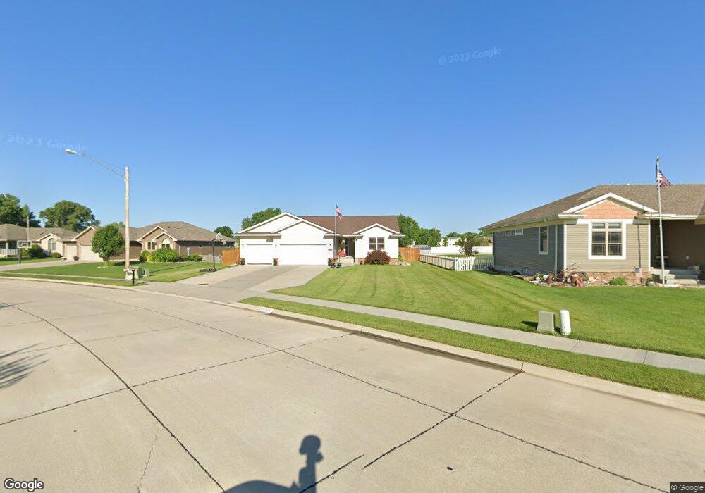
1504 Independence Ave Grand Island, NE 68803
Estimated Value: $435,000 - $556,000
5
Beds
3
Baths
1,666
Sq Ft
$283/Sq Ft
Est. Value
About This Home
This home is located at 1504 Independence Ave, Grand Island, NE 68803 and is currently estimated at $472,251, approximately $283 per square foot. 1504 Independence Ave is a home located in Hall County with nearby schools including Engleman Elementary School, Westridge Middle School, and Grand Island Senior High School.
Ownership History
Date
Name
Owned For
Owner Type
Purchase Details
Closed on
Jul 8, 2013
Sold by
Shamrock Construction Inc
Bought by
Cockerham Michael S and Cockerham Justine R
Current Estimated Value
Home Financials for this Owner
Home Financials are based on the most recent Mortgage that was taken out on this home.
Original Mortgage
$246,905
Outstanding Balance
$180,067
Interest Rate
3.99%
Mortgage Type
New Conventional
Estimated Equity
$292,184
Purchase Details
Closed on
May 23, 2011
Sold by
Valasek Gary E and Valasek Mary G
Bought by
Connelly Thomas R and Connelly Vickie K
Create a Home Valuation Report for This Property
The Home Valuation Report is an in-depth analysis detailing your home's value as well as a comparison with similar homes in the area
Home Values in the Area
Average Home Value in this Area
Purchase History
| Date | Buyer | Sale Price | Title Company |
|---|---|---|---|
| Cockerham Michael S | $26,000 | Grand Island Abstract | |
| Connelly Thomas R | $38,000 | -- |
Source: Public Records
Mortgage History
| Date | Status | Borrower | Loan Amount |
|---|---|---|---|
| Open | Cockerham Michael S | $246,905 |
Source: Public Records
Tax History Compared to Growth
Tax History
| Year | Tax Paid | Tax Assessment Tax Assessment Total Assessment is a certain percentage of the fair market value that is determined by local assessors to be the total taxable value of land and additions on the property. | Land | Improvement |
|---|---|---|---|---|
| 2024 | $5,412 | $371,444 | $39,002 | $332,442 |
| 2023 | $6,615 | $364,024 | $39,002 | $325,022 |
| 2022 | $6,111 | $304,067 | $35,000 | $269,067 |
| 2021 | $6,201 | $304,067 | $35,000 | $269,067 |
| 2020 | $6,308 | $304,067 | $35,000 | $269,067 |
| 2019 | $5,764 | $273,417 | $35,000 | $238,417 |
| 2017 | $5,472 | $252,824 | $35,000 | $217,824 |
| 2016 | $5,268 | $252,824 | $35,000 | $217,824 |
| 2015 | $5,349 | $252,824 | $35,000 | $217,824 |
| 2014 | $5,323 | $242,451 | $35,000 | $207,451 |
Source: Public Records
Map
Nearby Homes
- 4242 Spur Ln
- 1429 Mansfield Rd
- 4121 Allen Ave
- 4128 Allen Ave
- 2110 Topeka Cir
- 1604 Meadow Rd
- 808 Redwood Rd
- 1103 Rylie Way
- 2203 Macron St
- 4019 Huff Blvd
- 4035 Huff Blvd
- 4043 Huff Blvd
- 4145 Elmwood Dr
- 4019 Sacramento Cir
- 3931 Chukar Cir
- 3826 Meadow Way Trail
- 1328 Diamond Dr
- 1315 Diamond Dr
- 4126 Sandalwood Dr
- 1539 Stonewood Ave
- 1422 Independence Ave
- 1508 Independence Ave
- 4207 Shanna St
- 1416 Independence Ave
- 1419 Independence Ave
- 4203 Shanna St
- 4219 Shanna St
- 4223 Shanna St
- 4227 Shanna St
- 1410 Independence Ave
- 4225 Shanna St
- 1409 Independence Ave
- 4212 Shanna St
- 1603 Lariat Ln
- 1404 Independence Ave
- 1403 Independence Ave
- 4220 Shanna St
- 1610 Lariat Ln
- 1609 Lariat Ln
- 4224 Shanna St