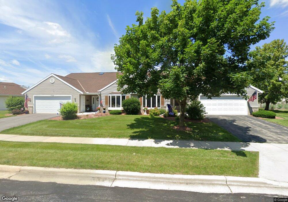
1504 Rangita St Fort Atkinson, WI 53538
Estimated Value: $286,000 - $340,000
--
Bed
--
Bath
--
Sq Ft
2,396
Sq Ft Lot
About This Home
This home is located at 1504 Rangita St, Fort Atkinson, WI 53538 and is currently estimated at $317,197. 1504 Rangita St is a home located in Jefferson County with nearby schools including Barrie Elementary School, Fort Atkinson Middle School, and Fort Atkinson High School.
Ownership History
Date
Name
Owned For
Owner Type
Purchase Details
Closed on
May 16, 2016
Sold by
Anderson Claudine L
Bought by
Anderson Claudine L and The Claudine L Anderson Revoca
Current Estimated Value
Purchase Details
Closed on
Jan 5, 2016
Sold by
Falk Laverne J and Falk Violet N
Bought by
Anderson Claudine L
Home Financials for this Owner
Home Financials are based on the most recent Mortgage that was taken out on this home.
Original Mortgage
$167,500
Outstanding Balance
$133,042
Interest Rate
3.92%
Mortgage Type
Purchase Money Mortgage
Estimated Equity
$184,155
Create a Home Valuation Report for This Property
The Home Valuation Report is an in-depth analysis detailing your home's value as well as a comparison with similar homes in the area
Home Values in the Area
Average Home Value in this Area
Purchase History
| Date | Buyer | Sale Price | Title Company |
|---|---|---|---|
| Anderson Claudine L | -- | None Available | |
| Anderson Claudine L | $167,500 | None Available |
Source: Public Records
Mortgage History
| Date | Status | Borrower | Loan Amount |
|---|---|---|---|
| Open | Anderson Claudine L | $167,500 |
Source: Public Records
Tax History Compared to Growth
Tax History
| Year | Tax Paid | Tax Assessment Tax Assessment Total Assessment is a certain percentage of the fair market value that is determined by local assessors to be the total taxable value of land and additions on the property. | Land | Improvement |
|---|---|---|---|---|
| 2024 | $4,712 | $251,900 | $40,000 | $211,900 |
| 2023 | $4,672 | $251,900 | $40,000 | $211,900 |
| 2022 | $4,450 | $170,000 | $30,000 | $140,000 |
| 2021 | $3,928 | $170,000 | $30,000 | $140,000 |
| 2020 | $3,841 | $170,000 | $30,000 | $140,000 |
| 2019 | $3,888 | $170,000 | $30,000 | $140,000 |
| 2018 | $3,722 | $170,000 | $30,000 | $140,000 |
| 2017 | $3,603 | $170,000 | $30,000 | $140,000 |
| 2016 | $3,926 | $177,500 | $30,000 | $147,500 |
| 2015 | $3,902 | $177,500 | $30,000 | $147,500 |
| 2014 | $3,769 | $177,500 | $30,000 | $147,500 |
| 2013 | $3,868 | $177,500 | $30,000 | $147,500 |
Source: Public Records
Map
Nearby Homes
- Lt40 Montclair Place
- 1612 Commonwealth Dr Unit 3
- 1709 Montclair Place
- 609 Cloute St
- 1233 Sherman Ave W
- 1222 Sherman Ave W Unit P
- 1220 Sherman Ave W
- 845 Messmer St
- 916 Madison Ave
- 1120 Van Buren St
- 605 Nelson St
- 42 Wilson Ave
- 715 Madison Ave
- 1112 Menomonee Ct
- 619 Robert St
- 505 Robert St
- 125 Monroe St
- 214 Hickory St
- 336 Jones Ave
- 311 N Main St