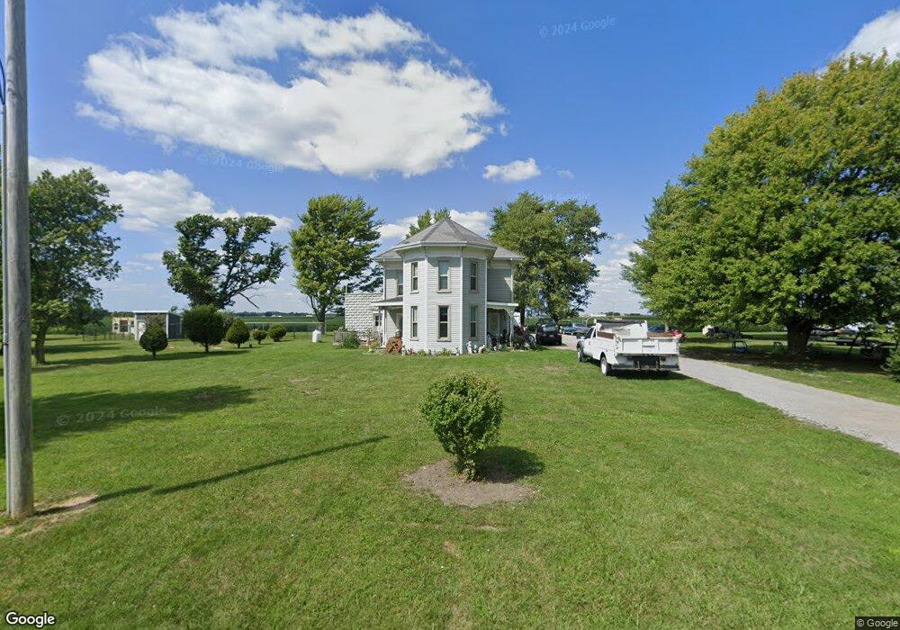
15040 Road R Columbus Grove, OH 45830
Estimated Value: $226,405 - $291,000
5
Beds
3
Baths
3,182
Sq Ft
$81/Sq Ft
Est. Value
About This Home
This home is located at 15040 Road R, Columbus Grove, OH 45830 and is currently estimated at $257,101, approximately $80 per square foot. 15040 Road R is a home located in Putnam County with nearby schools including Columbus Grove Elementary School, Columbus Grove Middle School, and Columbus Grove High School.
Ownership History
Date
Name
Owned For
Owner Type
Purchase Details
Closed on
May 4, 2018
Sold by
Schumacher Jamie M and Schumacher Kevin M
Bought by
Martin Rick W and Martin Ashly M
Current Estimated Value
Purchase Details
Closed on
Jan 25, 2013
Sold by
Shady Lawn Farms Inc
Bought by
Schumacher Kevin M and Schumacher Jamie M
Home Financials for this Owner
Home Financials are based on the most recent Mortgage that was taken out on this home.
Original Mortgage
$92,000
Interest Rate
3.31%
Mortgage Type
Purchase Money Mortgage
Purchase Details
Closed on
Nov 29, 2011
Sold by
Pingle Donna L
Bought by
Shady Lawn Farms Inc
Purchase Details
Closed on
Jul 28, 2011
Sold by
Estate Of Frank James Pingle
Bought by
Pingle Donna L
Create a Home Valuation Report for This Property
The Home Valuation Report is an in-depth analysis detailing your home's value as well as a comparison with similar homes in the area
Home Values in the Area
Average Home Value in this Area
Purchase History
| Date | Buyer | Sale Price | Title Company |
|---|---|---|---|
| Martin Rick W | $165,000 | None Available | |
| Schumacher Kevin M | $122,000 | Attorney | |
| Shady Lawn Farms Inc | $50,000 | Attorney | |
| Pingle Donna L | -- | None Available |
Source: Public Records
Mortgage History
| Date | Status | Borrower | Loan Amount |
|---|---|---|---|
| Previous Owner | Schumacher Kevin M | $92,000 |
Source: Public Records
Tax History Compared to Growth
Tax History
| Year | Tax Paid | Tax Assessment Tax Assessment Total Assessment is a certain percentage of the fair market value that is determined by local assessors to be the total taxable value of land and additions on the property. | Land | Improvement |
|---|---|---|---|---|
| 2024 | $2,077 | $69,350 | $7,320 | $62,030 |
| 2023 | $2,210 | $49,460 | $5,590 | $43,870 |
| 2022 | $1,809 | $49,459 | $5,590 | $43,869 |
| 2021 | $1,826 | $49,460 | $5,590 | $43,870 |
| 2020 | $1,828 | $36,300 | $4,700 | $31,600 |
| 2019 | $1,587 | $43,970 | $5,590 | $38,380 |
| 2018 | $1,580 | $43,970 | $5,590 | $38,380 |
| 2017 | $1,324 | $36,300 | $5,590 | $30,710 |
| 2016 | $1,278 | $36,300 | $4,700 | $31,600 |
| 2015 | $1,287 | $36,380 | $4,700 | $31,680 |
| 2014 | $597 | $16,290 | $4,700 | $11,590 |
| 2013 | $608 | $16,290 | $4,700 | $11,590 |
Source: Public Records
Map
Nearby Homes
- 147 Elm St
- 148 S Water St
- 15105 Road 15m
- 11059 Ottawa Rd
- 308 Delphos Rd
- 209 Willow Bend Dr
- 205 S Broadway St
- 204 S Broadway St
- 106 Carnation St
- 4150 W Lincoln Hwy
- 2525 W Lincoln Hwy
- 20501 U S 224
- 17736 Road 20p
- 6585 Ottawa Rd
- 300 Sweaney Ave
- 309 Wall St
- 201 Wall St
- 220 Parklane Dr
- 12806 Road K
- 3798 Kissing Hollow Dr
- 17794 Road 15
- 15225 Road R
- 17721 Road Unit 15
- 17721 Road
- 17721 Road 15
- 17649 Road 15
- 17624 Road 15
- 17701 State Route 115
- 17820 State Route 115
- 18417 State Route 115
- 18567 State Route 115
- 14375 Road R
- 18526 State Route 115
- 17794 Road 15q
- 18657 State Route 115
- 17303 State Route 115
- 17303 St Route
- 14239 Road R
- 14169 Road R