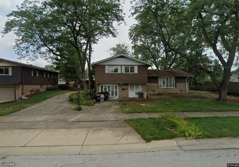
15045 La Palm Dr Oak Forest, IL 60452
Estimated Value: $327,000 - $360,000
3
Beds
2
Baths
1,672
Sq Ft
$203/Sq Ft
Est. Value
About This Home
This home is located at 15045 La Palm Dr, Oak Forest, IL 60452 and is currently estimated at $338,638, approximately $202 per square foot. 15045 La Palm Dr is a home located in Cook County with nearby schools including Kerkstra Elementary School, Jack Hille Middle School, and Oak Forest High School.
Ownership History
Date
Name
Owned For
Owner Type
Purchase Details
Closed on
Oct 16, 1996
Sold by
Duris Milan A and Duris Betty J
Bought by
Oak Brook Bank and Trust #F-402
Current Estimated Value
Purchase Details
Closed on
Sep 23, 1996
Sold by
Oak Brook Bank
Bought by
Duris Milan A and Duris Betty J
Purchase Details
Closed on
Dec 30, 1994
Sold by
Duris Milan A and Duris Betty J
Bought by
Oak Brook Bank
Home Financials for this Owner
Home Financials are based on the most recent Mortgage that was taken out on this home.
Original Mortgage
$36,000
Interest Rate
9.06%
Purchase Details
Closed on
Dec 5, 1994
Sold by
Oak Brook Bank
Bought by
Duris Milan A and Duris Betty J
Home Financials for this Owner
Home Financials are based on the most recent Mortgage that was taken out on this home.
Original Mortgage
$36,000
Interest Rate
9.06%
Create a Home Valuation Report for This Property
The Home Valuation Report is an in-depth analysis detailing your home's value as well as a comparison with similar homes in the area
Home Values in the Area
Average Home Value in this Area
Purchase History
| Date | Buyer | Sale Price | Title Company |
|---|---|---|---|
| Oak Brook Bank | -- | -- | |
| Duris Milan A | -- | -- | |
| Oak Brook Bank | -- | -- | |
| Duris Milan A | -- | Lawyers Title Insurance Corp |
Source: Public Records
Mortgage History
| Date | Status | Borrower | Loan Amount |
|---|---|---|---|
| Previous Owner | Duris Milan A | $36,000 |
Source: Public Records
Tax History Compared to Growth
Tax History
| Year | Tax Paid | Tax Assessment Tax Assessment Total Assessment is a certain percentage of the fair market value that is determined by local assessors to be the total taxable value of land and additions on the property. | Land | Improvement |
|---|---|---|---|---|
| 2024 | $2,778 | $26,001 | $3,988 | $22,013 |
| 2023 | $3,847 | $26,001 | $3,988 | $22,013 |
| 2022 | $3,847 | $19,017 | $3,544 | $15,473 |
| 2021 | $3,653 | $19,017 | $3,544 | $15,473 |
| 2020 | $3,272 | $19,017 | $3,544 | $15,473 |
| 2019 | $3,700 | $21,233 | $3,322 | $17,911 |
| 2018 | $3,644 | $21,233 | $3,322 | $17,911 |
| 2017 | $3,592 | $21,233 | $3,322 | $17,911 |
| 2016 | $4,806 | $18,335 | $3,101 | $15,234 |
| 2015 | $4,927 | $18,335 | $3,101 | $15,234 |
| 2014 | $4,684 | $18,335 | $3,101 | $15,234 |
| 2013 | $4,299 | $18,483 | $3,101 | $15,382 |
Source: Public Records
Map
Nearby Homes
- 15143 Geoffrey Rd
- 15001 Park Ave
- 14825 Parkside Ave
- 15027 Park Ave
- 15100 Crescent Green Dr
- 5568 Natalie Dr
- 15251 Colina Ave
- 5756 Lancaster Dr
- 16207 Long Ave
- 5340 Crescent Ln Unit C
- 5341 Crescent Ln Unit D
- 5430 Grange Ave
- 14525 Walden Ct Unit PH4
- 14511 Central Ct Unit M2
- 14515 Central Ct Unit M3
- 14515 Central Ct Unit G3
- 5208 Woodland Dr Unit A
- 5237 Diamond Dr Unit B
- 5735 Dover Rd
- 5653 Dover Rd
- 15037 La Palm Dr
- 15051 La Palm Dr
- 15052 Parkside Ave
- 15044 Parkside Ave
- 15036 Parkside Ave
- 15031 La Palm Dr
- 5711 150th Place
- 15044 La Palm Dr
- 15030 Parkside Ave
- 5712 Vine St
- 15025 La Palm Dr
- 15030 La Palm Dr
- 15024 Parkside Ave
- 5721 150th Place
- 5701 Vine St
- 5705 Vine St
- 5722 Vine St
- 15019 La Palm Dr
- 5711 Vine St
- 15024 La Palm Dr