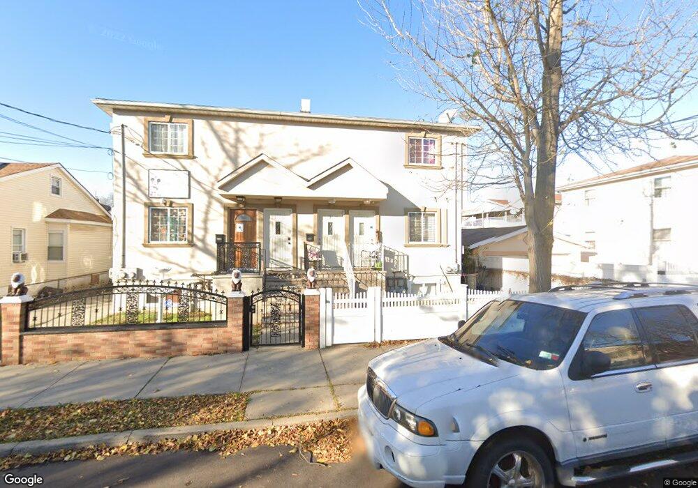
15049 119th Rd Jamaica, NY 11434
South Jamaica NeighborhoodEstimated Value: $847,500 - $1,041,000
--
Bed
--
Bath
1,900
Sq Ft
$514/Sq Ft
Est. Value
About This Home
This home is located at 15049 119th Rd, Jamaica, NY 11434 and is currently estimated at $975,875, approximately $513 per square foot. 15049 119th Rd is a home located in Queens County with nearby schools including P.S. 223 - Lyndon B. Johnson, J.H.S. 226 Virgil I. Grisson, and Rochdale Early Advantage Charter School.
Ownership History
Date
Name
Owned For
Owner Type
Purchase Details
Closed on
Sep 26, 2007
Sold by
Mountain Group Inc
Bought by
Lawton Robert
Current Estimated Value
Home Financials for this Owner
Home Financials are based on the most recent Mortgage that was taken out on this home.
Original Mortgage
$500,000
Outstanding Balance
$313,813
Interest Rate
6.49%
Mortgage Type
Purchase Money Mortgage
Estimated Equity
$662,062
Create a Home Valuation Report for This Property
The Home Valuation Report is an in-depth analysis detailing your home's value as well as a comparison with similar homes in the area
Home Values in the Area
Average Home Value in this Area
Purchase History
| Date | Buyer | Sale Price | Title Company |
|---|---|---|---|
| Lawton Robert | $575,000 | -- | |
| Lawton Robert | $575,000 | -- |
Source: Public Records
Mortgage History
| Date | Status | Borrower | Loan Amount |
|---|---|---|---|
| Open | Lawton Robert | $500,000 | |
| Closed | Lawton Robert | $500,000 |
Source: Public Records
Tax History Compared to Growth
Tax History
| Year | Tax Paid | Tax Assessment Tax Assessment Total Assessment is a certain percentage of the fair market value that is determined by local assessors to be the total taxable value of land and additions on the property. | Land | Improvement |
|---|---|---|---|---|
| 2025 | $7,531 | $39,746 | $12,903 | $26,843 |
| 2024 | $7,531 | $37,498 | $12,843 | $24,655 |
| 2023 | $7,531 | $37,498 | $11,790 | $25,708 |
| 2022 | $7,429 | $47,520 | $17,940 | $29,580 |
| 2021 | $7,389 | $41,580 | $17,940 | $23,640 |
| 2020 | $7,011 | $41,340 | $17,940 | $23,400 |
| 2019 | $6,537 | $45,540 | $17,940 | $27,600 |
| 2018 | $6,370 | $31,248 | $17,399 | $13,849 |
| 2017 | $6,322 | $31,013 | $16,559 | $14,454 |
| 2016 | $5,849 | $31,013 | $16,559 | $14,454 |
| 2015 | $3,621 | $27,602 | $18,894 | $8,708 |
| 2014 | $3,621 | $26,040 | $19,920 | $6,120 |
Source: Public Records
Map
Nearby Homes
- 11829 152nd St
- 118-39 153rd St
- 12002 153rd St
- 118-36 154th St
- 118-38 154th St
- 15333 119th Rd
- 15209 118th Ave
- 150-13 118th Ave
- 15013 118th Ave
- 121-02 153rd St
- 15243 118th Ave
- 11825 154th St
- 11842 155th St
- 153-07 118th Ave
- 153-05 118th Ave
- 15070 Foch Blvd
- 153-36 118th Ave
- 15320 121st Ave
- 153-02 Foch Blvd
- 15323 118th Ave
- 150-49 119th Rd
- 15047 119th Rd
- 15045 119th Rd
- 11914 153rd St
- 11918 153rd St
- 150-41 119th Rd Unit 1
- 150-41 119th Rd
- 15212 119th Ave
- 152-10 119th Ave
- 15210 119th Ave
- 15041 119th Rd
- 15216 119th Ave
- 15208 119th Ave
- 15218 119th Ave
- 15206 119th Ave
- 152-06 119th Ave
- 15206 119th Ave
- 119-26 153rd St
- 119-28 153 St
- 15220 119th Ave