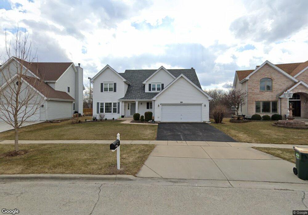
1505 Creekside Dr Unit 3 Hoffman Estates, IL 60169
South Hoffman Estates NeighborhoodEstimated Value: $643,831 - $747,000
4
Beds
3
Baths
2,939
Sq Ft
$238/Sq Ft
Est. Value
About This Home
This home is located at 1505 Creekside Dr Unit 3, Hoffman Estates, IL 60169 and is currently estimated at $700,708, approximately $238 per square foot. 1505 Creekside Dr Unit 3 is a home located in Cook County with nearby schools including Neil Armstrong Elementary School, Dwight D Eisenhower Junior High School, and Hoffman Estates High School.
Ownership History
Date
Name
Owned For
Owner Type
Purchase Details
Closed on
Nov 13, 1996
Sold by
American National Bk & Tr Co Of Chicago
Bought by
Shah Rohit M and Shah Dipika R
Current Estimated Value
Home Financials for this Owner
Home Financials are based on the most recent Mortgage that was taken out on this home.
Original Mortgage
$130,000
Interest Rate
7.91%
Create a Home Valuation Report for This Property
The Home Valuation Report is an in-depth analysis detailing your home's value as well as a comparison with similar homes in the area
Home Values in the Area
Average Home Value in this Area
Purchase History
| Date | Buyer | Sale Price | Title Company |
|---|---|---|---|
| Shah Rohit M | $232,000 | -- | |
| Shah Rohit M | $232,000 | -- |
Source: Public Records
Mortgage History
| Date | Status | Borrower | Loan Amount |
|---|---|---|---|
| Previous Owner | Shah Rohit M | $130,000 |
Source: Public Records
Tax History
| Year | Tax Paid | Tax Assessment Tax Assessment Total Assessment is a certain percentage of the fair market value that is determined by local assessors to be the total taxable value of land and additions on the property. | Land | Improvement |
|---|---|---|---|---|
| 2025 | $12,592 | $64,000 | $11,171 | $52,829 |
| 2024 | $12,592 | $47,000 | $10,473 | $36,527 |
| 2023 | $12,130 | $47,000 | $10,473 | $36,527 |
| 2022 | $12,130 | $47,000 | $10,473 | $36,527 |
| 2021 | $11,132 | $39,221 | $9,251 | $29,970 |
| 2020 | $11,006 | $39,221 | $9,251 | $29,970 |
| 2019 | $10,951 | $43,579 | $9,251 | $34,328 |
| 2018 | $11,942 | $42,807 | $7,854 | $34,953 |
| 2017 | $12,629 | $42,807 | $7,854 | $34,953 |
| 2016 | $12,753 | $42,807 | $7,854 | $34,953 |
| 2015 | $11,220 | $39,430 | $6,807 | $32,623 |
| 2014 | $12,441 | $39,430 | $6,807 | $32,623 |
| 2013 | $10,737 | $39,430 | $6,807 | $32,623 |
Source: Public Records
Map
Nearby Homes
- 1975 Leiter Way Unit 12002
- 1982 Leiter Way Unit 13004
- 1985 Leiter Way Unit 1102
- 1988 Leiter Way Unit 13001
- 1979 Leiter Way Unit 12004
- 1981 Leiter Way Unit 12005
- 1994 Leiter Way Unit 14003
- 1977 Leiter Way Unit 12003
- 1986 Leiter Way Unit 13002
- 1989 Leiter Way Unit 11004
- 1365 Newcastle Ln
- 1103 Southbridge Ln
- 1708 Southbridge Ct
- 1335 Blair Ln
- 845 Harmon Blvd
- 1300 Chatsworth Ln
- 1026 Denham Place Unit 1
- 1360 Devonshire Ln
- 1880 Bonnie Ln Unit 416
- 1880 Bonnie Ln Unit 112
- 1515 Creekside Dr
- 1495 Creekside Dr
- 1525 Creekside Dr
- 1520 Creekside Dr
- 1500 Creekside Dr
- 1535 Creekside Dr Unit 1
- 1155 Woodcreek Ln
- 1145 Woodcreek Ln
- 1540 Creekside Dr Unit 1
- 1165 Woodcreek Ln
- 1180 Woodcreek Ln Unit 1
- 1545 Creekside Dr Unit 3
- 1175 Woodcreek Ln
- 1560 Creekside Dr
- 1185 Woodcreek Ln
- 1555 Creekside Dr
- 1154 Kingsdale Rd
- 1160 Kingsdale Rd
- 1170 Kingsdale Rd
- 1195 Woodcreek Ln
Your Personal Tour Guide
Ask me questions while you tour the home.