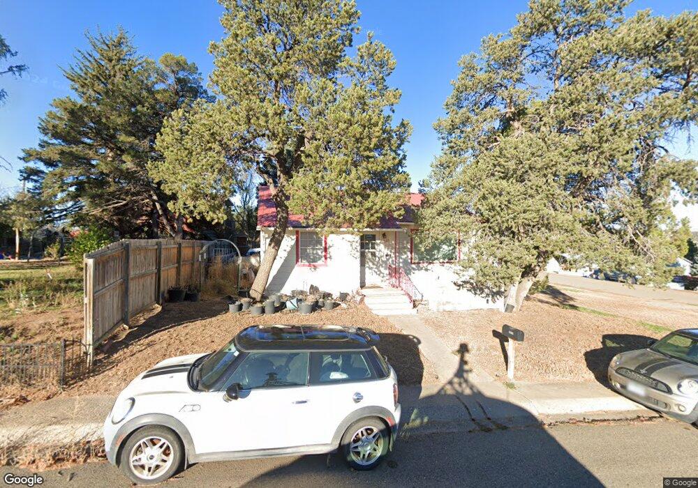
1505+ Hayes Trinidad, CO 81082
Estimated Value: $118,451 - $167,000
2
Beds
1
Bath
682
Sq Ft
$215/Sq Ft
Est. Value
About This Home
This home is located at 1505+ Hayes, Trinidad, CO 81082 and is currently estimated at $146,613, approximately $214 per square foot. 1505+ Hayes is a home located in Las Animas County with nearby schools including Fisher's Peak Elementary School, Trinidad Middle School, and Trinidad High School.
Ownership History
Date
Name
Owned For
Owner Type
Purchase Details
Closed on
May 27, 2014
Sold by
Secretary Of Housing & Urban Development
Bought by
Allum Alan Frank
Current Estimated Value
Purchase Details
Closed on
Dec 2, 2013
Sold by
Colorado Housing And Finance Authority
Bought by
The Secretary Of Housing & Urban Develop
Purchase Details
Closed on
Nov 26, 2013
Sold by
Mullins Jesse Veris
Bought by
Colorado Housing And Finance Authority
Purchase Details
Closed on
Jun 9, 2006
Sold by
Grace Stephanie
Bought by
Mullins Jesse Veris
Home Financials for this Owner
Home Financials are based on the most recent Mortgage that was taken out on this home.
Original Mortgage
$85,981
Interest Rate
6.58%
Mortgage Type
FHA
Create a Home Valuation Report for This Property
The Home Valuation Report is an in-depth analysis detailing your home's value as well as a comparison with similar homes in the area
Home Values in the Area
Average Home Value in this Area
Purchase History
| Date | Buyer | Sale Price | Title Company |
|---|---|---|---|
| Allum Alan Frank | $46,000 | None Available | |
| The Secretary Of Housing & Urban Develop | -- | None Available | |
| Colorado Housing And Finance Authority | -- | None Available | |
| Mullins Jesse Veris | $86,800 | None Available |
Source: Public Records
Mortgage History
| Date | Status | Borrower | Loan Amount |
|---|---|---|---|
| Previous Owner | Mullins Jesse Veris | $85,981 |
Source: Public Records
Tax History Compared to Growth
Tax History
| Year | Tax Paid | Tax Assessment Tax Assessment Total Assessment is a certain percentage of the fair market value that is determined by local assessors to be the total taxable value of land and additions on the property. | Land | Improvement |
|---|---|---|---|---|
| 2025 | $126 | $6,430 | $2,040 | $4,390 |
| 2024 | $126 | $6,040 | $2,040 | $4,000 |
| 2023 | $126 | $1,000 | $440 | $560 |
| 2022 | $182 | $3,530 | $2,120 | $1,410 |
| 2021 | $185 | $3,630 | $2,180 | $1,450 |
| 2020 | $191 | $3,800 | $2,180 | $1,620 |
| 2019 | $2 | $3,800 | $2,180 | $1,620 |
| 2018 | $186 | $3,630 | $2,190 | $1,440 |
| 2017 | $183 | $3,690 | $0 | $0 |
| 2015 | $198 | $4,077 | $0 | $0 |
| 2013 | $296 | $5,902 | $2,487 | $3,415 |
Source: Public Records
Map
Nearby Homes
- 316 Monroe St
- 11510
- 1216 (?) Carbon Ave
- 1008 Grant Ave
- TBD W Jefferson St
- 0 W Jefferson St
- 1009 Grant Ave
- 1000 Grant Ave
- 809 S Maple St
- 502 W Washington Ave
- 1002 Imperial St
- 704 W Jefferson St
- 720 W Washington Ave
- 213 E 7th St
- 403 High St
- 312 E 6th St
- 315 High St
- 728 W Adams St
- 406 E 7th St
- 1106 Alamo St
- 0 Hayes St
- 1502 Hayes St
- 1508 Hayes St
- 1505 Hayes St
- 1422 Hayes St
- 1513 Hayes St
- 1513 & 1509 Hayes St
- 1512 Hayes St
- 203 Jackson St
- 1516 Hayes St
- 1517 Hayes St
- 1520 Hayes St
- 1519 Hayes St
- 1500 Garfield Ave
- 1504 Garfield Ave
- 1510 Garfield Ave
- 1420 Garfield Ave
- 1600 Hayes St
- 1516 Garfield Ave
- 1601 Hayes St