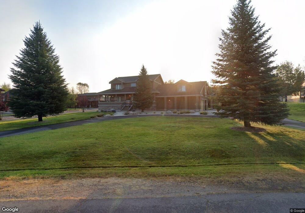
1505 Mccall Ave N McCall, ID 83638
Estimated Value: $1,028,000 - $1,540,950
3
Beds
3
Baths
2,673
Sq Ft
$476/Sq Ft
Est. Value
About This Home
This home is located at 1505 Mccall Ave N, McCall, ID 83638 and is currently estimated at $1,273,488, approximately $476 per square foot. 1505 Mccall Ave N is a home located in Valley County with nearby schools including McCall-Donnelly High School, Mountain Life Education, and The North Fork School.
Ownership History
Date
Name
Owned For
Owner Type
Purchase Details
Closed on
Aug 31, 2023
Sold by
Privon Christopher John and Keron Chew
Bought by
Privon Family Trust and Privon
Current Estimated Value
Purchase Details
Closed on
Jan 3, 2007
Sold by
Gingrich Byron W and Gingrich Karma L
Bought by
Privon Christopher J and Privon Keron C
Home Financials for this Owner
Home Financials are based on the most recent Mortgage that was taken out on this home.
Original Mortgage
$955,500
Interest Rate
5.5%
Mortgage Type
Adjustable Rate Mortgage/ARM
Create a Home Valuation Report for This Property
The Home Valuation Report is an in-depth analysis detailing your home's value as well as a comparison with similar homes in the area
Home Values in the Area
Average Home Value in this Area
Purchase History
| Date | Buyer | Sale Price | Title Company |
|---|---|---|---|
| Privon Family Trust | -- | None Listed On Document | |
| Privon Christopher J | -- | -- |
Source: Public Records
Mortgage History
| Date | Status | Borrower | Loan Amount |
|---|---|---|---|
| Previous Owner | Privon Christopher J | $955,500 |
Source: Public Records
Tax History Compared to Growth
Tax History
| Year | Tax Paid | Tax Assessment Tax Assessment Total Assessment is a certain percentage of the fair market value that is determined by local assessors to be the total taxable value of land and additions on the property. | Land | Improvement |
|---|---|---|---|---|
| 2025 | $5,234 | $1,143,655 | $312,825 | $830,830 |
| 2023 | $5,234 | $1,038,066 | $312,825 | $725,241 |
| 2022 | $4,502 | $894,825 | $297,928 | $596,897 |
| 2021 | $8,338 | $1,125,772 | $431,241 | $694,531 |
| 2020 | $7,931 | $944,265 | $404,288 | $539,977 |
| 2019 | $7,444 | $802,527 | $269,526 | $533,001 |
| 2018 | $7,832 | $772,729 | $278,526 | $494,203 |
| 2017 | $8,231 | $762,255 | $280,093 | $482,162 |
| 2016 | $8,493 | $770,153 | $277,274 | $492,879 |
| 2015 | $8,363 | $730,919 | $0 | $0 |
| 2013 | -- | $598,864 | $0 | $0 |
Source: Public Records
Map
Nearby Homes
- 1520 Roosevelt Ave
- 1517 Roosevelt Ave
- 601 Hemlock St Unit 10
- 601 Hemlock St Unit 3
- 622 Blue Water Cir
- 1391 Greystone Dr
- 611 Blue Water Cir
- 1630 Davis Ave Unit C18
- 1630 Davis Ave Unit B13
- 1630 Davis Ave Unit 19
- 1305 Greystone Dr
- 1305 Greystone Dr Unit 2
- 1543 Mccall Ave
- 2 Spruce St
- 2 Spruce St Unit 6
- 712 Reedy Ln
- 628 Ruby St Unit B-20
- 628 Ruby St Unit 12
- 717 Spruce St
- 703 Wooley Ave
- 1507 Mccall Ave
- 1511 Mccall Ave
- 1511 Mccall Ave Unit 17
- 1516 Mccall Ave N
- 1535 Mccall Ave N
- 1509 Mccall Ave Unit 18
- 1509 Mccall Ave
- 1531 Mccall Ave N
- 1514 Roosevelt Ave
- 1506 Mccall Ave
- 1518 Roosevelt Ave
- 1510 Roosevelt Ave
- 1508 Mccall Ave
- 1512 Roosevelt Ave
- 1516 Roosevelt Ave
- 507 Hemlock St Unit 23
- 507 Hemlock St Unit 71
- 507 Hemlock St Unit 21
- 507 Hemlock St Unit 69
- 507 Hemlock St Unit 11