


1505 N Monroe St Decatur, IL 62526
Neighborhood Empowerment NeighborhoodAbout This Home
Property Id: 2141714
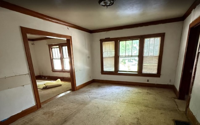
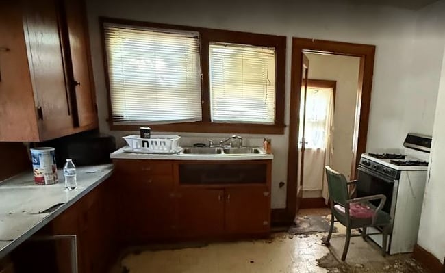
(NEGOTIABLE) Rent to Own/ Owner financing - handyman special - NO credit check. Homeownership OPPORTUNITY 3 minute away from
Millikin University.
Ideal for handymen, contractors, and cleaners.
Needs tlc in the living room, kitchen, and bath.
STOP renting. Be a homeowner. Act now; a down payment secures keys today!
30-year agreement for deed. You choose a fair down payment and a fair monthly rate.
Closing via a third party: title company or notary.
Discover Visual Video — 1st File, Helpful Guides, Video Testimonials and Photos — Are the Rest, Along with a Standard Doc File with Tips:
Drive by anytime. To view, call or text and state your preferred time
Quick sale expected; leave a voicemail with your max down payment and max monthly.
The American Dream is still homeownership! With just sweat equity, own your American Dream home!
Call or text anytime at

Map
Property History
| Date | Event | Price | List to Sale | Price per Sq Ft |
|---|---|---|---|---|
| 11/17/2025 11/17/25 | For Rent | $1,000 | -- | -- |
- 1545 N Monroe St
- 644 W Division St
- 1653 N Maple Ave
- 909 W Cushing St
- 1458 N Union St
- 1245 N Union St
- 1595 N Church St
- 925 W Olive St
- 912 W Olive St
- 1429 N Walnut Grove Ave
- 254 W Leafland Ave
- 1221 N Church St
- 1643 N Main St
- 1568 N Main St
- 230 W Garfield Ave
- 216 W Garfield Ave
- 1124 W Cushing St
- 777 W Harper Ave
- 1059 W Packard St
- 878 W Harrison Ave
- 701 W Grand Ave
- 1691 N Edward St Unit 3
- 1852 N Gulick Ave
- 327 E Stuart Ave
- 917 W King St
- 1174 W King St
- 1353 N Morgan St
- 2248 N Water St
- 816 W William St
- 1076 W Main St
- 1160 N Summit Ave
- 1061 W Decatur St
- 552 S Church St
- 1405 W Wood St
- 105 N Illinois St
- 2474 N Florian Ave
- 1344 Sedgwick St
- 1035 S Main St
- 1613 E Johns Ave
- 1524 E Whitmer St