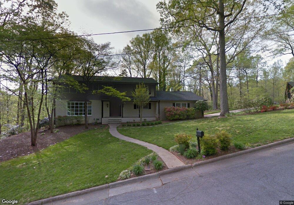
1506 Brentwood Cir Newton, NC 28658
Estimated Value: $420,000 - $471,000
4
Beds
3
Baths
2,994
Sq Ft
$148/Sq Ft
Est. Value
About This Home
This home is located at 1506 Brentwood Cir, Newton, NC 28658 and is currently estimated at $441,921, approximately $147 per square foot. 1506 Brentwood Cir is a home located in Catawba County with nearby schools including South Newton Elementary School, Newton-Conover Middle School, and Newton-Conover High School.
Ownership History
Date
Name
Owned For
Owner Type
Purchase Details
Closed on
Oct 28, 2015
Sold by
Unverfert William E and Unverfehrt Kathleen E
Bought by
Frye Christopher B and Frye Bryna R
Current Estimated Value
Home Financials for this Owner
Home Financials are based on the most recent Mortgage that was taken out on this home.
Original Mortgage
$239,400
Outstanding Balance
$189,190
Interest Rate
3.93%
Mortgage Type
New Conventional
Estimated Equity
$252,731
Purchase Details
Closed on
Jul 1, 1998
Bought by
Setzer Kenneth Glenn and Setzer Pauline
Create a Home Valuation Report for This Property
The Home Valuation Report is an in-depth analysis detailing your home's value as well as a comparison with similar homes in the area
Home Values in the Area
Average Home Value in this Area
Purchase History
| Date | Buyer | Sale Price | Title Company |
|---|---|---|---|
| Frye Christopher B | $252,000 | Attorney | |
| Setzer Kenneth Glenn | $173,000 | -- |
Source: Public Records
Mortgage History
| Date | Status | Borrower | Loan Amount |
|---|---|---|---|
| Open | Frye Christopher B | $239,400 |
Source: Public Records
Tax History Compared to Growth
Tax History
| Year | Tax Paid | Tax Assessment Tax Assessment Total Assessment is a certain percentage of the fair market value that is determined by local assessors to be the total taxable value of land and additions on the property. | Land | Improvement |
|---|---|---|---|---|
| 2025 | $3,419 | $402,900 | $21,400 | $381,500 |
| 2024 | $3,419 | $402,900 | $21,400 | $381,500 |
| 2023 | $3,419 | $402,900 | $21,400 | $381,500 |
| 2022 | $2,896 | $259,700 | $21,400 | $238,300 |
| 2021 | $2,896 | $259,700 | $21,400 | $238,300 |
| 2020 | $2,896 | $259,700 | $21,400 | $238,300 |
| 2019 | $2,896 | $259,700 | $0 | $0 |
| 2018 | $2,650 | $237,700 | $21,400 | $216,300 |
| 2017 | $2,650 | $0 | $0 | $0 |
| 2016 | $2,650 | $0 | $0 | $0 |
| 2015 | $2,043 | $188,070 | $21,400 | $166,670 |
| 2014 | $2,043 | $202,300 | $25,000 | $177,300 |
Source: Public Records
Map
Nearby Homes
- 108 Pinehurst Ln
- 1401 Brentwood Dr
- 1401 Southwest Blvd
- 409 Cardinal Dr
- 230 Park Ln
- 425 E N St
- 426B E N St
- 1478 Glenoaks Dr
- 743 S College Ave
- 1633 Fulbright Dr
- 103 W Herman St
- 1241 E I St Unit 20
- 1251 E I St
- 1127 Mckay Rd
- 624 Overlook Dr
- 406 S Caldwell Ave
- 2168 Sterling Ridge Dr
- 355 S College Ave
- 2194 Sterling Ridge Dr
- 250 S Caldwell Ave
- 1544 Brentwood Cir Unit 20
- 219 Pinehurst Ln
- 1547 Brentwood Cir
- 0 Brentwood Cir
- 224 Pinehurst Ln
- 215 Pinehurst Ln
- 214 Pinehurst Ln
- 1548 Brentwood Cir
- 0 Oak Cir
- 207 Pinehurst Ln
- 221 Oak Cir
- 229 Oak Cir
- 29 Oak Cir
- 252 Oakland Cir
- 1552 Brentwood Cir
- 145 Pinehurst Ln
- 1520 Brentwood Dr
- 0 Brentwood Dr
- 216 Brentwood Cir
- 246 Oakland Cir