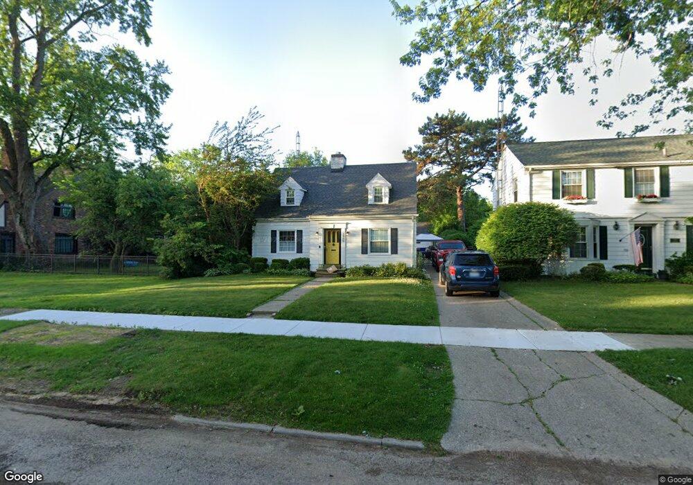
1506 Brookwood Ave Flint, MI 48503
College Cultural Neighborhood NeighborhoodEstimated Value: $144,152 - $164,000
3
Beds
2
Baths
1,338
Sq Ft
$113/Sq Ft
Est. Value
About This Home
This home is located at 1506 Brookwood Ave, Flint, MI 48503 and is currently estimated at $151,288, approximately $113 per square foot. 1506 Brookwood Ave is a home located in Genesee County with nearby schools including Pierce Elementary School, Flint Southwestern Classical Academy, and Flint Cultural Center Academy.
Ownership History
Date
Name
Owned For
Owner Type
Purchase Details
Closed on
Jan 28, 2010
Sold by
Donovan Shaun and Secretary Of Housing & Urban D
Bought by
Flores Christopher and Diment Flores Pamela
Current Estimated Value
Purchase Details
Closed on
Aug 12, 2009
Sold by
Gmac Mortgage Llc
Bought by
The Secretary Of Housing & Urban Develop
Purchase Details
Closed on
Feb 13, 2009
Sold by
Mortgage Electronic Registration Systems
Bought by
Gmac Mortgage Llc
Purchase Details
Closed on
Feb 11, 2009
Sold by
Rolf Jeffrey M and Rolf Megan H
Bought by
Mortgage Electronic Registration Systems
Purchase Details
Closed on
Jan 27, 2005
Sold by
Rasberry Timothy T and Rasberry Margaret
Bought by
Rolf Jeffrey M and Rolf Megan H
Create a Home Valuation Report for This Property
The Home Valuation Report is an in-depth analysis detailing your home's value as well as a comparison with similar homes in the area
Home Values in the Area
Average Home Value in this Area
Purchase History
| Date | Buyer | Sale Price | Title Company |
|---|---|---|---|
| Flores Christopher | $50,500 | None Available | |
| The Secretary Of Housing & Urban Develop | -- | None Available | |
| Gmac Mortgage Llc | -- | None Available | |
| Mortgage Electronic Registration Systems | $126,301 | None Available | |
| Rolf Jeffrey M | $128,900 | Sargents Title Company |
Source: Public Records
Tax History Compared to Growth
Tax History
| Year | Tax Paid | Tax Assessment Tax Assessment Total Assessment is a certain percentage of the fair market value that is determined by local assessors to be the total taxable value of land and additions on the property. | Land | Improvement |
|---|---|---|---|---|
| 2025 | $1,775 | $55,100 | $0 | $0 |
| 2024 | $1,630 | $52,600 | $0 | $0 |
| 2023 | $1,581 | $43,900 | $0 | $0 |
| 2022 | $0 | $36,800 | $0 | $0 |
| 2021 | $1,610 | $33,600 | $0 | $0 |
| 2020 | $1,466 | $32,900 | $0 | $0 |
| 2019 | $1,422 | $31,400 | $0 | $0 |
| 2018 | $1,445 | $27,100 | $0 | $0 |
| 2017 | $1,404 | $0 | $0 | $0 |
| 2016 | $1,393 | $0 | $0 | $0 |
| 2015 | -- | $0 | $0 | $0 |
| 2014 | -- | $0 | $0 | $0 |
| 2012 | -- | $23,100 | $0 | $0 |
Source: Public Records
Map
Nearby Homes
- 930 Belmont Ave
- 1510 S Franklin Ave
- 841 E 8th St
- 911 E 7th St
- 1018 Lafayette St
- 1110 Pingree Ave
- 2010 Crocker Ave
- 1601 Wayne St
- 2122 Pierce St
- 2013 E Court St
- 2313 Brookside Dr
- 1623 Montclair Ave
- 2029 Aitken Ave
- 915 E Court St Unit 104
- 915 E Court St
- 903 E Court St
- 2319 Calumet St
- 420 Pingree Ave
- 2050 Ferris Ave
- 1917 Whittlesey St
- 1502 Brookwood Ave
- 1514 Brookwood Ave
- 1505 Ridgelawn Ave
- 1509 Ridgelawn Ave
- 1501 Ridgelawn Ave
- 1412 Brookwood Ave
- 1513 Ridgelawn Ave
- 1419 Ridgelawn Ave
- 1518 Brookwood Ave
- 1503 Brookwood Ave
- 1501 Brookwood Ave
- 1505 Brookwood Ave
- 1771 Brookside Dr
- 1417 Brookwood Ave
- 1413 Brookwood Ave
- 1601 Woodlawn Park Dr
- 1521 Brookwood Ave
- 1602 Brookwood Ave
- 1619 Woodlawn Park Dr
- 1407 Brookwood Ave